


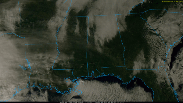
CLEARING CONTINUES: The sky is now mostly sunny over most of Alabama; the exception is Northeast Alabama, where clouds are still hanging on at mid-afternoon. Temperatures remain below average… where clouds are still in place temperatures are in the 30s, we are seeing 40s and low 50s elsewhere. The remaining cloud cover should dissipate tonight.
Most communities will see a low near the freezing mark early tomorrow. Then, during the day tomorrow, the sky will be partly to mostly sunny with a high in the mid to upper 50s.
Clouds return Thursday, and a few showers are possible Thursday afternoon and Thursday night, but this feature will be working with limited moisture, and rain amounts should be light. Most places will see 1/4″ or less. The high Thursday will be in the 50s.
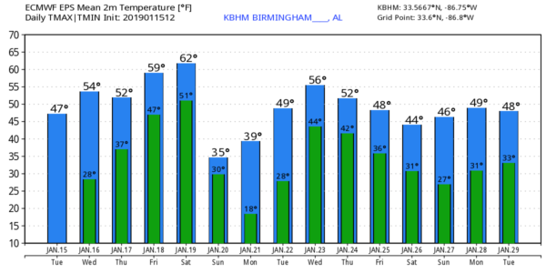
FRIDAY/SATURDAY: Friday will be mostly cloudy and mild with temperatures rising into the mid 60s. We will mention the chance of a few scattered showers, but once again rain will be light and spotty. A dynamic weather system will bring a good coverage of rain to the state Saturday afternoon and Saturday night; this will bring rain amounts of around one inch. The main window for rain comes from noon until midnight Saturday; some thunder is possible, but for now we don’t expect any severe thunderstorms due to the lack of surface based instability. Saturday should be fairly mild with a high in the 60s.
COLDEST AIR SO FAR BY SUNDAY: Rain ends late Saturday night, and then the coldest air so far this season rushes into the state Sunday. It will be a mostly cloudy day with temperatures struggling to rise above the freezing mark, and strong north winds of 15-30 mph will push the wind chill index down into the single digits at times.
A few snow flurries are possible over North Alabama Sunday morning, but we expect no accumulation or impact. The cold air is the big story. The wind dies down Sunday night and the sky becomes mostly clear, allowing temperatures to fall into the 10-20 degree range by early Monday morning. The day Monday will be sunny with a high in the 40s.
REST OF NEXT WEEK: Another weather system will bring a chance of rain back to the state Tuesday night and Wednesday; a few flurries are possible on the back side of the system Wednesday night, but again there is no hint of accumulation or impact for now. Thursday and Friday look cold and dry… see the Weather Xtreme video for maps, graphics, and more details.
ON THIS DATE IN 1967: The Green Bay Packers beat the Kansas City Chiefs, 35-10, in Super Bowl I at the Memorial Coliseum in Los Angeles. From the weather station at the USC campus in downtown LA, the high temperature was 79 degrees and the low was 51. There was a light west wind.
BEACH FORECAST: Click here to see the AlabamaWx Beach Forecast Center page.
WEATHER BRAINS: Don’t forget you can listen to our weekly 90 minute show anytime on your favorite podcast app. This is the show all about weather featuring many familiar voices, including our meteorologists here at ABC 33/40.
CONNECT: You can find me on all of the major social networks…
Facebook
Twitter
Instagram
Pinterest
Snapchat: spannwx
I enjoyed seeing the second graders today at Edgewood Elementary in Homewood… be looking for them on the Pepsi KIDCAM today at 5:00 on ABC 33/40 News! The next Weather Xtreme video will be posted here early tomorrow morning by 7:00…


