

Sunday Evening Notes On The Tuesday Snow Threat
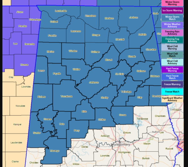
A winter storm watch remains in effect for most of North and Central Alabama for late tomorrow night and Tuesday morning. Here are some notes…
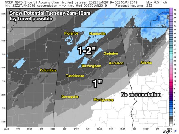
WHEN: Rain could change to snow over Northwest Alabama as early as midnight tomorrow night. But the main window for accumulating snow comes from 2:00 until 10:00 a.m. It will snow for only about 2-3 hours at any one given point, but snow rates could be locally heavy during that window. Snow could begin in places like Birmingham, Tuscaloosa, Anniston, and Gadsden as early as 5:00 a.m.
HOW MUCH: Generally speaking, most communities are expected to see 1-2 inches of snow in the winter storm watch. Our “boom” value… the highest amount possible in this setup, for the Birmingham metro is 4 inches, and the “bust” value is 1/4″, or basically a dusting.
Note model note… the SREF (short range ensemble forecast) model has one ensemble member printing 6 inches for Birmingham; the ensemble mean is 2.38″. But, for now that is an outlier and other high resolution model guidance is in line with the ongoing forecast. We won’t make any changes at this point.
IMPACT: With any winter storm, it is all about impact, not necessarily the amount of snow we receive. We do expect temperatures to fall below freezing as the snow falls Tuesday morning, meaning icy travel is certainly possible, if not likely. Initially on bridges, and then it is possible that other road surfaces could become snow packed and dangerous.
The sun will break out Tuesday afternoon, pushing temperatures into the mid 30s in some places. This will help to improve road conditions temporarily, and hopefully drier air moving in will accelerate the evaporation process. But, any lingering snow or water on roads will likely refreeze Tuesday night into Wednesday morning, when temperatures will drop into the 18-24 degree range. The extent of travel impact Tuesday night and early Wednesday is somewhat conditional; it all depends on how much evaporation/drying happens Tuesday afternoon when the sun comes out.
We project a high Wednesday afternoon in the mid 40s with a good supply of sunshine, so road conditions should be back to normal by late morning Wednesday. We rise into the upper 40s Thursday, and upper 50s Friday as the warming trend continues.
POWER OUTAGES? We don’t expect any power outages. No freezing rain or ice accumulation. Just light rain changing to snow.
BUT MY APP SAYS NO SNOW??? Automated weather apps (most all of them are automated) are pretty much useless in this kind of situation. Always check with actual professional meteorologists who give you information like you are getting on this blog post. Timing, amount, uncertainty, etc. Apps use raw computer model data without any human intervention, and can lead you down a bad path.
REMEMBER: Not everyone in the winter storm watch will get snow. Some will get nothing at all. And the volume of social media posts about snow is not necessarily directly proportional to the amount of snow we’re actually going to get. It seems like the more people are talking about it, the worse it’s going to be, but that’s not always the case. This is a fairly light snow event; remember we are looking at one to two inches for most communities across North/Central Alabama.
And, if you want the most accurate and up-to-date information, you will have to check the forecast several times a day. Otherwise, you’re working with old information.
We will keep you posted with frequent blog updates, and on ABC 33/40!
Category: Alabama's Weather, ALL POSTS, Winter Weather
About the Author (Author Profile)
James Spann is one of the most recognized and trusted television meteorologists in the industry. He holds the AMS CCM designation and television seals from the AMS and NWA. He is a past winner of the Broadcast Meteorologist of the Year from both professional organizations.Subscribe
If you enjoyed this article, subscribe to receive more just like it.


