

Forecast On Track: New Model Data Is In
The new model data from the morning runs are mostly in and it doesn’t change our thinking.
The SREF plume from the SPC plots various model output for the total snowfall at Birmingham and it looks like this.
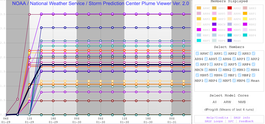
There is a range from 0.5 inches to 3.5 inches, with the mean around 1.75 inches. That corresponds well with our boom/bust forecast based on Birmingham, with a boom amount of 4 inches (the upper-end amount we are forecasting) to a bust forecast of 1/4 inch (the lower end).
Here is the new deterministic GFS snowfall map:

And the European:

Here is our forecast map:
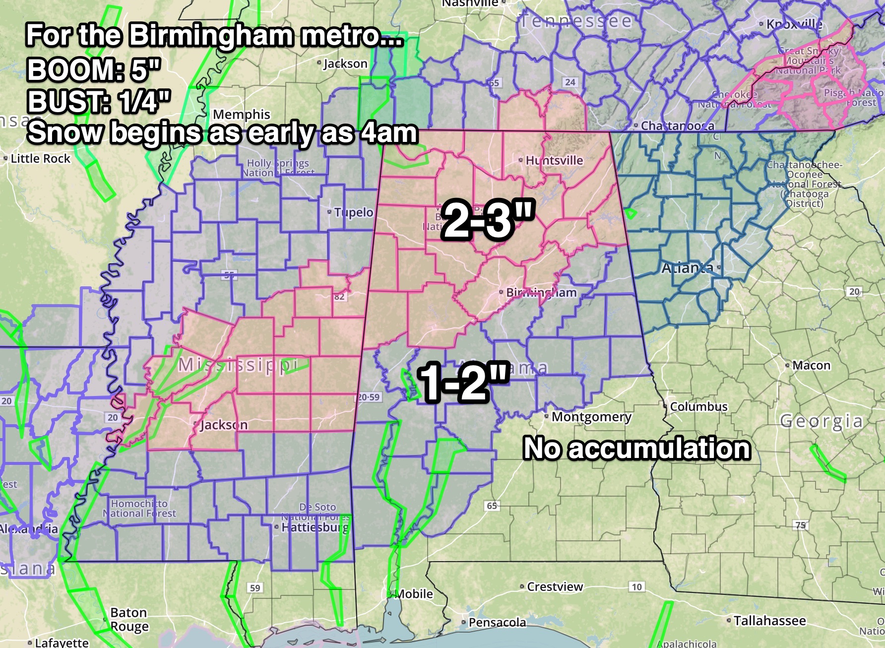
There will, of course, be variability within each amount area.
TIMING: Rain will reach northwestern Alabama by 10 p.m. or so and change over to snow shortly after midnight. The rain band will slide southeastward through the overnight hours, reaching I-59 around 3 a.m. and changing to snow around 4-5 a.m. The snow should be over by noon in the I-59 Corridor, earlier in places like Hamilton, Jasper and Cullman. It will be out of East Alabama by mid-afternoon.
IMPACTS: Roads will become snowpacked and icy with the heavy burst nature of the snow. Travel will become hazardous shortly after midnight tonight over northwestern sections and through the pre-dawn hours as the band slides southeastward. It will be a slippery commute in places like Tuscaloosa, Birmingham and Gadsden. Road conditions will become hazardous all across the winter storm warning and winter weather advisory areas during the snow. There may be some melting as the sun comes out, but with rapidly falling temperatures late Tuesday afternoon and evening, moisture on roads will freeze.
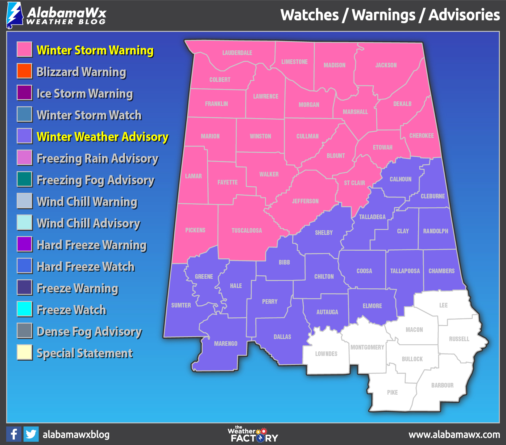
WINTER STORM WARNING/WINTER WEATHER ADVISORY: Here are current warnings and advisories from the NWS.
Category: Alabama's Weather, ALL POSTS
About the Author (Author Profile)
Bill Murray is the President of The Weather Factory. He is the site's official weather historian and a weekend forecaster. He also anchors the site's severe weather coverage. Bill Murray is the proud holder of National Weather Association Digital Seal #0001 @wxhistorianSubscribe
If you enjoyed this article, subscribe to receive more just like it.


