

Marginal Severe Weather Threat For Central Alabama Is Now Over
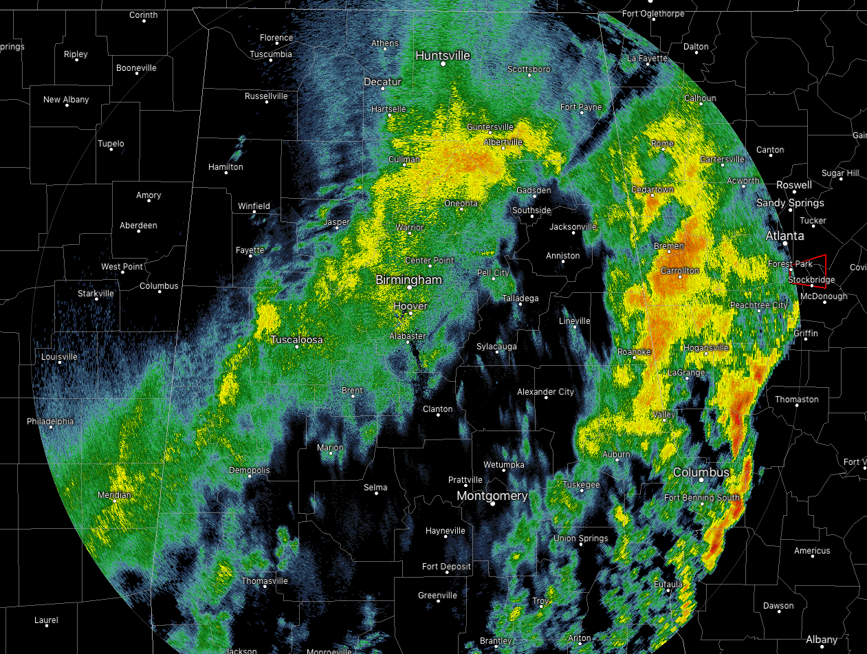
As just before 1:00 pm on this Tuesday afternoon, the main line of strong to severe thunderstorms have now pushed out of Central Alabama and into Georgia. While no warnings were issued for any part of Central Alabama, one Severe Thunderstorm Warning is currently in effect for parts of the southwestern corner of Georgia.
We have another line of light to moderate showers falling roughly over and around the I-59 corridor throughout Central Alabama just ahead of the cold front. These should be out of the area by sunset or just after.
Temperatures are currently in the mid-50s to the mid-60s throughout the area and those will continue to drop during the afternoon and evening hours. It’s already down to 55 degrees in Cullman, 59 degrees in Birmingham, and 65 degrees at Montgomery. We’re headed to the lower 30s to near 40 degrees for overnight lows.
So far, this is the only damage report into NWS Birmingham with this event…
Local Storm Report by NWS BMX: 2 NW Blue Ridge [Elmore Co, AL] emergency manager reports TSTM WND DMG at 10:52 AM CST — wind damage reported in Wetumpka, particularly in the southern portions of town near Lowes and Walmart along Highway 231. Damage was reported at Lowes along with multiple trees and power lines down.
Category: Alabama's Weather, ALL POSTS, Severe Weather
About the Author (Author Profile)
Scott Martin is an operational meteorologist, professional graphic artist, musician, husband, and father. Not only is Scott a member of the National Weather Association, but he is also the Central Alabama Chapter of the NWA president. Scott is also the co-founder of Racecast Weather, which provides forecasts for many racing series across the USA. He also supplies forecasts for the BassMaster Elite Series events including the BassMaster Classic.Subscribe
If you enjoyed this article, subscribe to receive more just like it.


