

Heavy Rain & Storms Pushing Across North Alabama, Showers Diminishing To The South
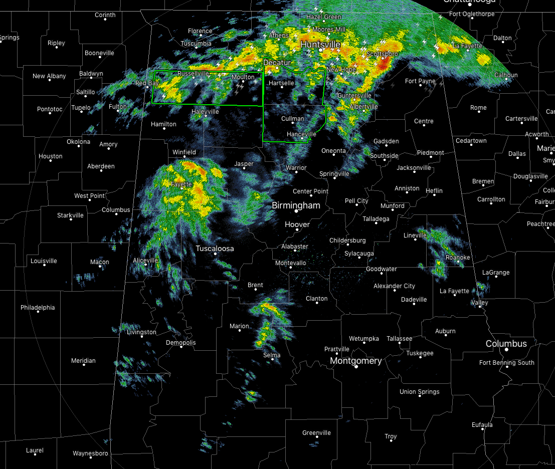
Activity over the southern 2/3rds of North/Central Alabama is really starting to calm down while rain and thunderstorms continue to move northeastward over North Alabama. Some of these storms have had a history of producing some small hail at times. The good news is that the activity is moving off pretty rapidly around 65-70 MPH.
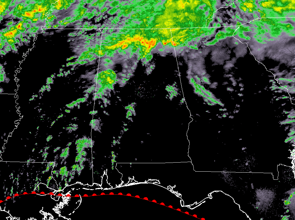
After that main body of rain and storms move out of North Alabama, the coverage in showers decreases substantially. We’ll continue to have a chance of scattered showers throughout the rest of the evening and into the overnight hours.
Flash Flood Warnings continue in effect for a few counties in North Alabama. Parts of Franklin and Lawrence counties are under a Flash Flood Warning until 9:15 pm tonight, while parts of Cullman and Morgan counties until 9:30 pm.
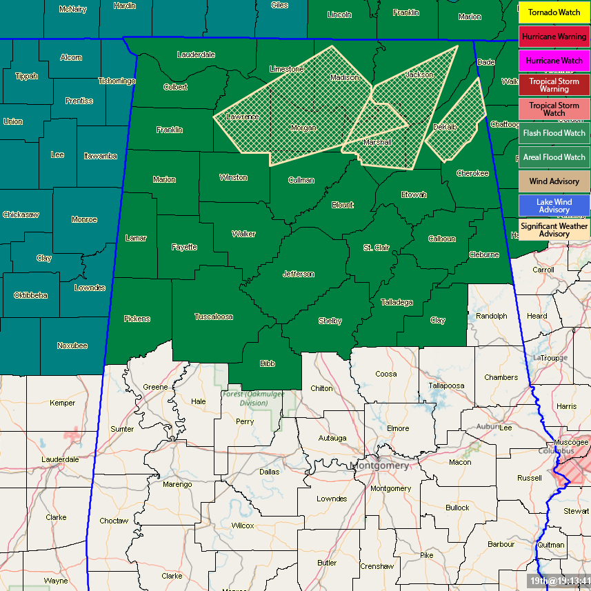
Areal Flood Watches continue across the area until Friday… North Alabama counties until 6:00 pm Friday (Colbert, Cullman, DeKalb, Franklin, Jackson, Lauderdale, Lawrence, Limestone, Madison, Marshall, and Morgan) and some Central Alabama counties until 6:00 am Friday (Bibb, Blount, Calhoun, Cherokee, Clay, Cleburne, Etowah, Fayette, Jefferson, Lamar, Marion, Pickens, Shelby, St. Clair, Talladega, Tuscaloosa, Walker, and Winston).
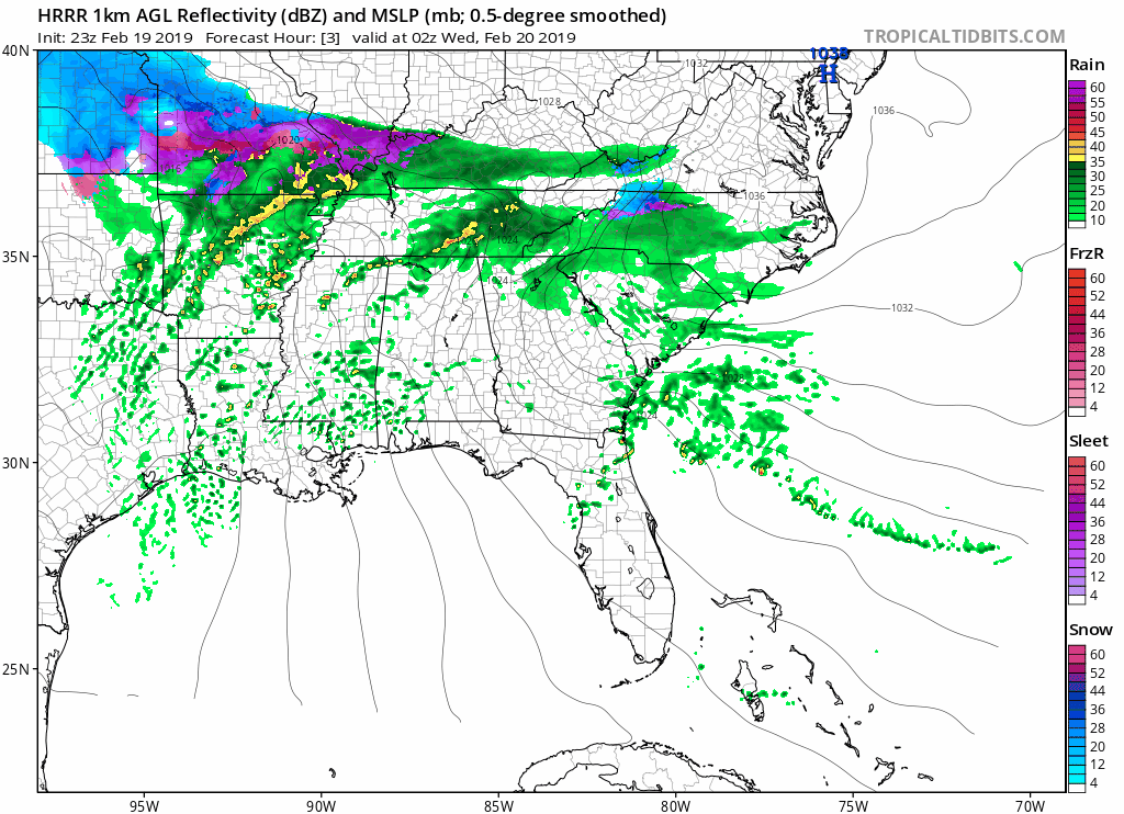
The HRRR is showing a squall line getting its act together to our west and moving into the northwestern parts of the state right around the morning rush hour on Wednesday and will begin to slowly move across the area during the morning hours. This will be along a cold front that will be sweeping through the southeast. While the line may not be completely organized, we could see some stronger storms on the middle and southern parts of the line with isolated damaging wind gusts as the main risk, but a brief isolated tornado can’t be ruled out.
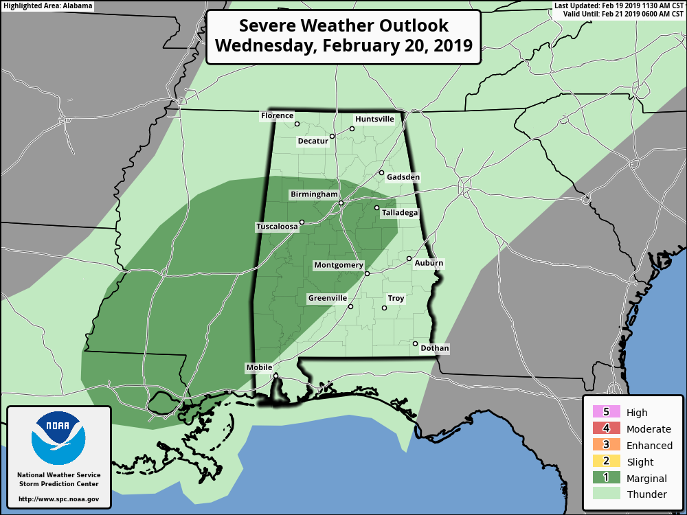
The Storm Prediction Center continues with a Marginal Risk of severe storms defined for a good chunk of Central Alabama on Wednesday. This includes the cities of Birmingham, Tuscaloosa, Jasper, Talladega, Sylacauga, Clanton, Selma, Demopolis, and Livingston.
We’ll keep you posted on any changes throughout the night.
Category: Alabama's Weather, ALL POSTS
About the Author (Author Profile)
Scott Martin is an operational meteorologist, professional graphic artist, musician, husband, and father. Not only is Scott a member of the National Weather Association, but he is also the Central Alabama Chapter of the NWA president. Scott is also the co-founder of Racecast Weather, which provides forecasts for many racing series across the USA. He also supplies forecasts for the BassMaster Elite Series events including the BassMaster Classic.Subscribe
If you enjoyed this article, subscribe to receive more just like it.


