

Line Of Storms Slowly Moving This Way; Strong To Severe Storm Potential Continues
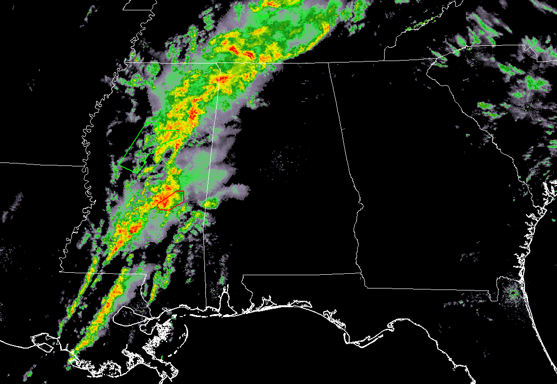
As of 8:50 am, an unorganized line of showers and storms stretches through the northwestern part of North Alabama back to the southwest through much of eastern and south-central Mississippi and down into eastern Louisiana. It is making very slow progress to the east but the cells within the line are moving rapidly to the north-northeast at around 55-60 MPH.
The cells that are affecting parts of Lauderdale and Colbert counties have the potential for some gusty winds in excess of 30 MPH and pea-size hail. Frequent cloud-to-ground lightning is occurring with these cells as well. If you are in the path of these cells, get to a safe shelter inside.
At this point, no severe weather watches or warnings are in effect anywhere in North/Central Alabama, but there is a Tornado Warning in effect back to the west for portions of Newton County in southeastern Mississippi until 9:45 am as a thunderstorm capable of producing a tornado was located near the western part of Newton. This cell is moving to the northeast at 30 MPH.
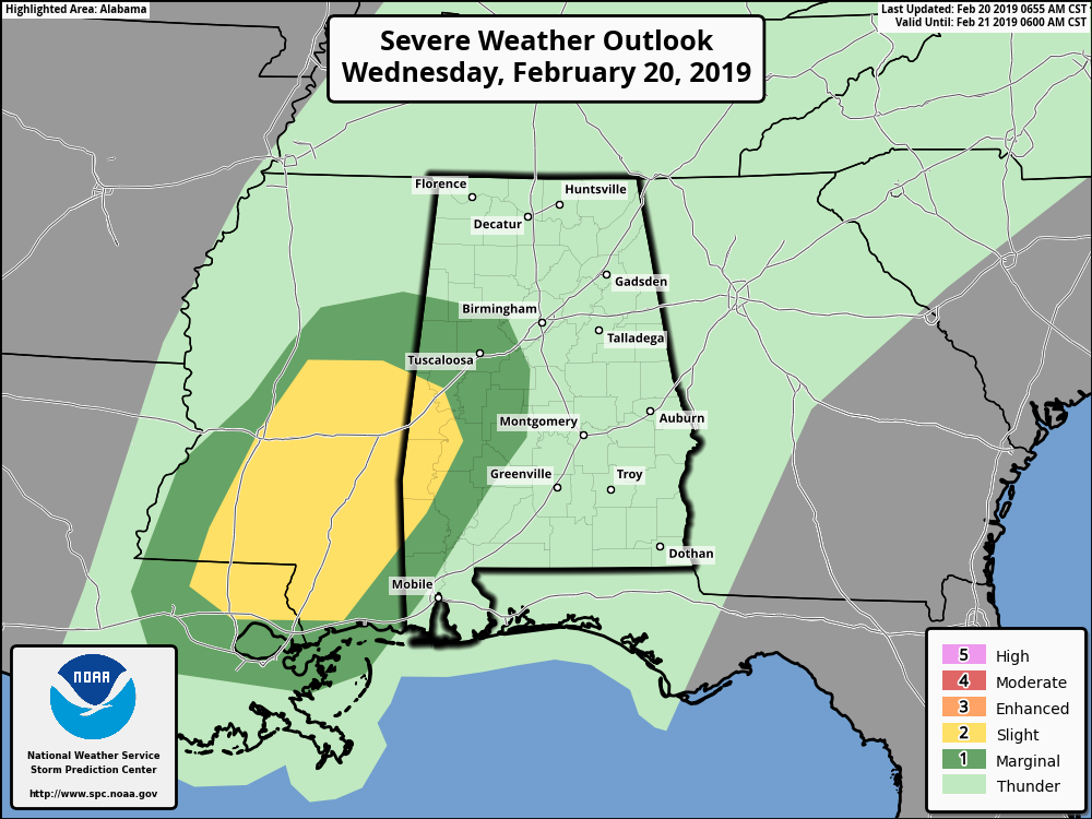
A Slight Risk of severe storms continues for locations west of a line from Geiger to Boligee to Linden to Sweet Water. A Marginal Risk of severe storms continues for locations outside of the Slight Risk out to Vernon to Berry to West Blocton to Selma. Strong to severe storms are possible later this morning through the early afternoon hours across the west and southwestern parts of Central Alabama. Main threat will be from isolated damaging wind gusts of up to and possibly over 60 MPH. A brief isolated tornado or two may also be possible.
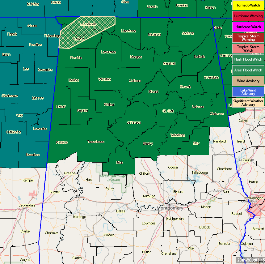
Areal Flood Watches continue across the area until Friday… North Alabama counties until 6:00 pm Friday (Colbert, Cullman, DeKalb, Franklin, Jackson, Lauderdale, Lawrence, Limestone, Madison, Marshall, and Morgan) and some Central Alabama counties until 6:00 am Friday (Bibb, Blount, Calhoun, Cherokee, Clay, Cleburne, Etowah, Fayette, Jefferson, Lamar, Marion, Pickens, Shelby, St. Clair, Talladega, Tuscaloosa, Walker, and Winston).
Category: Alabama's Weather, ALL POSTS, Severe Weather
About the Author (Author Profile)
Scott Martin is an operational meteorologist, professional graphic artist, musician, husband, and father. Not only is Scott a member of the National Weather Association, but he is also the Central Alabama Chapter of the NWA president. Scott is also the co-founder of Racecast Weather, which provides forecasts for many racing series across the USA. He also supplies forecasts for the BassMaster Elite Series events including the BassMaster Classic.Subscribe
If you enjoyed this article, subscribe to receive more just like it.


