

Stronger Storms Approaching Montgomery & Wetumpka
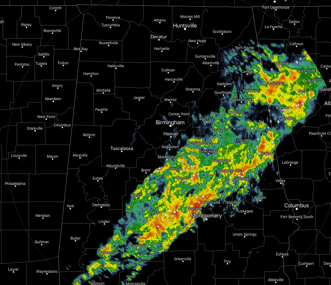
As of 7:45 pm, radar shows the line of thunderstorms continuing to push eastward across Central Alabama, now with all of the activity east of I-59. One stronger cell with plenty of lightning and heavy rain is approaching the cities of Montgomery and Wetumpka. Some small hail may be occurring with the storm along with some gusty winds, but at this moment, the storm is below severe criteria.
The back edge of the line is now approaching the cities of Piedmont to Vincent to Marion, while the stronger frontside of the line is approaching Montgomery to Dadeville to Five Points.
As we have now lost the heating of the day, the likelihood of any severe storms has diminished, but I wouldn’t be surprised if one or two more storms may have significant weather advisories issued for small hail and/or gusty winds.
We’ll continue to keep you posted through the evening.
Category: Alabama's Weather, ALL POSTS, Severe Weather
About the Author (Author Profile)
Scott Martin is an operational meteorologist, professional graphic artist, musician, husband, and father. Not only is Scott a member of the National Weather Association, but he is also the Central Alabama Chapter of the NWA president. Scott is also the co-founder of Racecast Weather, which provides forecasts for many racing series across the USA. He also supplies forecasts for the BassMaster Elite Series events including the BassMaster Classic.Subscribe
If you enjoyed this article, subscribe to receive more just like it.


