

Heavy Rain & Storms Drenching the Central Alabama Evening
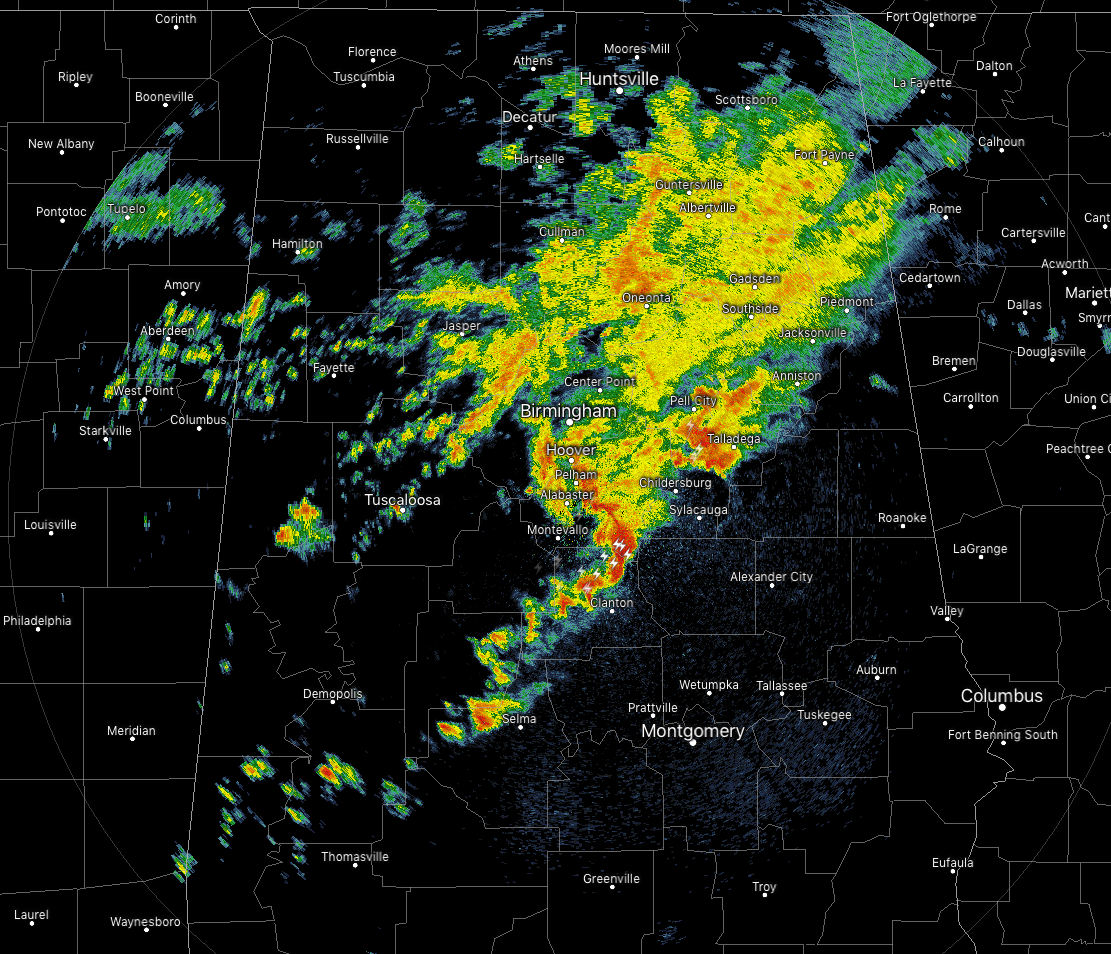
Radar at 6:43 shows a large shield of rain and thunderstorms over much of the northeastern quarter of the state, with a few stronger storms on the southern end now moving north of and approaching the city of Clanton. While organized severe weather is not expected over the area, there is a very small risk of a brief spin-up tornado over the next hour or so over the south and southeastern parts of Central Alabama. These individual cells are moving to the east-northeast around 40 MPH.
While coverage of the shower and thunderstorm activity will diminish somewhat during the overnight hours, scattered showers and a thunderstorm or two will remain possible. As we go later into the night, this activity should weaken as well, but some strong storms may be possible until around 8:00 pm tonight.
We’ll keep you covered throughout the night.
Category: Alabama's Weather, ALL POSTS
About the Author (Author Profile)
Scott Martin is an operational meteorologist, professional graphic artist, musician, husband, and father. Not only is Scott a member of the National Weather Association, but he is also the Central Alabama Chapter of the NWA president. Scott is also the co-founder of Racecast Weather, which provides forecasts for many racing series across the USA. He also supplies forecasts for the BassMaster Elite Series events including the BassMaster Classic.Subscribe
If you enjoyed this article, subscribe to receive more just like it.


