

Storms Forming & Becoming Strong
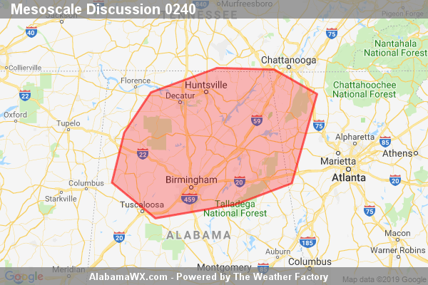
As mentioned earlier, a Severe Thunderstorm Watch may be needed as convection across the area is expected to increase over the next 1-2 hours. A few stronger cells may become capable of producing hail and/or isolated damaging wind gusts.
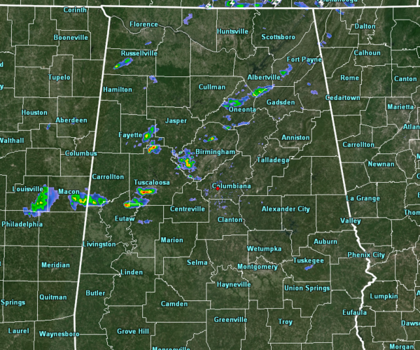
With that being said, convective development is occurring over parts of Central Alabama at 3:30 pm, with a few stronger cells located over Tuscaloosa County and southwestern Jefferson County. These cells are moving to the east-southeast at around 30 MPH. So far, no lighting has been detected with these cells, but as they grow in strength, I wouldn’t be surprised if lightning will begin soon.
Instability has increased to 500-1000 J/kg across the area, and mix that with 0-6 km bulk shear values above 50-60 knots, we should start seeing hail with these cells as they continue to grow. What is keeping us from tornadic development today is the unidirectional flow aloft. While the threat continues to be very small, it is still not at zero. We have to stay on guard as this is our Spring Severe Weather Season. We need to expect the unexpected.
Category: Alabama's Weather, ALL POSTS, Severe Weather
About the Author (Author Profile)
Scott Martin is an operational meteorologist, professional graphic artist, musician, husband, and father. Not only is Scott a member of the National Weather Association, but he is also the Central Alabama Chapter of the NWA president. Scott is also the co-founder of Racecast Weather, which provides forecasts for many racing series across the USA. He also supplies forecasts for the BassMaster Elite Series events including the BassMaster Classic.Subscribe
If you enjoyed this article, subscribe to receive more just like it.


