

Heads Up For Lee & Macon Counties… Severe Storm Heading In That Direction
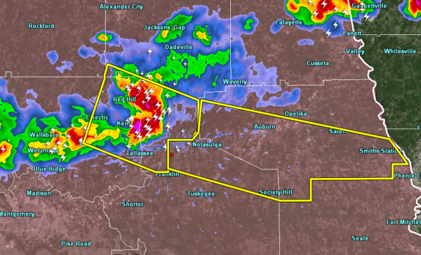
A Severe Thunderstorm has been issued for much of Lee County and the northern parts of Macon County for a severe thunderstorm capable of producing large hail and damaging winds. This storm has a history of producing damage as it moved through Chilton County, including some structural damage.
If you are in the path of this storm, please seek shelter immediately. Those in the path are Notasulga, Loachapoka, Auburn, Society Hill, Salem, Beauregard, Bleeker, and Smiths Station.
Winds up to 70 MPH are possible along with hail up to ping pong ball size.
Category: Alabama's Weather, ALL POSTS, Severe Weather
About the Author (Author Profile)
Scott Martin is an operational meteorologist, professional graphic artist, musician, husband, and father. Not only is Scott a member of the National Weather Association, but he is also the Central Alabama Chapter of the NWA president. Scott is also the co-founder of Racecast Weather, which provides forecasts for many racing series across the USA. He also supplies forecasts for the BassMaster Elite Series events including the BassMaster Classic.Subscribe
If you enjoyed this article, subscribe to receive more just like it.


