

Tornadic Storms in Eastern Mississippi will Impact West Alabama
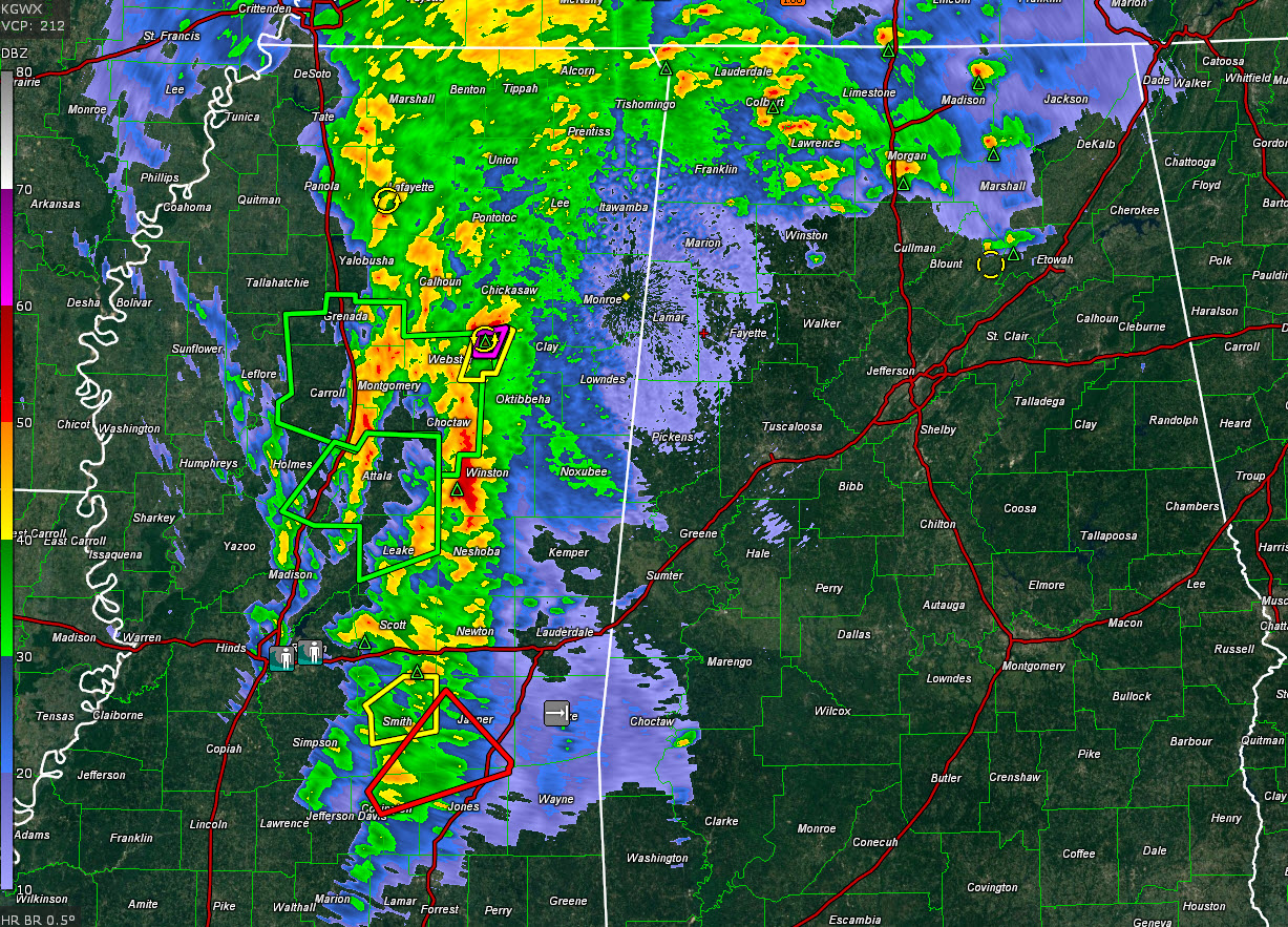
The storm northwest of Starkville has shown radar confirmation of a tornado near Mathison. Power flashes were also observed by spotters.
This storm is moving toward Houston and Okalona.
The storm will eventually move toward Marion County. It would arrive there between 10:30 and 11 p.m. on its present track.
Additionally, dangerous storms are moving toward Meridian MS. These will impact Sumter County starting around 11 p.m.
The cold front is surging eastward across Mississippi at this hour. This will work in tandem with an increasing low-level jet to intensify the storms as they approach the Alabama border. The threat for damaging winds and spin up tornadoes will increase as they do.
Now is the time to make sure you have your plan in place for tonight and early tomorrow morning if you live in the western two-thirds of our state. And for later Sunday morning over the eastern half of the state.
Have a way to receive warnings that WILL WAKE YOU UP. And if you live in manufactured housing, be ready to move to a more substantial structure before the storms approach your area.
Monitor the latest conditions throughout tonight and Sunday morning right here on AlabamaWX.
Category: Alabama's Weather, ALL POSTS
About the Author (Author Profile)
Bill Murray is the President of The Weather Factory. He is the site's official weather historian and a weekend forecaster. He also anchors the site's severe weather coverage. Bill Murray is the proud holder of National Weather Association Digital Seal #0001 @wxhistorianSubscribe
If you enjoyed this article, subscribe to receive more just like it.


