

A Reset as of 12:45 a.m.: Severe Weather Threat Continues; New Tornado Watch Coming
Thunderstorms intensified rapidly late last night as a surging cold front and rapidly increasing low-level jet worked in tandem to energize them.
Those storms have pushed into western Alabama now. They appear to be transitioning into line segments. They will be capable of damaging winds and tornadoes.
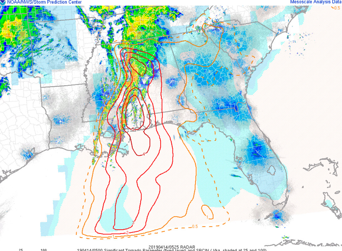
Significant tornado parameter (STP) values are still high west of I-65. They are over 5 over Southwest Alabama from Choctaw County south to the coast. They are over 4 over Marion, Lamar, Fayette, and Walker Counties.
A new tornado watch is coming shortly for much of North and Central Alabama.
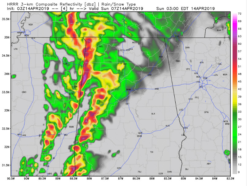
Let’s walk through the timing using the HRRR model:
Here is 2 a.m. showing the storms approaching Tuscaloosa and the University of Alabama. They could arrive as early as 1:30 a.m. The storms could have damaging winds and a threat of a tornado.
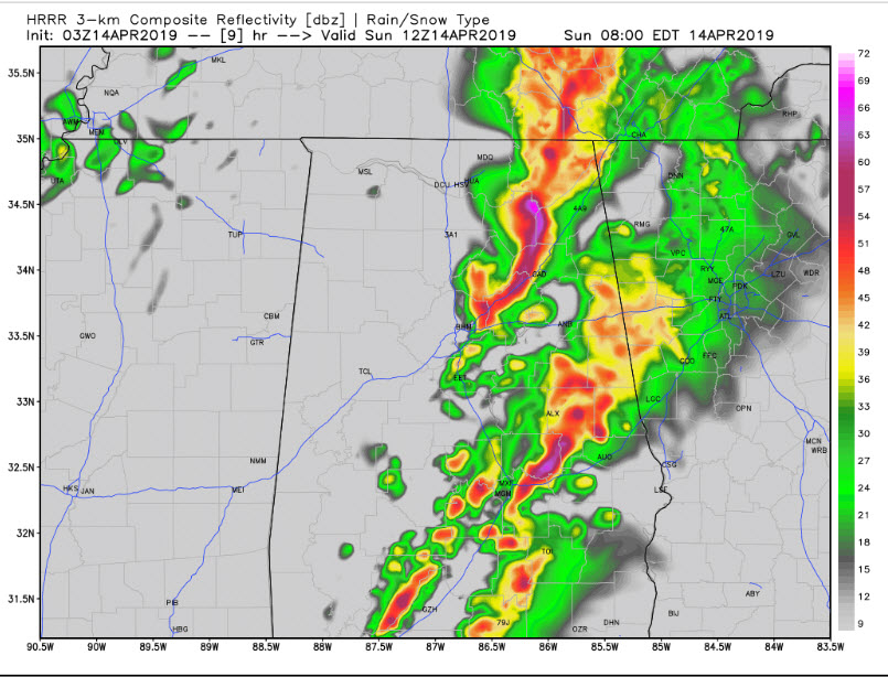
By 4 a.m., the first line of storms is moving into Birmingham. Notice there is clearly a second line behind the first. That line would be moving into Tuscaloosa and Jasper.

By 6 a.m., the second line is approaching Birmingham. It is already through Cullman. The lead storms are going through Anniston and Montgomery.

By 7 a.m., strong storms are Gadsden and Auburn.
The storms should weaken with time after that. By 11 a.m., they are into Georgia.
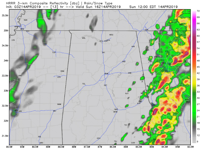
The severe weather threat will be over.
Wind advisory
Category: Alabama's Weather, ALL POSTS
About the Author (Author Profile)
Bill Murray is the President of The Weather Factory. He is the site's official weather historian and a weekend forecaster. He also anchors the site's severe weather coverage. Bill Murray is the proud holder of National Weather Association Digital Seal #0001 @wxhistorianSubscribe
If you enjoyed this article, subscribe to receive more just like it.


