

A Quick Mid-Morning Check On Our Weather & Tonight’s Severe Weather Threat
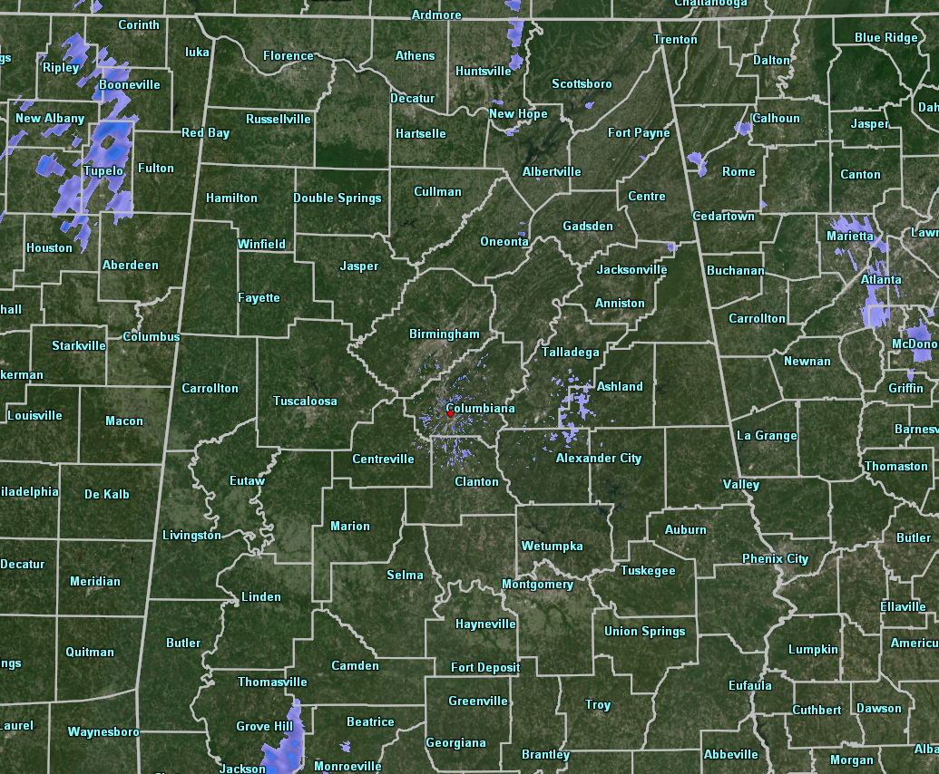
At 9:20 am, radar is quiet across Central Alabama so far this morning and it should stay that way for a good while throughout the morning and into the afternoon hours. Skies at this point are partly to mostly cloudy, but some sunshine is breaking through.
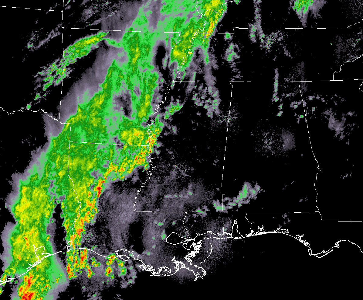
At this point, all of the activity mostly remains along and west of the Mississippi River back into Arkansas, Louisiana, and eastern Texas. No severe watches are up, but there is one severe thunderstorm warning up for portions of Grant, Natchitoches, and Winn parishes in Central Louisiana. This activity is expected to grow much stronger, bringing a threat of tornadoes and damaging winds throughout the southeast today.
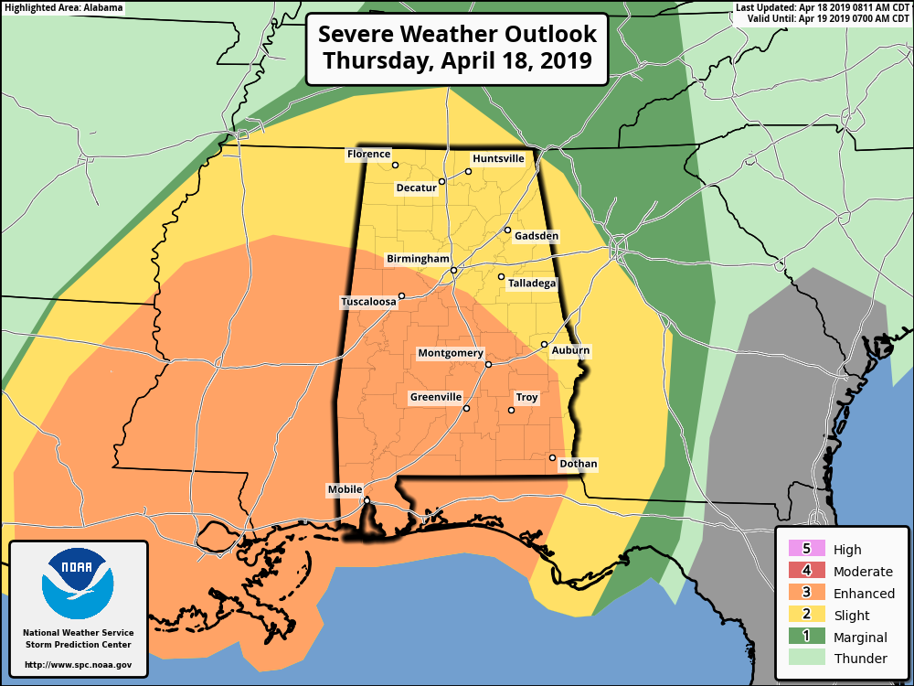
SPC has an Enhanced Risk for severe storms up for locations south of a line from Vernon to Hoover to just north of Tuskegee for today through 7:00 am Friday. A Slight risk is up for the rest of Central Alabama. Tornadoes and damaging winds will be the main threats with this event, but there is a much smaller risk of large hail up to quarter size.
The higher chance of tornadoes will be in the enhanced risk locations, mainly south of a line stretching from Tuscaloosa to Clanton to Auburn. The Storm Prediction Center has a 10% chance of a tornado occurring within 25 miles of a point in the enhanced risk locations with the possibility of a strong tornado of EF2 or higher.
In the slight risk locations, the main threat will be from damaging winds up to 60 MPH or more, but there is still a threat of a few tornadoes.
No matter what the risk level is for your location, you will need to be weather aware starting late this afternoon through the late night and into the early morning hours.
The main window for severe storms across Central Alabama continues to be from 4:00 pm this afternoon until 4:00 am Friday morning. To break it down, the western third of the area (west of a line from Demopolis to West Jefferson to Holly Pond) will occur from 4:00 pm to 10:00 pm west to east, the central third of the area (east to a line from Fort Deposit to Alexander City to Ranburne) from 7:00 pm to 1:00 am, and the eastern third of the area from 10:00 pm to 4:00 am.
Now is the time to be prepared for severe weather, and be sure that your friends and relatives are prepared as well. Have multiple ways to receive weather warnings. Never rely on outdoor sirens to be your only source of receiving a tornado warning. Download trustworthy apps that will notify you of warnings and get a NOAA WeatherRadio if you do not have one. Also, download the ABC 33/40 app on your smartphone so you can watch live coverage from your safe place if your location goes under a warning.
Have your emergency preparedness kit ready to go and have your severe weather safety plan ready to act. Know where to go and be sure you can get there quickly. If you live in a mobile or manufactured home, be sure that you can get to a place of safety, like an interior room in a well-constructed home or building, basement, storm shelter, or a safe room. If it takes you longer than five minutes to get to a place of safety, consider staying with friends or family who do have a safe place until the threat is over. It’s better to be safe then sorry, even if it inconveniences you for a few hours.
We’ll continue to have updates throughout the day and through the event. Check back often.
Category: Alabama's Weather, ALL POSTS, Severe Weather
About the Author (Author Profile)
Scott Martin is an operational meteorologist, professional graphic artist, musician, husband, and father. Not only is Scott a member of the National Weather Association, but he is also the Central Alabama Chapter of the NWA president. Scott is also the co-founder of Racecast Weather, which provides forecasts for many racing series across the USA. He also supplies forecasts for the BassMaster Elite Series events including the BassMaster Classic.Subscribe
If you enjoyed this article, subscribe to receive more just like it.


