

Strong Storms Soon To Move Into The Birmingham Metropolitan Area
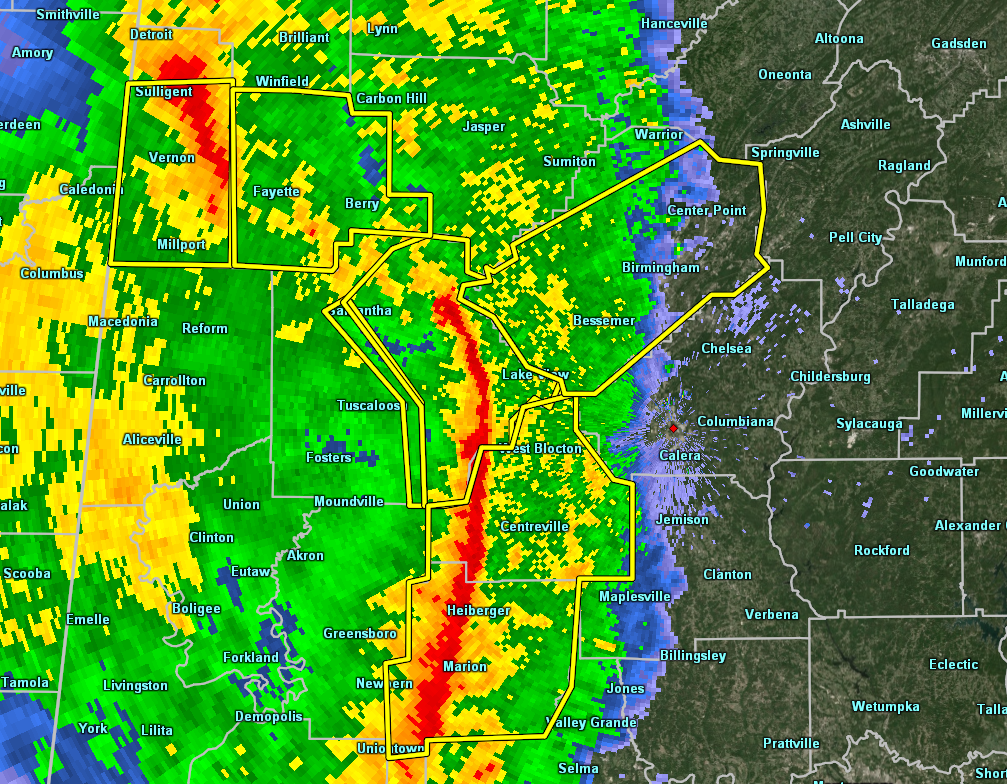
The strongest segment of the line of storms is now stretching from the northeastern corner of Tuscaloosa County and stretching to the south through Brookwood and Vance, then down into Heiberger and Marion in Perry County, and down into the eastern parts of Marengo County.
The north end of the bowing segment is pushing into the extreme western parts of Jefferson County as I type. Winds up to 70 MPH can be expected as this moves through. Should be in the Birmingham metropolitan area within the next 30 minutes.
If you are in the path of this line segment, take cover just like it was a tornado warning. With the potential for 70 MPH winds, trees and power lines being blown down, and some damage to structures are possible.
Category: Alabama's Weather, ALL POSTS, Severe Weather
About the Author (Author Profile)
Scott Martin is an operational meteorologist, professional graphic artist, musician, husband, and father. Not only is Scott a member of the National Weather Association, but he is also the Central Alabama Chapter of the NWA president. Scott is also the co-founder of Racecast Weather, which provides forecasts for many racing series across the USA. He also supplies forecasts for the BassMaster Elite Series events including the BassMaster Classic.Subscribe
If you enjoyed this article, subscribe to receive more just like it.


