

Alabama Weather Update Just After 10:30 p.m.: Second Line of Storms Develops; Severe Threat Mainly for Far South Alabama
Strong storms continue tonight from southwest of Auburn near Tuskegee southward to just northwest of Troy.
The heaviest activity is near Tuskegee.
Instabilities are low though over all of the state except for extreme South Alabama, generally south of US-84.
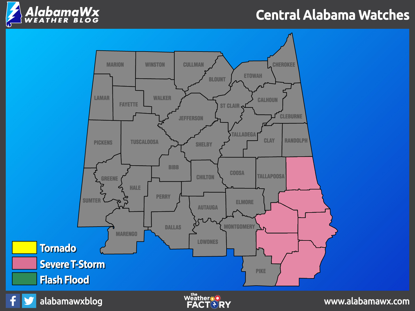
The tornado threat is lessening, and the tornado watch will be allowed to expire over all of South Alabama at 11 p.m.
A severe thunderstorm watch is in effect until 2 a.m. for a few counties in Southeast Alabama.
A second line of storms is pushing eastward across western Alabama tonight. It extends from west of Birmingham to east of Demopolis to near Chatom. There is some chance that the instability could be pulled northward as this line progresses eastward, and the storms could intensify again. Winds have veered to southwesterly over all but extreme Southeast Alabama tonight, and the tornado threat has lessened. But storms could become severe again as they slide eastward.
Category: Alabama's Weather, ALL POSTS
About the Author (Author Profile)
Bill Murray is the President of The Weather Factory. He is the site's official weather historian and a weekend forecaster. He also anchors the site's severe weather coverage. Bill Murray is the proud holder of National Weather Association Digital Seal #0001 @wxhistorianSubscribe
If you enjoyed this article, subscribe to receive more just like it.


