

An 11:30 Look at the Alabama Weather Situation: Tornado Threat May Increase Again for Areas Along and South of I-85/I-65
The severe weather threat is over tonight for the northern half of Alabama.
But to the south, very juicy, unstable air is lurking over the Florida Panhandle and extreme South Alabama. Dewpoints are in the 70s tonight from Ozark, Fort Rucker, Enterprise and Andalusia to Evergreen. This air will be pulled northward by strong low-level winds over the next few hours.
Surface winds continue to be out of the south southeast in these areas, from Evergreen to Auburn, and this could lead to a tornado threat for areas along and south of I-85, and I-65 south of Montgomery.
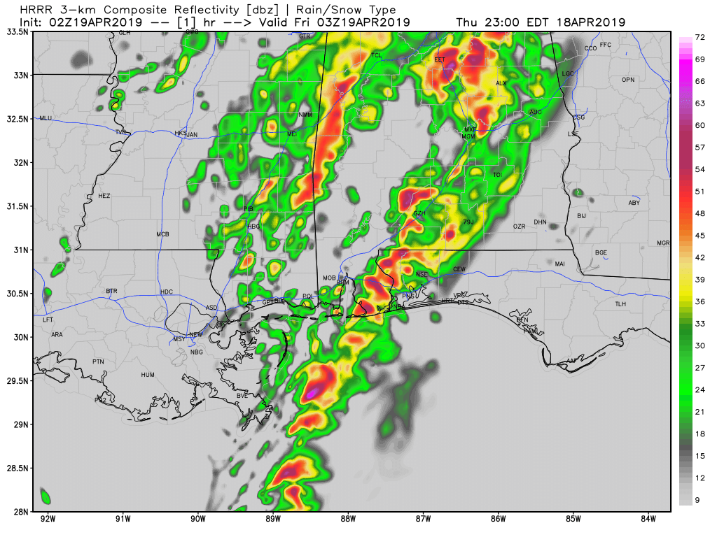
We will be watching the storms that are forming from Evergreen to Pensacola. These storms will grow in intensity and coverage over the next couple of hours.
A severe thunderstorm watch remains in effect for 6 counties in East Central Alabama until 2 a.m. An additional tornado watch is possible if the storms begin to increase.
For the rest of the state, rain and some thunder do continue across parts of North and Central Alabama. The rain will be heavy at times, and there will be some thunder overnight.
Category: Alabama's Weather, ALL POSTS
About the Author (Author Profile)
Bill Murray is the President of The Weather Factory. He is the site's official weather historian and a weekend forecaster. He also anchors the site's severe weather coverage. Bill Murray is the proud holder of National Weather Association Digital Seal #0001 @wxhistorianSubscribe
If you enjoyed this article, subscribe to receive more just like it.


