

Severe Threat Has Diminished Considerably
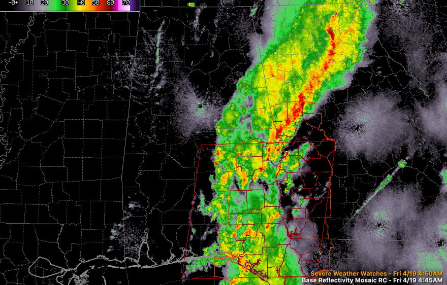
The area of rain and storms has lost intensity over the past couple of hours, and the main threat is becoming flooding in some locations.
A flood advisory is in effect for Lee and Macon Counties. 3.18 inches of rain at Auburn tonight, with all of it falling since 11 o’clock.
The severe weather threat continues southeast of a line from Auburn to Luverne, and even there it is marginal.
A tornado watch does continue for Southeast Alabama. It will be canceled before its expiration time of 8 a.m. CDT.
A bowling ball of an upper low will develop over North Mississippi and northern Alabama today. The result will be clouds, lots of light rain and highs struggling to get out of the 40s over the North and 50s elsewhere.
Category: Alabama's Weather, ALL POSTS
About the Author (Author Profile)
Bill Murray is the President of The Weather Factory. He is the site's official weather historian and a weekend forecaster. He also anchors the site's severe weather coverage. Bill Murray is the proud holder of National Weather Association Digital Seal #0001 @wxhistorianSubscribe
If you enjoyed this article, subscribe to receive more just like it.


