


**No Weather Xtreme video this afternoon; I am live at Regions Field for the annual Severe Weather Awareness Night sponsored by the Birmingham Barons**
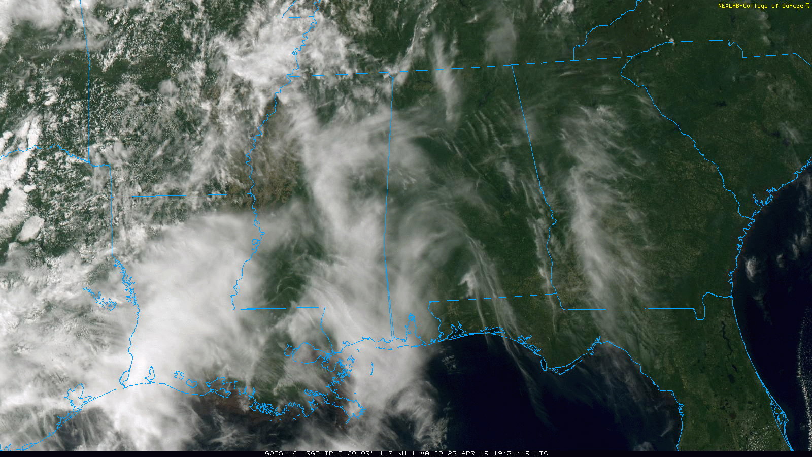
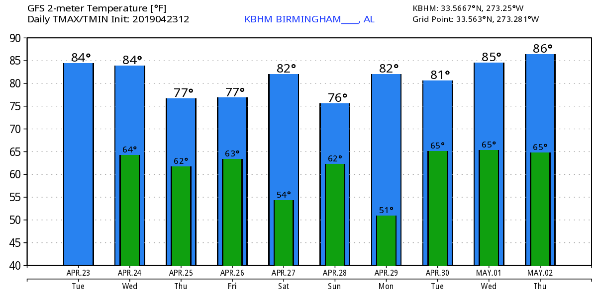
WARM IS THE WORD: Temperatures are generally in the low 80s across Alabama this afternoon with lots of sunshine through high, thin cirrus clouds. Tonight will be mostly fair with a low close to 60 degrees.
Tomorrow will be another warm, dry day with ample sunshine along with a high in the 82-85 degree range.
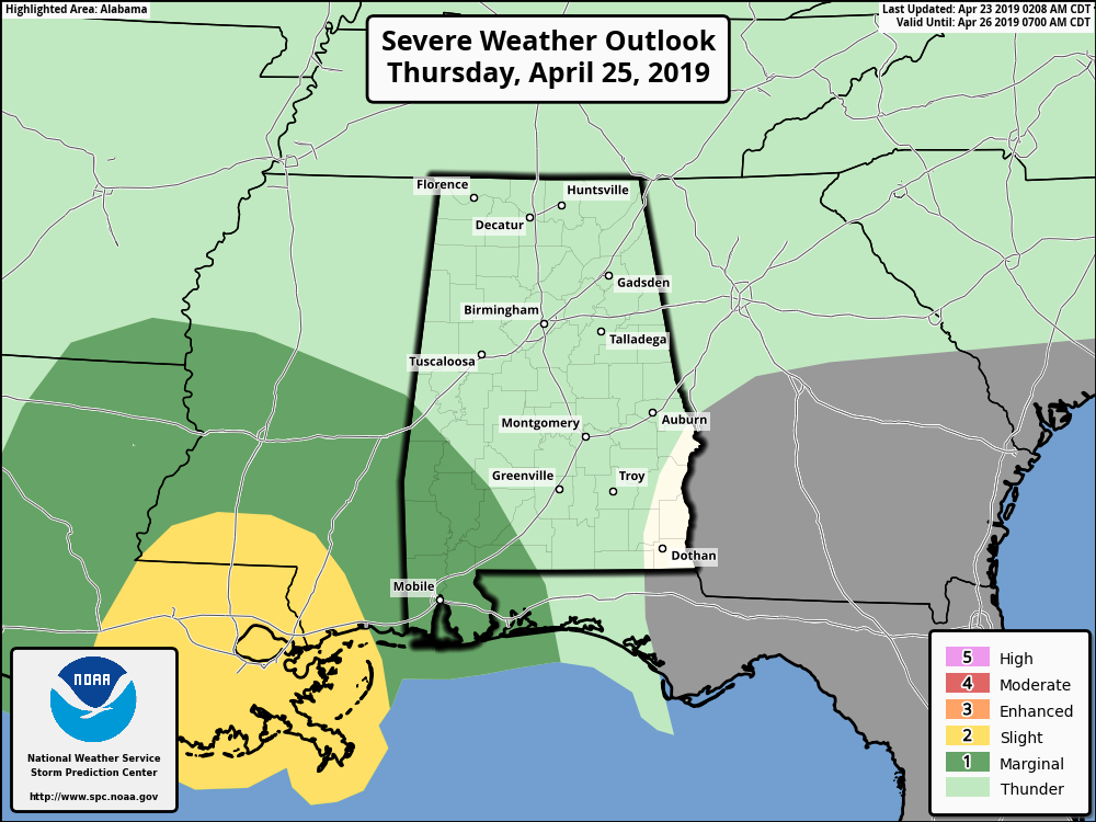
THURSDAY/FRIDAY: Clouds will increase on Thursday, and a few showers could creep into West Alabama by mid to late afternoon. But, the best chance of showers will come Thursday night, when a few thunderstorms could be involved as well. There is a “marginal risk” (Level 1/5) of severe storms for Southwest Alabama, but for most of the state, severe weather is not expected.
Rain amounts will be mostly 1/2 inch or less, and the rain will end early in the day Friday. The sky becomes mostly sunny by Friday afternoon. The high will be in the upper 70s both days.
THE ALABAMA WEEKEND: The weather still looks warm and dry both days. Lots of sunshine Saturday with a high in the low 80s, then a mix of sun and clouds Sunday with a high between 78 and 81. A weak surface boundary will drift into North Alabama Sunday afternoon, but for now the air looks too dry for any meaningful rain.
RACE WEEKEND AT TALLADEGA: We are still forecasting warm, dry weather Saturday and Sunday with a good supply of sunshine both days; highs will be generally in the low 80s.
NEXT WEEK: A building upper ridge will set up a very warm and dry pattern for the Deep South next week. Highs will be in the 80s, and a few spots could flirt with 90 degrees along the way.
ON THIS DATE IN 1999: On Friday, April 23, 1999, a horrific hailstorm moved southeast from Pennsylvania across Garrett County, Maryland and into the Eastern Panhandle of West Virginia. It had weakened some as it crossed Garrett County and the Allegany Front, but as it passed east of Keyser, West Virginia, hail began to increase in size once again. By the time it reached Capon Bridge in eastern Hampshire County, West Virginia, the size of the hail had grown from golf balls to baseballs. The damage left behind was incredible. In Northern Virginia alone, it amounted to over $50 million in losses to public and private properties. Some communities saw a third of the homes with siding and roof damage. Some required total replacement.
BEACH FORECAST: Click here to see the AlabamaWx Beach Forecast Center page.
WEATHER BRAINS: Don’t forget you can listen to our weekly 90 minute show anytime on your favorite podcast app. This is the show all about weather featuring many familiar voices, including our meteorologists here at ABC 33/40.
CONNECT: You can find me on all of the major social networks…
Facebook
Twitter
Instagram
Pinterest
Snapchat: spannwx
I had a great time today visiting with the students at Creekview Elementary in Alabaster, and also the 3rd graders at Calera Intermediate School… be looking for them on the Pepsi KIDCAM today at 5:00 and 6:00 on ABC 33/40 News! The next Weather Xtreme video will be posted here by 7:00 a.m. tomorrow…


