

Here’s an Update on the Alabama Weather Situation at 2:30 p.m.
A line of strong storms continues to push east this afternoon across Alabama.
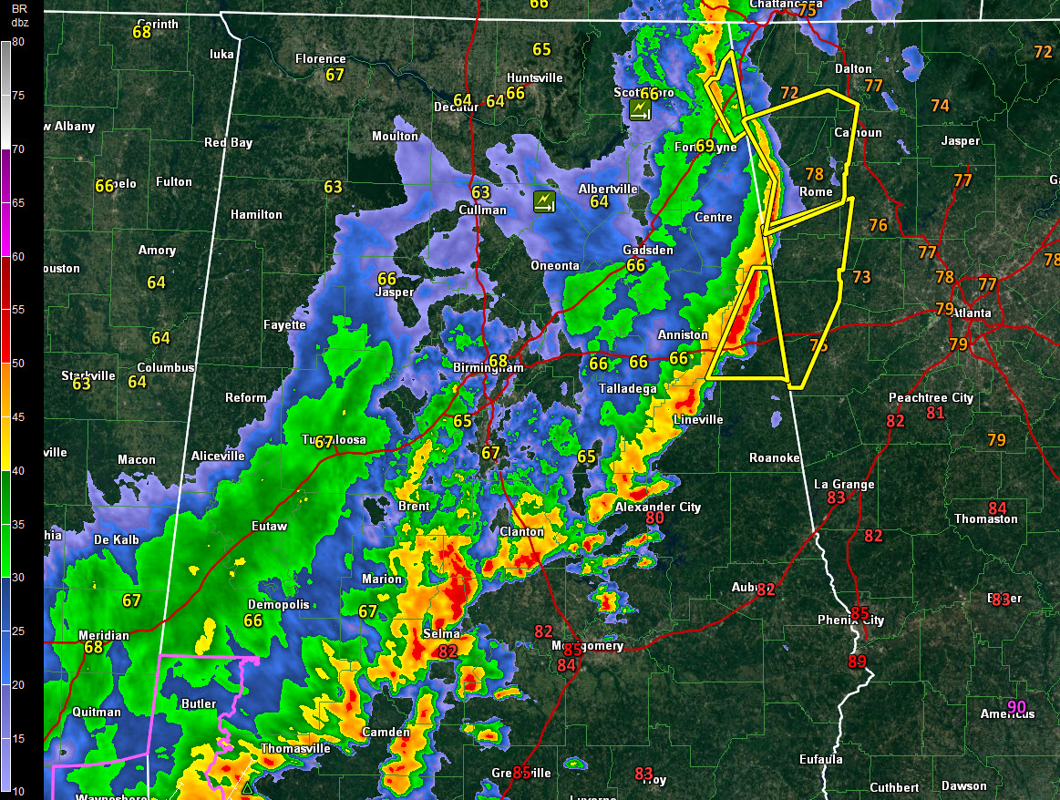
It extends from Bridgeport and Stevenson in Northeast Alabama’s Jackson County to near Valley Head through extreme southeastern Cherokee County to near Heflin in Cleburne County. It then goes on to Ashland in Clay County and to near Alex City. it gets heavier between Maplesville and Selma and even extends down into Washington County near Chatom.
A mesovortex has developed over Northeast Alabama’s Jackson County. It is moving northeast toward Chattanooga. Fortunately, instability is less over northern Georgia and weakening should occur.
The northern part of the line is accelerating eastward at some 35-40 mph, while the southern part is slowing.
There is probably some hail around Selma. Damaging winds are possible in the stronger storms.
The tornado warnings in Northeast Alabama have been canceled.
There is still a severe thunderstorm warning for southeastern Cleburne County until 3 p.m. and a severe thunderstorm warning for Jackson and DeKalb Counties until 2:45 p.m.
The Cherokee County warning expired at 2:30 p.m.
There was damage to a barn and chicken houses near Joppa and West Point in Cullman County. Trees were also down east northeast of Boaz. Other trees were down in Etowah County.
Trees were down west of Warrior in northern Jefferson County. Scott Martin also reported damage to a fence at Cullman-Jefferson Gas in Warrior.
Category: ALL POSTS
About the Author (Author Profile)
Bill Murray is the President of The Weather Factory. He is the site's official weather historian and a weekend forecaster. He also anchors the site's severe weather coverage. Bill Murray is the proud holder of National Weather Association Digital Seal #0001 @wxhistorianSubscribe
If you enjoyed this article, subscribe to receive more just like it.


