

Air Stable Over NW Alabama, Storms Continue Over SE Alabama
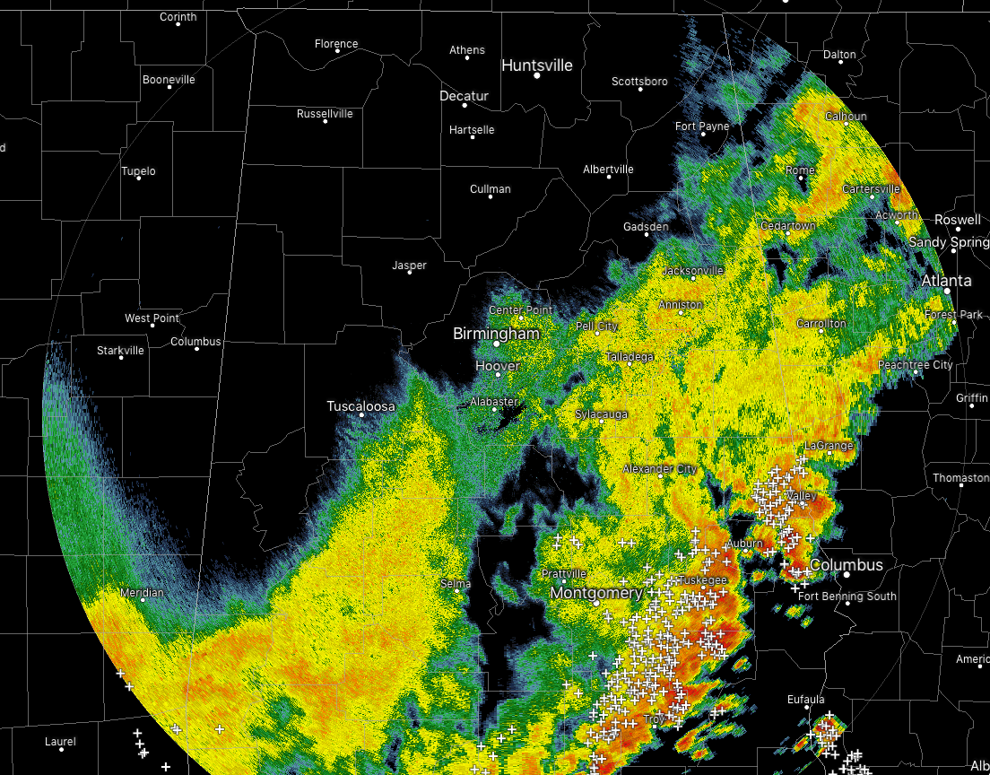
At 4:45 pm, the leading edge of the line of showers and thunderstorms is moving through the southeastern parts of the area, arriving or already arrived in Smiths Station, Midway, Hurtsboro, Troy, and Brundidge. Some gusty winds and dangerous cloud-to-ground lightning are currently occurring, but none of the line is severe at this point. Rain is already starting to come to an end along the I-59 corridor and is dry north of that.
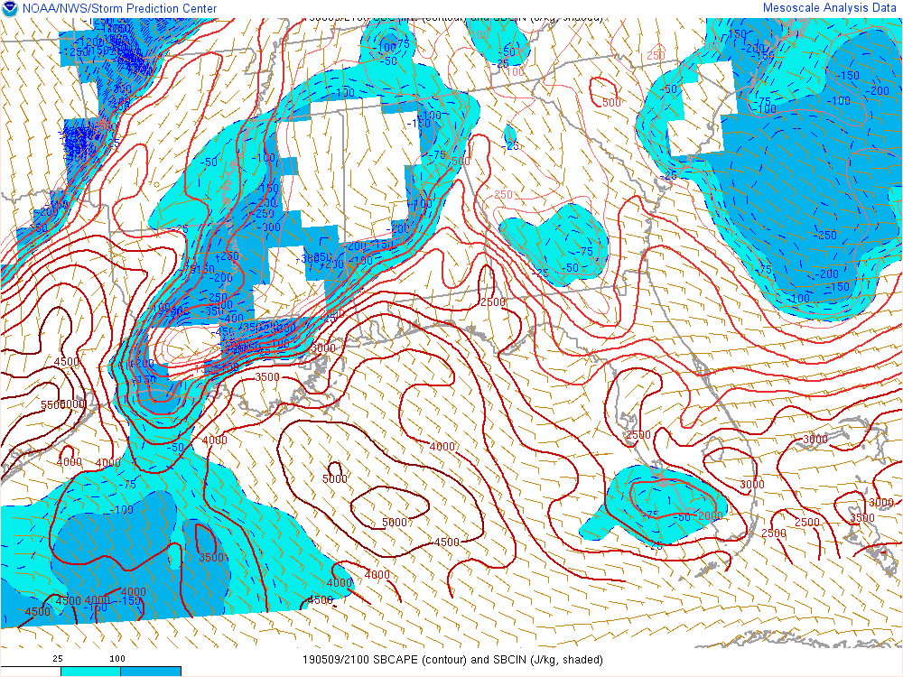
Rain-cooled air has stabilized the atmosphere for locations north of the I-59 corridor. The above image shows the latest update from the SPC’s Mesoscale Analysis with instability being confined to the extreme south and southeastern parts of Central Alabama, while there is none in the northern half of the area.
The latest run of the HRRR keeps us dry behind this line throughout the rest of the evening and through the overnight hours. It looks like it is painting an MCV that will be moving through Louisiana and into Mississippi during the predawn hours and into the late morning hours on Friday. If it holds together that will move into the western parts of Central Alabama around or just after the midday hour.
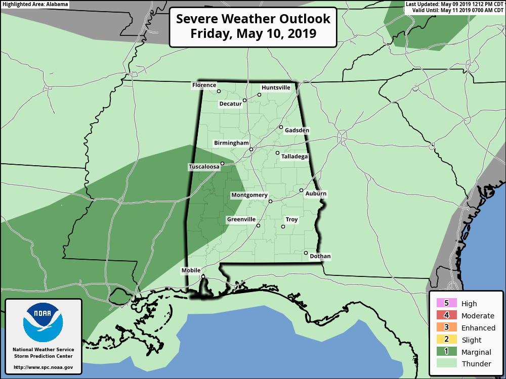
At this point, SPC has the west and southwestern parts of the area in a Marginal Risk of severe storms on Friday, mainly for isolated damaging wind gusts up to 60 MPH. We’ll continue to look at that threat throughout this evening. Keep checking back.
Category: Alabama's Weather, ALL POSTS, Severe Weather
About the Author (Author Profile)
Scott Martin is an operational meteorologist, professional graphic artist, musician, husband, and father. Not only is Scott a member of the National Weather Association, but he is also the Central Alabama Chapter of the NWA president. Scott is also the co-founder of Racecast Weather, which provides forecasts for many racing series across the USA. He also supplies forecasts for the BassMaster Elite Series events including the BassMaster Classic.Subscribe
If you enjoyed this article, subscribe to receive more just like it.


