

Alabama Weather Update – 10:15 a.m.: A Few Periods of Rain and Storms Through the Weekend
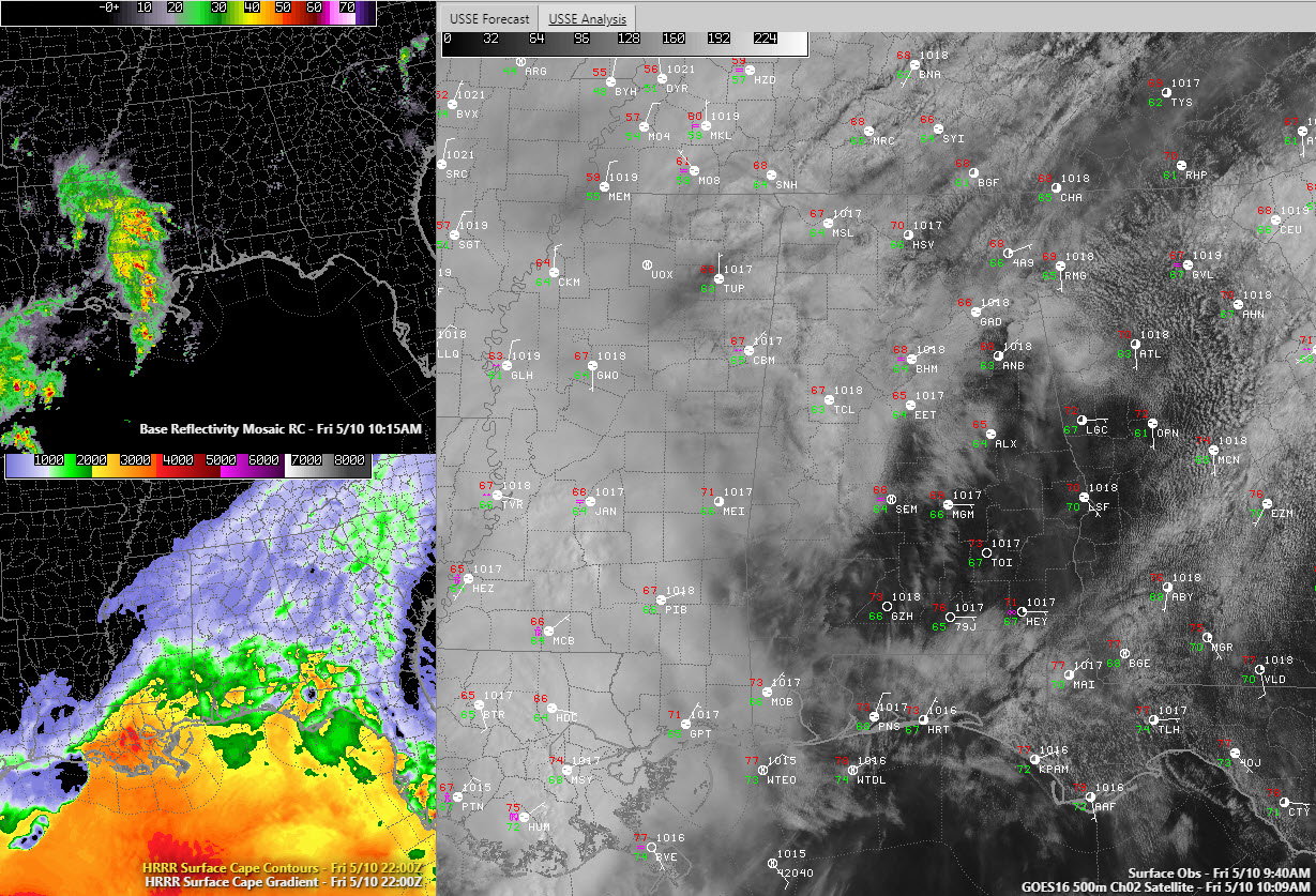
The upper left panel shows curret radar with storms to the southwest. Lower left shows current CAPE (instability). Main panel shows visible satellite and station observations.
It’s a quiet morning across Alabama at this hour, with no rain occurring across the state. Areas north of I-59 have mostly cloudy skies, but a large part of South Central Alabama has sunshine. Temperatures are in the 60s in the cloudy areas and 70s in the sunny ones.
Alabama continues in an unsettled pattern thanks to a large trough over the WEstern and central United States that is keeping a moist and active southwesterly flow aloft over Alabama. At the surface, broad low pressure is over the South with a stationary front to our northwest near Memphis.
A complex of thunderstorms is in moving through southwestern Mississippi and southeastern Louisiana. The storms have been moving northeast and weakening, as evidenced by warming cloud tops on infrared satellite imagery. This system should slowly gain intensity again as well head through the day and surface heating induces increasing instability. The current cloud coverage will help to keep a damper on things so, and consequently, the severe weather threat for today is minimal.
I think we will second a second round of storms late tonight, after midnight.
The scattered storms will develop during the day on Saturday. There should be sufficient instability for a few strong storms. In addition, 500 millibar winds will be increasing to 40-60 knots by late in the day. This means the storms will have the possibility of becoming organized and this will result in a few severe storms. Damaging winds will be the threat.
A second upper low is expected to develop over the northern Plains and dive southeast into the Midwest on Saturday. This will provide the impetus to push the stalled front southeastward through the area on Sunday.
I would expect storms to increase late Saturday night into Sunday morning as the front gets on the move. With increasing dynamics, more severe storms are possible late Saturday night into Sunday morning. Damaging winds and hail will be the main threats. As isolated brief tornado cannot be ruled out though, much like yesterday when a brief today occurred in northern Madison County in North Alabama. NWS Survey temps are also in Marshall and DeKalb counties today to confirm whether damage there was from a tornado.
The storms may weaken a bit Sunday morning before intensifying again south of I-59 during the afternoon. Once again, severe weather will be a possibility. Damaging winds and hail will be the main threats.
There is low confidence in timing for specific rounds of storms, just be ready for the rain and the possibility of severe weather when they come your way. There will be large parts of all three days that will be rain-free, like right now.
Most areas should average around 2 inches of rain between now and late Sunday. Any areas that get locally heavier rains could see some flash flooding, but that is not expected to be widespread.
Weather should improve by Monday, with increasing sunshine and highs in the middle 70s. Tuesday and Wednesday will be about as perfect as it gets weatherwise in Alabama, with lots of sunshine, slightly cool morning starts in the 50s and highs between 76-82 along with dewpoints in the 40s and 50s.
Category: Alabama's Weather, ALL POSTS
About the Author (Author Profile)
Bill Murray is the President of The Weather Factory. He is the site's official weather historian and a weekend forecaster. He also anchors the site's severe weather coverage. Bill Murray is the proud holder of National Weather Association Digital Seal #0001 @wxhistorianSubscribe
If you enjoyed this article, subscribe to receive more just like it.


