

Severe Threat Over For Most, Only A Few Showers & Storms Out There
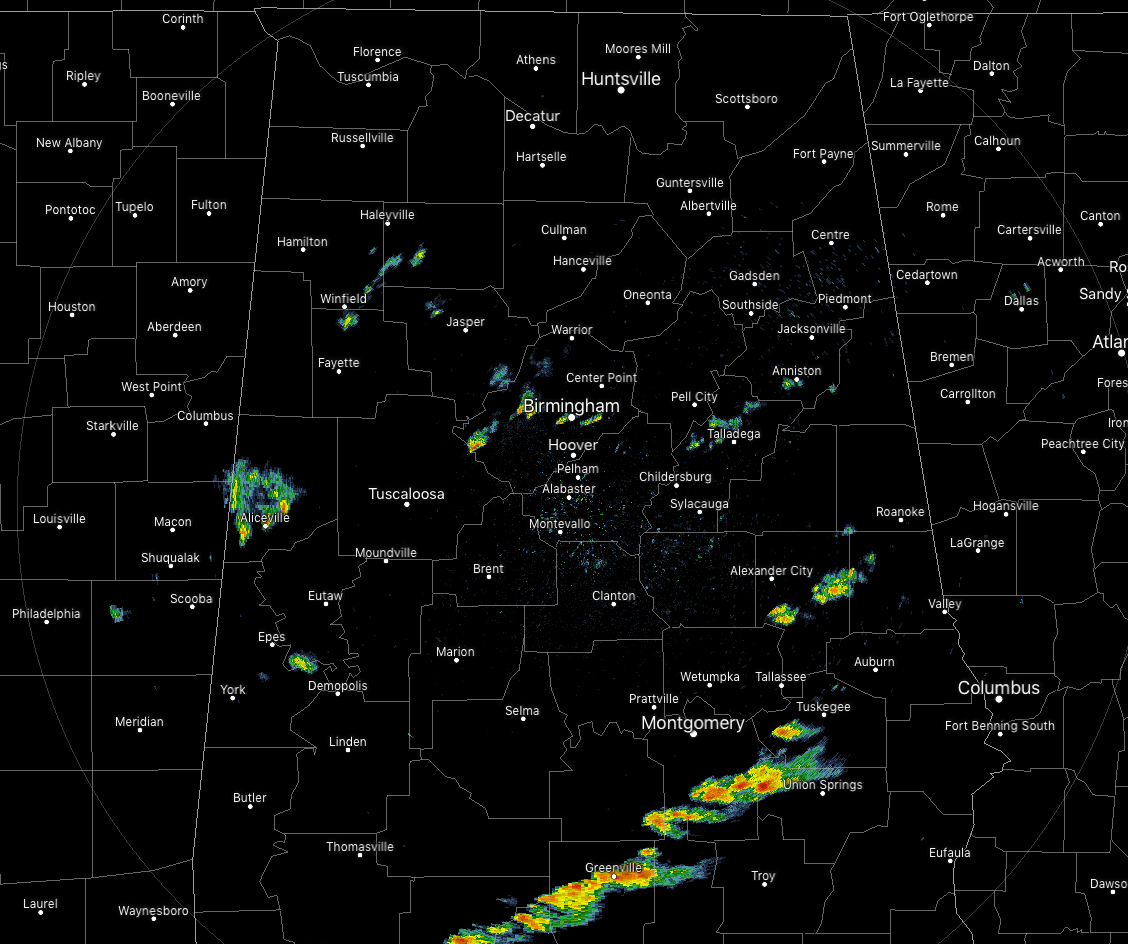
We have a few isolated showers across the central parts of Central Alabama as of 7:30 PM with a line of broken showers and a few rumbles of thunder moving eastward across the southeastern parts of Central Alabama.
None of these are strong and are putting down light to moderate rainfall at this point. The ones in the southeastern parts have a little more moisture to work with so they are putting down some heavier amounts. At this point, the threat for severe storms should be over, but I wouldn’t be surprised if we have one strong storm before the end of the evening.

SPC has once again reduced the size of the Marginal Risk to strictly the extreme southeastern parts of the area south of the I-85 corridor. Even in the risk area, I still believe that the threat will be extremely low.
We’ll continue to have a chance of isolated to scattered showers throughout the rest of the evening and into the late night and the first part of the overnight hours. Lows will be down into the lower 50s to the lower 60s.
Category: Alabama's Weather, ALL POSTS, Severe Weather
About the Author (Author Profile)
Scott Martin is an operational meteorologist, professional graphic artist, musician, husband, and father. Not only is Scott a member of the National Weather Association, but he is also the Central Alabama Chapter of the NWA president. Scott is also the co-founder of Racecast Weather, which provides forecasts for many racing series across the USA. He also supplies forecasts for the BassMaster Elite Series events including the BassMaster Classic.Subscribe
If you enjoyed this article, subscribe to receive more just like it.


