

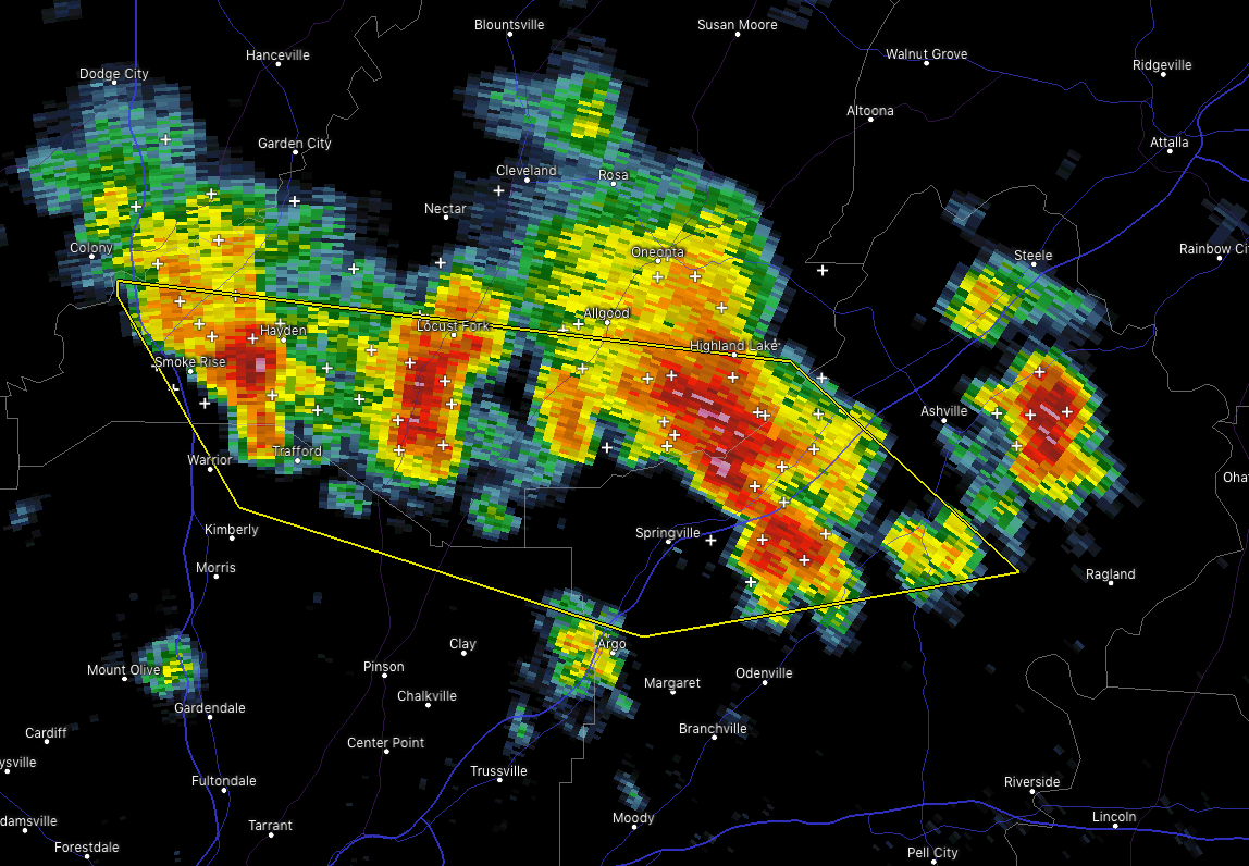
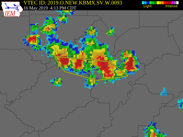
Severe T-Storm Warning For Parts Of Blount, Jefferson, St. Clair Counties Until 5:00 PM
BULLETIN – IMMEDIATE BROADCAST REQUESTED
Severe Thunderstorm Warning
National Weather Service Birmingham AL
412 PM CDT Thu May 16 2019
The National Weather Service in Birmingham has issued a
* Severe Thunderstorm Warning for…
Southern Blount County in central Alabama…
Northeastern Jefferson County in central Alabama…
Northwestern St. Clair County in central Alabama…
* Until 500 PM CDT.
* At 411 PM CDT, severe thunderstorms were located along a line
extending from near Inland Lake to near Warrior, moving southeast
at 5 mph.
HAZARD…60 mph wind gusts and quarter size hail.
SOURCE…Radar indicated.
IMPACT…Hail damage to vehicles is expected. Expect wind damage
to roofs, siding, and trees.
* Locations impacted include…
Springville, Dallas, Clay, Argo, Warrior, Kimberly, Ashville,
Locust Fork, Trafford, Hayden, County Line, Inland Lake, Highland
Lake, St. Clair Springs, Holly Springs, Smoke Rise, Village
Springs, Caldwell, Remlap and Clear Springs.
PRECAUTIONARY/PREPAREDNESS ACTIONS…
For your protection move to an interior room on the lowest floor of a
building.
Category: Alabama's Weather, ALL POSTS, Severe Weather
About the Author (Author Profile)
Scott Martin is an operational meteorologist, professional graphic artist, musician, husband, and father. Not only is Scott a member of the National Weather Association, but he is also the Central Alabama Chapter of the NWA president. Scott is also the co-founder of Racecast Weather, which provides forecasts for many racing series across the USA. He also supplies forecasts for the BassMaster Elite Series events including the BassMaster Classic.Subscribe
If you enjoyed this article, subscribe to receive more just like it.


