

Quick Update Just After 5:00 PM
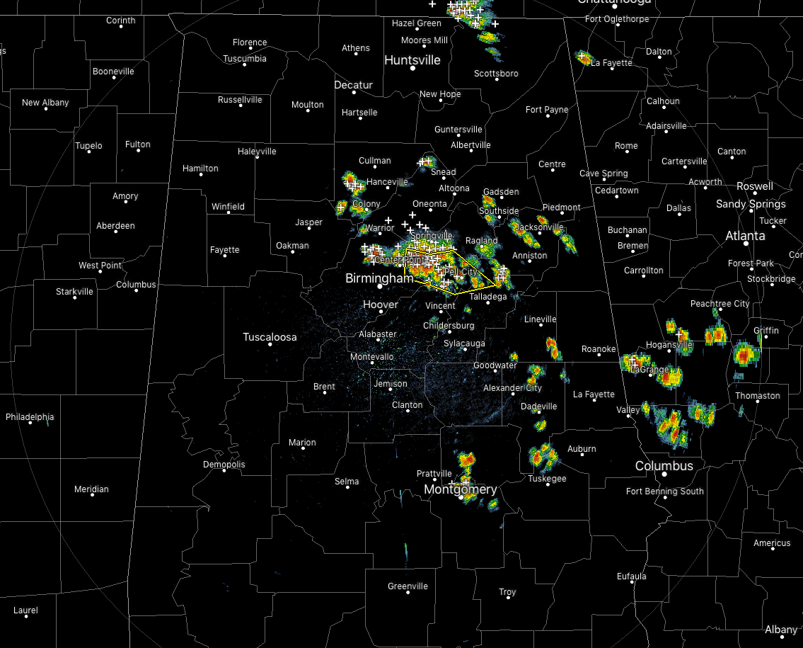
Severe Thunderstorm Warning continues until 5:30 PM for parts of Jefferson, St. Clair, and Talladega counties for the threats of damaging winds up to 60 MPH and quarter-size hail.
Strong storms continue to move slowly to the southeast across portions of Central Alabama with more moving into the eastern parts of North Alabama from southern Tennessee. These storms have plenty of instability to work with and will have the potential to become strong to briefly severe. Strong, gusty winds and hail are possible with any of these cells.
Along with those severe threats, there is also plenty of dangerous cloud-to-ground lightning and very heavy rainfall occurring with most of these cells. If you are in the path of any of these, move indoors immediately.
Category: Alabama's Weather, ALL POSTS, Severe Weather
About the Author (Author Profile)
Scott Martin is an operational meteorologist, professional graphic artist, musician, husband, and father. Not only is Scott a member of the National Weather Association, but he is also the Central Alabama Chapter of the NWA president. Scott is also the co-founder of Racecast Weather, which provides forecasts for many racing series across the USA. He also supplies forecasts for the BassMaster Elite Series events including the BassMaster Classic.Subscribe
If you enjoyed this article, subscribe to receive more just like it.


