

Hot and Dry Saturday Afternoon
It is a mostly sunny Saturday afternoon across the state today, with only a few fair weather cumulus clouds floating through the Alabama sky.
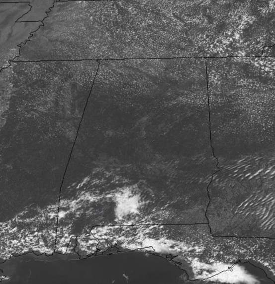
We note, there are a few showers and storms across extreme South Alabama and along the Northern Gulf Coast, but unfortunately those will be staying down that way. Temperatures are well into the 80s for us all early this afternoon and we should see upper 80s to lower 90s across the state for highs by the end of the day. Tonight will be a fair night with a mainly clear sky and lows in the lower to mid 60s.
FOR OUR SUNDAY: Expect more of the same, with ample sunshine and hot temperatures, highs tomorrow will be a few degrees warmer than today, so most locations should see lower 90s. Late in the day, a weak boundary will move into North Alabama and could produce a storm somewhere across the northern third of Alabama, but once again, just about everyone will remain dry.
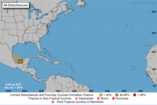
WELCOME TO HURRICANE SEASON: Today marks the first day of the Atlantic hurricane season, which will run until November 30. We’ve already had Andrea last month, and we will be waiting and watching for our next system, Barry…which may be here sooner than later. A broad area of low pressure located over the southern Bay of Campeche is producing disorganized showers and thunderstorms. The low is forecast to move westward to west-northwestward across the southern Bay of Campeche toward the east coast of Mexico during the next few days. If the system remains over water, a tropical depression could form before it moves inland early next week. Regardless of development, the disturbance will likely produce heavy rainfall over portions of southern and southeastern Mexico during the next few days. Formation chance through 48 hours…medium…40 percent. Formation chance through 5 days…medium…50 percent.
BEACH FORECAST CENTER: Get the latest weather and rip current forecasts for the beaches from Fort Morgan to Panama City on our Beach Forecast Center page. There, you can select the forecast of the region that you are interested in visiting.
WORLD TEMPERATURE EXTREMES: Over the last 24 hours, the highest observation outside the U.S. was 125.4F at Benina, Libya. The lowest observation was -101.7F at Dome A, Antarctica.
CONTIGUOUS TEMPERATURE EXTREMES: The highest observation was 103F at Death Valley, CA and at Falcon Lake, TX. The lowest observation was 29F at Nepp Site, ME.
Category: Alabama's Weather, ALL POSTS
About the Author (Author Profile)
Macon, Georgia Television Chief Meteorologist, Birmingham native, and long time Contributor on AlabamaWX. Stormchaser. I did not choose Weather, it chose Me. College Football Fanatic. @Ryan_StinnetSubscribe
If you enjoyed this article, subscribe to receive more just like it.


