

Watching Storms Moving Into Western Parts Of The Area At 8:00 PM; Marginal Risk Expanded
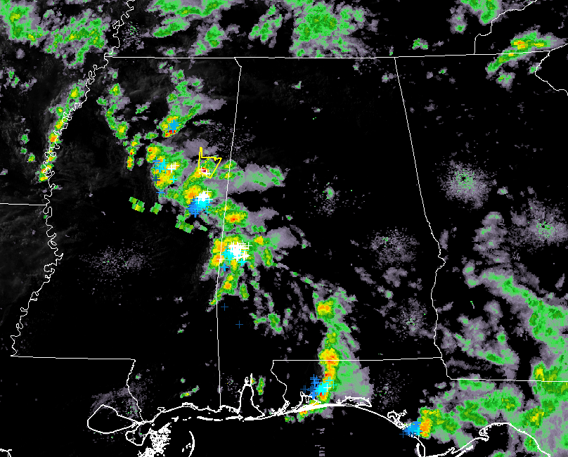
We are watching storms that are moving into the western and southwestern parts of Central Alabama, especially since we have a Severe Thunderstorm warning issued on one cell located over Starkville and moving to the northeast at 25 MPH.
These storms are producing a good bit of cloud-to-ground lightning especially near Livingston, Cuba, and approaching Epes, Forkland, and Demopolis. Parts of Greene and Sumter counties are under a significant weather advisory until 8:45 pm this evening. This cluster is moving to the northeast at 25 MPH.
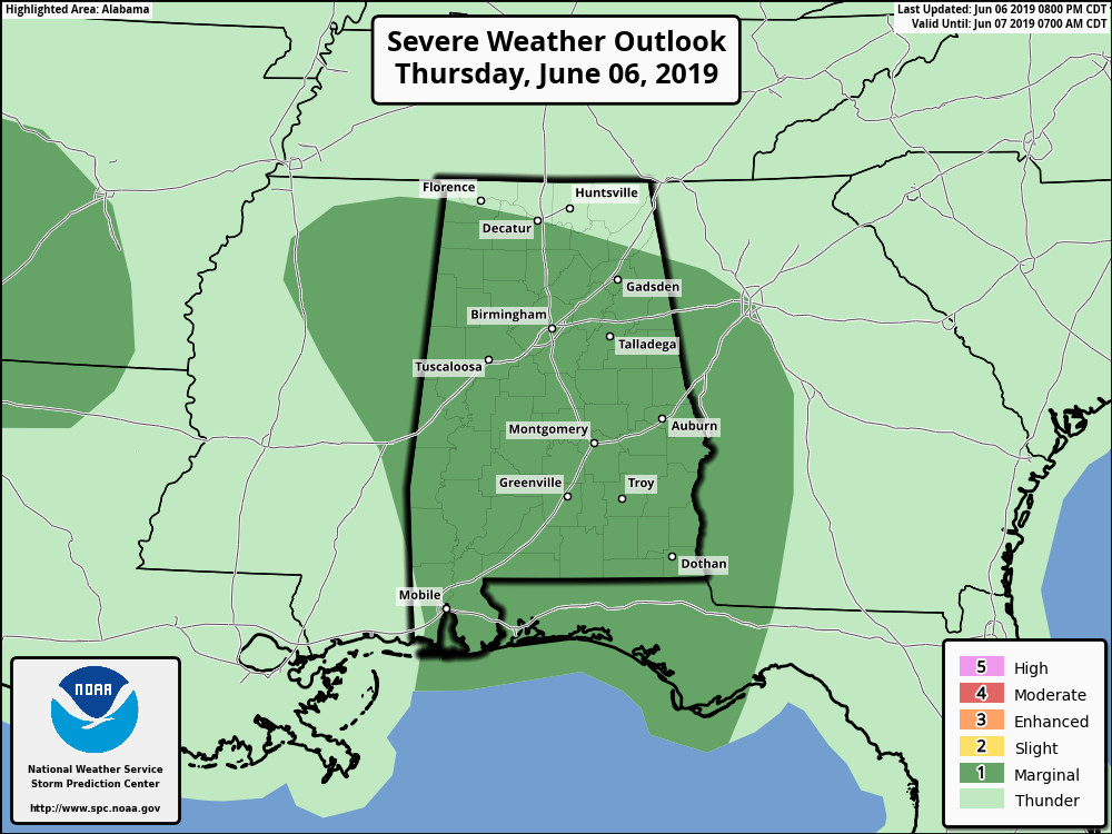
SPC has expanded the Marginal Risk of severe storms to include all of Central Alabama and nearly the rest of the state. Damaging winds up to 60 MPH will be the main threat, but there is a very small risk of an isolated tornado or two.
A local storm report talked about a possible tornado touchdown just to the west-northwest of Selma earlier this afternoon that snapped some trees and caused some roof and shingle damage to a house.
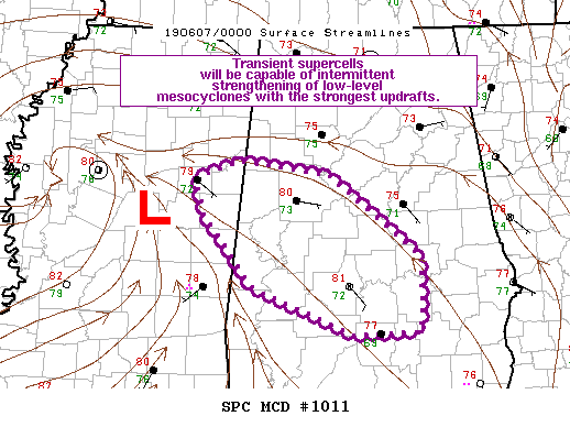
SPC just issued a Mesoscale Discussion for west and west-central parts of the area due to the threat of damaging winds and the possibility of a brief spin-up tornado. Since the tornado threat is isolated in nature, a watch at this time is not necessary.
We’ll keep you updated through the evening.
Category: Alabama's Weather, ALL POSTS, Severe Weather
About the Author (Author Profile)
Scott Martin is an operational meteorologist, professional graphic artist, musician, husband, and father. Not only is Scott a member of the National Weather Association, but he is also the Central Alabama Chapter of the NWA president. Scott is also the co-founder of Racecast Weather, which provides forecasts for many racing series across the USA. He also supplies forecasts for the BassMaster Elite Series events including the BassMaster Classic.Subscribe
If you enjoyed this article, subscribe to receive more just like it.


