

Strong To Severe Storms Invading The Western Parts Of Central Alabama
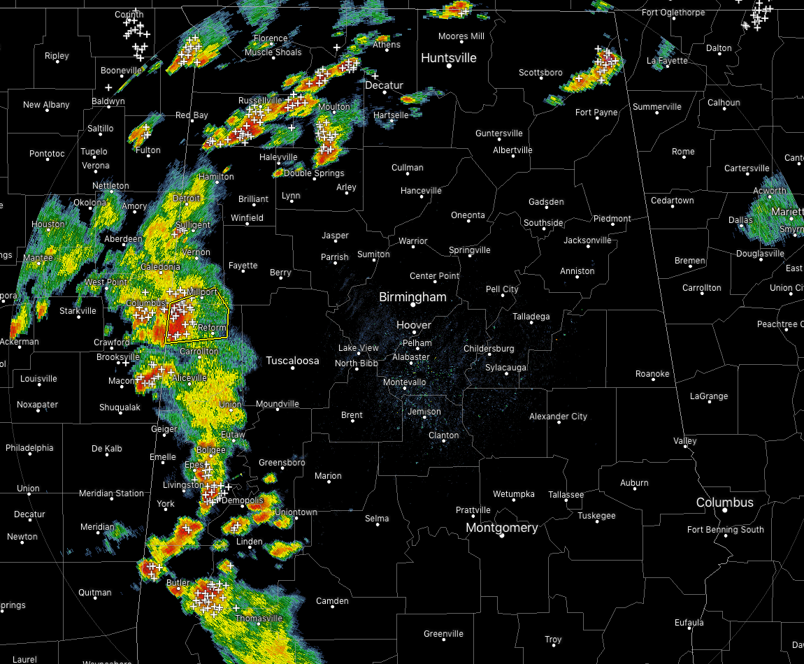
Strong to severe thunderstorms are lined up in a disorganized line along and just east of the AL/MS state line. Gusty winds, plenty of cloud-to-ground lightning, and heavy downpours are occurring along this entire group of storms.
The strongest storm is over parts of Lamar and Pickens counties, and a Severe Thunderstorm Warning is in effect until 6:00 pm this evening. Multiple Significant Weather Advisories are in effect for Greene, Hale, Pickens, Sumter, and Marengo counties for strong storms with gusty winds up to 50 MPH.
Another stronger storm was located over the northern parts of Dekalb County in the eastern parts of North Alabama with gusty winds up to 40 MPH possible.
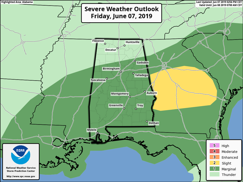
A Marginal Risk remains for much of Central Alabama through the remainder of the day and tonight as damaging winds up to 60 MPH will be the main threat, but with a low amount of shear, a brief spin-up tornado or two may be possible.
CAPE values continue to run in the 1500-2500 J/kg range across much of the area, while locations that were previously rain-cooled have quickly become unstable once again. Storms will continue at there current strength or possibly strengthen throughout the next few hours until we really start losing the heating of the day.
We’ll continue to keep you posted.
Category: Alabama's Weather, ALL POSTS, Severe Weather
About the Author (Author Profile)
Scott Martin is an operational meteorologist, professional graphic artist, musician, husband, and father. Not only is Scott a member of the National Weather Association, but he is also the Central Alabama Chapter of the NWA president. Scott is also the co-founder of Racecast Weather, which provides forecasts for many racing series across the USA. He also supplies forecasts for the BassMaster Elite Series events including the BassMaster Classic.Subscribe
If you enjoyed this article, subscribe to receive more just like it.


