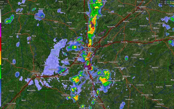
Radar Update at 5:55 p.m.: A Few Heavy Storms
A line of storms has formed generally in the I-65 COrridor this afternoon, from eastern Madison and western Jackson Counties in North Alabama through parts of Morgan, Cullman, Blount, Jefferson, Shelby, and Bibb Counties.
The heaviest storms are east of Kimberly and Warrior in northern Jefferson County extending into southwestern Blount County near Lehigh. Lots of lightning and heavy rain with these storms. They are drifting slowly southeastward toward Pinson and Village Springs. A flood advisory was just posted for these storms over northern Jefferson into Blount County.
A storm has rapidly formed in the Pelham area of northern Shelby County. It has frequent cloud to ground lightning with it as well as very heavy rain right on I-65.
There is another strong storm in Autauga County just west of Prattville. It extends down into Lowndes County west of Haynesville.
Elsewhere, showers are scattered across all of Alabama this afternoon.
Category: Alabama's Weather, ALL POSTS


