

Line Of Storms Moving Through Eastern Parts Of North/Central Alabama
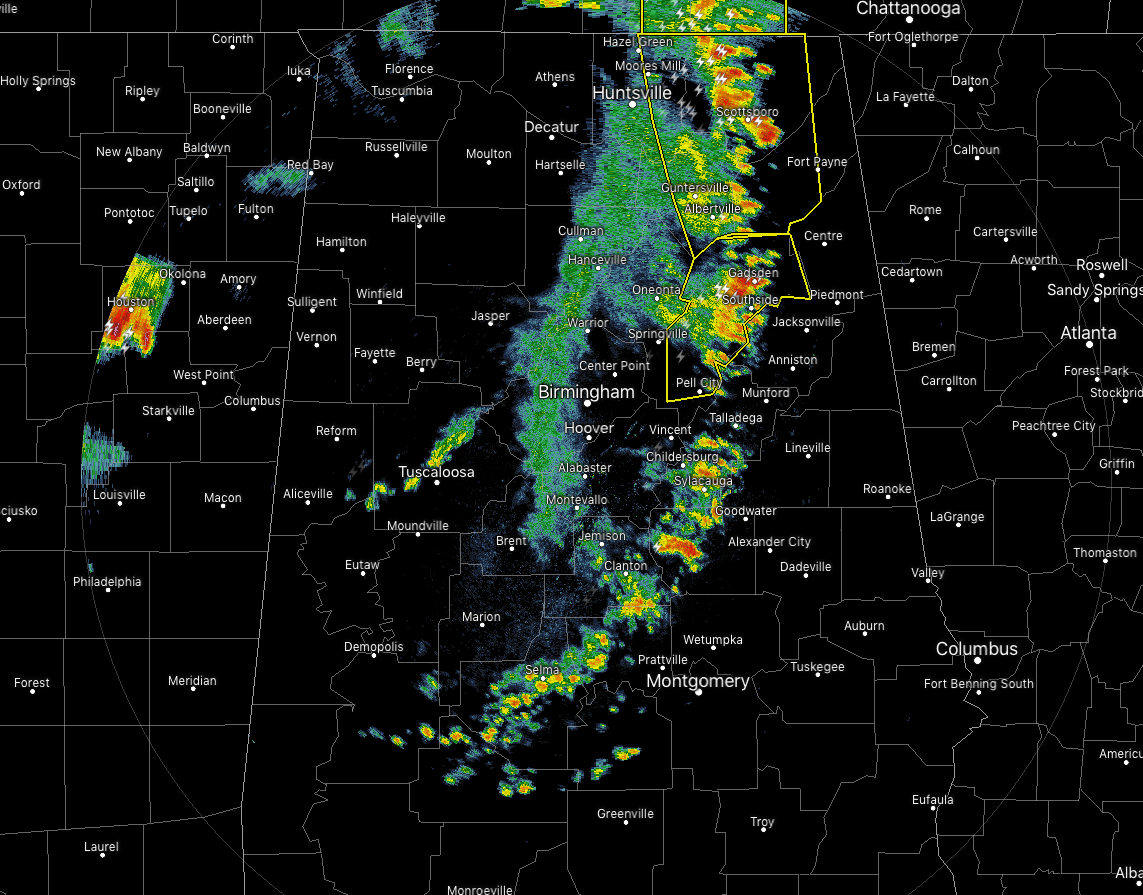
The MCS is looking a little more disheveled than what it did just an hour or so ago. The leading edge is now broken in nature and stretched from just east of Hazel Green to Ashville to Clanton to Selma. Not very much lightning occurring with the line with the exception of the stronger cells in the northeastern parts of the area. We still have a couple of severe thunderstorm warnings in effect for gusty winds up to 60 MPH.
As the line continues to move to the east at 50 MPH, weakening should continue. The bottom half of the line has pretty much weakened to an unorganized line of moderate showers with no lightning occurring. At the current rate of movement, the northern half of the line will be in Georgia within the next 60 minutes, with the southern parts of the line finally exiting within another 60 minutes after that.
A good bit of the Severe Thunderstorm Watch has been canceled for the western parts of North/Central Alabama while it continues until 6:00 am for Calhoun, Cherokee, Cleburne, Etowah, Madison, Marshall, St. Clair, and Talladega counties.
No major report of damage at this time, only a few trees downed and some sporadic power outages.
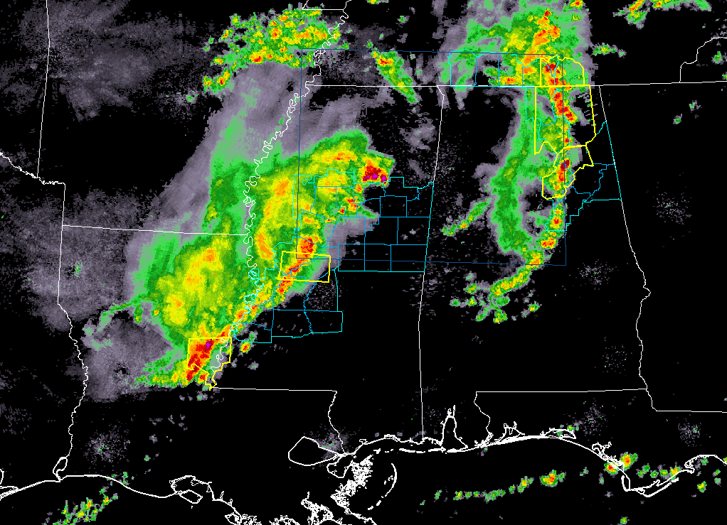
More storms are moving eastward through Mississippi, but those should be falling apart as well. The latest HRRR has this batch of storms dissipating completely before affecting the western locations of Central Alabama. We’ll keep an eye on those just in case.
Category: Alabama's Weather, ALL POSTS, Severe Weather
About the Author (Author Profile)
Scott Martin is an operational meteorologist, professional graphic artist, musician, husband, and father. Not only is Scott a member of the National Weather Association, but he is also the Central Alabama Chapter of the NWA president. Scott is also the co-founder of Racecast Weather, which provides forecasts for many racing series across the USA. He also supplies forecasts for the BassMaster Elite Series events including the BassMaster Classic.Subscribe
If you enjoyed this article, subscribe to receive more just like it.


