


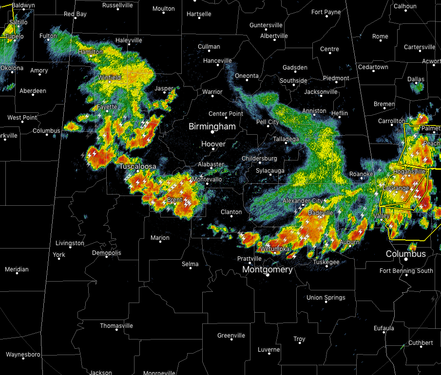
At 6:07 pm across Central Alabama, we continue to have a line of stronger thunderstorms moving southeast across the west-central and south-central portions of the area. Gusty winds, dangerous cloud-to-ground lightning, and heavy rainfall can be expected along the leading edge of the line that currently stretched from Moundville to Wetumpka to Auburn. The line is moving at around 30 MPH.
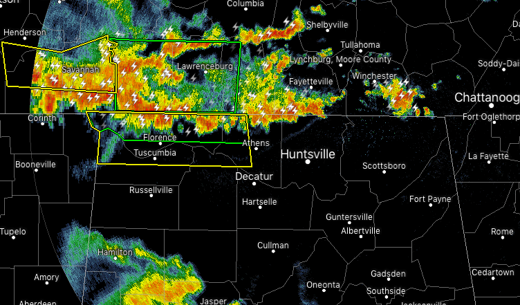
Back behind the line, we have a little break in the action before we get to more storms that have crossed over the AL/TN state line. There are currently two Severe Thunderstorm Warnings on cells that are on the leading edge of this line with the main threat being from damaging wind gusts up to 60 MPH.
We are getting plenty of wind damage reports from all across the area as the leading line moves through the area. If you remain in the path of either of these lines, please get to your place of safety and stay there until it passes. Severe thunderstorm winds can be as strong as a smaller tornado and could cause significant damage, injuries, and even death.
We’ll keep you posted throughout the evening with updates.


