

Storms Lose a Bit of Intensity: Severe Thunderstorm Watch Continues
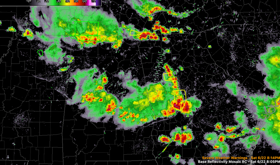
Storms continue across Alabama this evening and no severe thunderstorm warnings are in effect at the time.
There is a flash flood warning for Lauderdale County in Northwest Alabama.
Two main areas of storms in the state at this hour:
…One extending from the Tuscaloosa/Birmingham area down through Clanton and Montgomery then up I-85 for Valley and Lanett.
…Another over the Tennessee Valley of North Alabama from Tuscumbia to Scottsboro.
Everything is dropping east southeast.
Ahead of the first line, instability values are still high so that will likely maintain.
The area of storms over the Tennessee Valley should dissipate before traveling much into Central Alabama.
The severe thunderstorm watch continues for much of Central and East Central Alabama until 9 p.m.
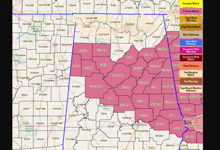
The main threat continues to be damaging winds with the stronger storms. SOme hail is also possible along with heavy rain and deadly lightning.
Category: Alabama's Weather, ALL POSTS
About the Author (Author Profile)
Bill Murray is the President of The Weather Factory. He is the site's official weather historian and a weekend forecaster. He also anchors the site's severe weather coverage. Bill Murray is the proud holder of National Weather Association Digital Seal #0001 @wxhistorianSubscribe
If you enjoyed this article, subscribe to receive more just like it.


