

Strong Storms Over The Northeastern Parts of Central Alabama As We Approach 5:00 PM
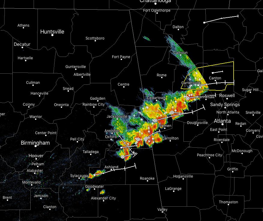
At 4:50 pm, a cluster of thunderstorms were over Cleburne County and down into the northern parts of Clay and Randolph counties. Some gusty winds, heavy rain, and dangerous cloud-to-ground lightning are likely with these storms as they continue to push off to the east at around 45 MPH.
With the trends that have been seen today, NWS Birmingham has removed the Slight Risk for the northeastern parts of the area and keeps a Marginal Risk up for the east and southeastern parts of the area through the evening hours. The main threat will be from isolated damaging wind gusts up to 60 MPH.
For the rest of the evening and late night hours, the western half of Central Alabama will stay dry while a few lingering showers and thunderstorms will remain possible. By midnight, all of Central Alabama should be rain free.
Just taking a look at the major reporting stations across Central Alabama, here are the highs for today:
Birmingham 89º
Montgomery 94º
Tuscaloosa 90º
Anniston 90º
Troy 91º
Calera (NWS Birmingham) 88º
Category: Alabama's Weather, ALL POSTS, Severe Weather
About the Author (Author Profile)
Scott Martin is an operational meteorologist, professional graphic artist, musician, husband, and father. Not only is Scott a member of the National Weather Association, but he is also the Central Alabama Chapter of the NWA president. Scott is also the co-founder of Racecast Weather, which provides forecasts for many racing series across the USA. He also supplies forecasts for the BassMaster Elite Series events including the BassMaster Classic.Subscribe
If you enjoyed this article, subscribe to receive more just like it.


