

Afternoon Storms Mainly Over South Alabama Today
HOT, MUGGY DAY AHEAD: Look for a high around 90 degrees this afternoon with a partly sunny sky; any shower later today over the northern half of the state should be pretty isolated. Scattered afternoon thunderstorms are a bit more likely over the southern half of the state; SPC has a “marginal risk” (level 1/5) defined for areas south of a line from near Eutaw to Fort Deposit to Abbeville…
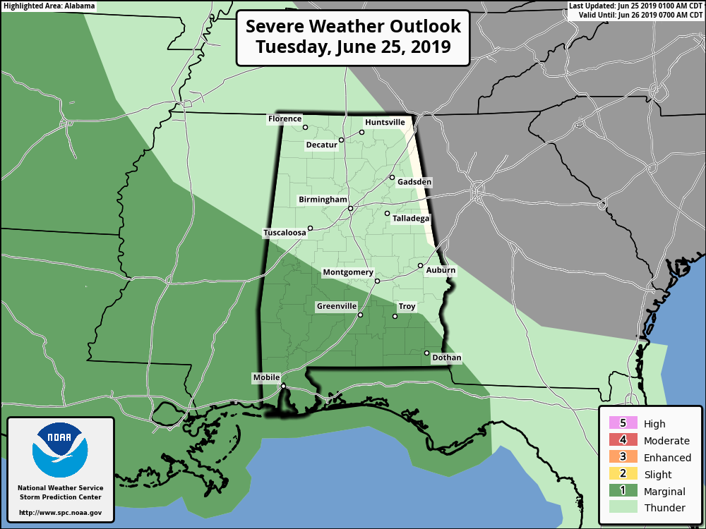
Where storms develop over South Alabama they could produce gusty winds and some small hail. Scattered storms will end once the sun goes down tonight.
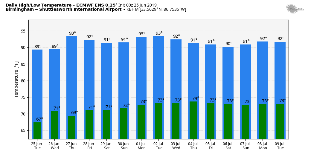
REST OF THE WEEK: Fairly routine summer weather is the story tomorrow through Friday; hot and humid with the risk of a few widely scattered showers or thunderstorms during the afternoon and evening hours. Partly sunny days, fair nights, highs mostly in the low 90s.
THE ALABAMA WEEKEND: We will mention the risk of random, scattered showers and storms Saturday and Sunday, generally between 2:00 and 10:00 p.m. Odds of any one spot getting wet both days will be in the 30/40 percent range, and afternoon highs will be in the 88 to 91 degree range. Otherwise partly sunny days, fair nights. Just what you expect at the end of June in Alabama.
NEXT WEEK: We will roll with a persistence forecast for the Fourth of July week… partly sunny, hot, humid days with “scattered, mostly afternoon and evening showers and thunderstorms on daily basis. Highs mostly in the low 90s… See the Weather Xtreme video for maps, graphics, and more details.
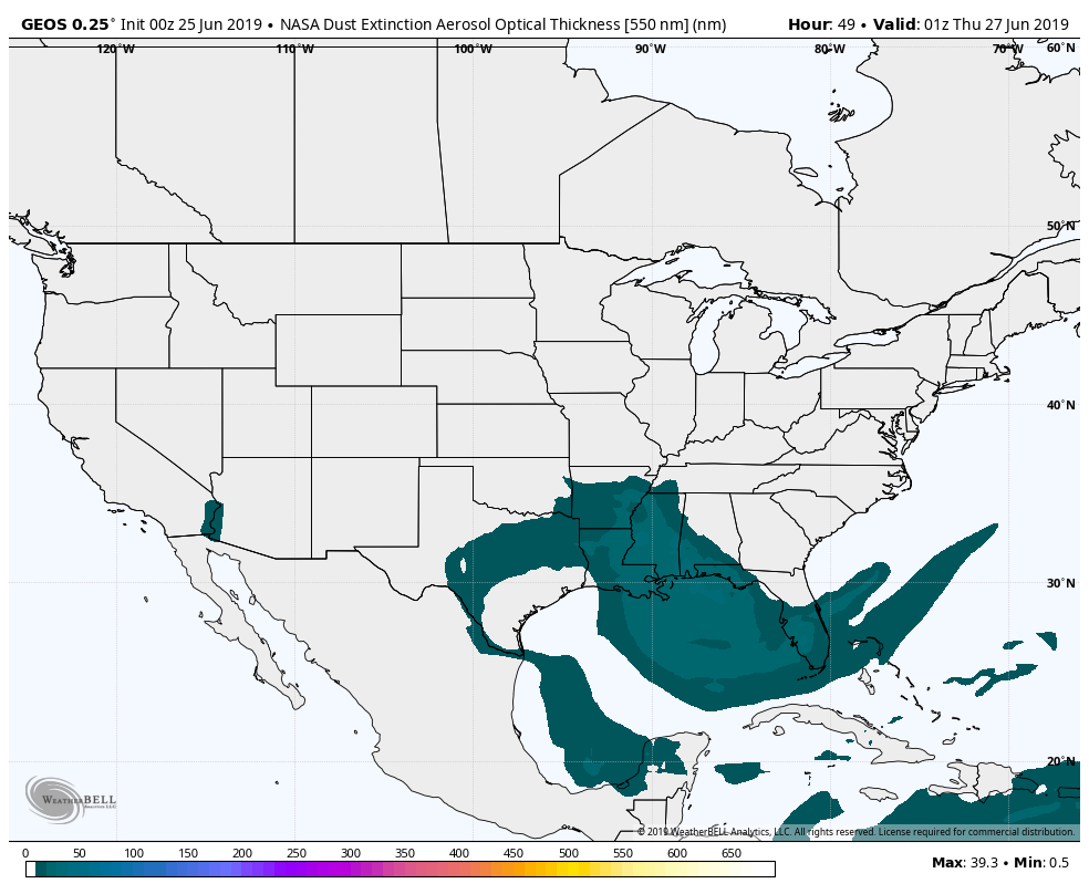
AFRICAN DUST: The Saharan Air Layer (SAL) has moved up into much of Alabama and Mississippi, and made for a great sunset last night and sunrise this morning. The highest dust concentration will slowly shift west of Alabama in coming days.
ON THIS DATE IN 1957: Hurricane Audrey moved northward, slowly strengthening until the 26th. At that time, a strong upper-level trough led to its acceleration and the hurricane deepened rapidly on its final approach to the Texas/Louisiana border. Audrey became the strongest hurricane on record for June upon landfall, as it reached category four strength. Its acceleration was unanticipated, and despite hurricane warnings in place, 418 people perished in the storm, mainly across southwest Louisiana.
BEACH FORECAST: Click here to see the AlabamaWx Beach Forecast Center page.
WEATHER BRAINS: Don’t forget you can listen to our weekly 90 minute show anytime on your favorite podcast app. This is the show all about weather featuring many familiar voices, including our meteorologists here at ABC 33/40.
CONNECT: You can find me on all of the major social networks…
Facebook
Twitter
Instagram
Pinterest
Snapchat: spannwx
I have a weather program this morning in Double Springs… look for the next Weather Xtreme video here by 4:00 this afternoon. Enjoy the day!
Category: Alabama's Weather, ALL POSTS, Weather Xtreme Videos
About the Author (Author Profile)
James Spann is one of the most recognized and trusted television meteorologists in the industry. He holds the AMS CCM designation and television seals from the AMS and NWA. He is a past winner of the Broadcast Meteorologist of the Year from both professional organizations.Subscribe
If you enjoyed this article, subscribe to receive more just like it.


