

A Few Storms Out There At 1:00 PM
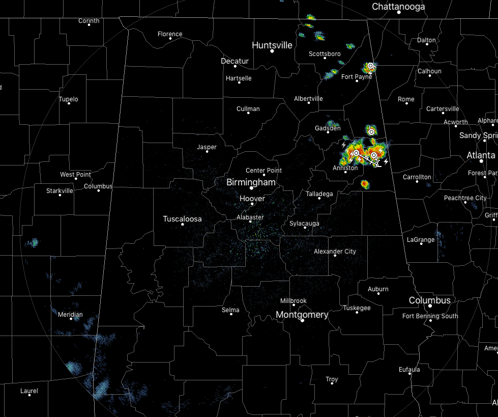
As of 1:00 pm, we have a few thunderstorms over the eastern parts of the area mainly over Calhoun and Cleburne counties. These are moving to the east-southeast at around 10 MPH. There is plenty of cloud-to-ground lightning occurring with these, along with gusty winds up to 40 MPH and some hail up to pea size. If you are in the path of these storms, move indoors until the storms have passed by.
The rest of Central Alabama is dry at this point and a few isolated showers are showing up over the east and northeastern parts of North Alabama. Temperatures are in the 80s to the lower 90s across the area. Birmingham was at 88 degrees while the warm spots were Tory and Uniontown at 90 degrees.
We’ll continue with partly to mostly cloudy skies across the area with a small chance of a few isolated showers and thunderstorms. Afternoon highs will top out in the upper 80s to the lower 90s. For this evening and tonight, we’ll continue to have a small risk of a few isolated showers early, but those will diminish as we reach the late night hours. Lows will be in the upper 60s to the lower 70s.
Much of the same story on Thursday as we’ll continue to have the typical summertime pattern across the area. Skies will be partly to mostly cloudy throughout the day with a small chance of a few isolated to scattered afternoon showers and thunderstorms. Most of those look to occur in the western half of the area. Highs will be in the lower to mid-90s.
TROPICS: A quiet Atlantic Hurricane Season continues for the next five days as no tropical cyclones are expected to form over the next five days.
BEACH FORECAST CENTER: Get the latest weather and rip current forecasts for the beaches from Fort Morgan to Panama City on our Beach Forecast Center page. There, you can select the forecast of the region that you are interested in.
ALREADY OFF TO A HOT START IN 2019! ADVERTISE WITH THE BLOG!: We have enjoyed over 10 MILLION page views on AlabamaWx.com so far in 2019! Don’t miss out! We can customize a creative, flexible and affordable package that will suit your organization’s needs. Contact Bill Murray at (205) 687-0782.
E-FORECAST: Get the Alabama Wx Weather Blog’s Seven-Day Forecast delivered directly to your inbox by email twice daily. It is the most detailed weather forecast available in Central Alabama. Subscribe here… It’s free!
CONNECT WITH THE BLOG ON SOCIAL MEDIA: You can find the AlabamaWx Weather Blog on the major social media networks:
Facebook
Twitter
Instagram
WEATHERBRAINS: Don’t forget you can listen to our weekly 90 minute netcast anytime on the web at WeatherBrains.com or on iTunes, Stitcher, or Spotify. This is the show all about weather featuring many familiar voices, including the meteorologists at ABC 33/40.
Category: Alabama's Weather, ALL POSTS
About the Author (Author Profile)
Scott Martin is an operational meteorologist, professional graphic artist, musician, husband, and father. Not only is Scott a member of the National Weather Association, but he is also the Central Alabama Chapter of the NWA president. Scott is also the co-founder of Racecast Weather, which provides forecasts for many racing series across the USA. He also supplies forecasts for the BassMaster Elite Series events including the BassMaster Classic.Subscribe
If you enjoyed this article, subscribe to receive more just like it.


