

No Active Severe Warnings, But Strong Storms Continue At 4:00 PM
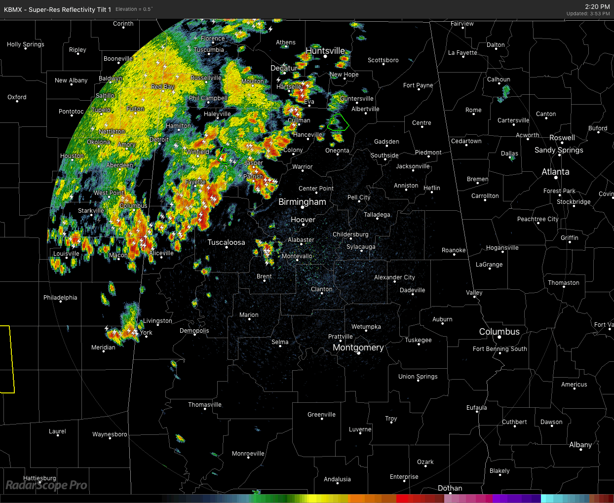
At 3:55 pm, we continue to see a complex of storms moving south-southeastward on the western side of Central Alabama with the strongest storms lined up from western Jefferson County down through parts of Tuscaloosa, Bibb, Greene, Hale, Perry, and into the extreme northern parts of Marengo County. These continue to develop and move south-southeastward behind an outflow boundary.
The good news is that the storms are staying sub-severe, but you can still expect to see very heavy rain, dangerous cloud-to-ground lightning, some small hail, and gusty winds up to 40-50 MPH. This complex has a history of causing tree, power line, and home damage as it moved through the northwestern parts of the area.
We’ll continue to see these storms move through during the rest of the late afternoon and the evening hours, and should start to dissipate as we head into the late night hours. While a few storms may become strong, the likelihood of severe storms is becoming less likely. As with thunderstorms in Central Alabama… expect the unexpected. Keep your guard up today.
Category: Alabama's Weather, ALL POSTS, Severe Weather
About the Author (Author Profile)
Scott Martin is an operational meteorologist, professional graphic artist, musician, husband, and father. Not only is Scott a member of the National Weather Association, but he is also the Central Alabama Chapter of the NWA president. Scott is also the co-founder of Racecast Weather, which provides forecasts for many racing series across the USA. He also supplies forecasts for the BassMaster Elite Series events including the BassMaster Classic.Subscribe
If you enjoyed this article, subscribe to receive more just like it.


