

Midday NowCast: Hot, Humid, Scattered Rain/Storms
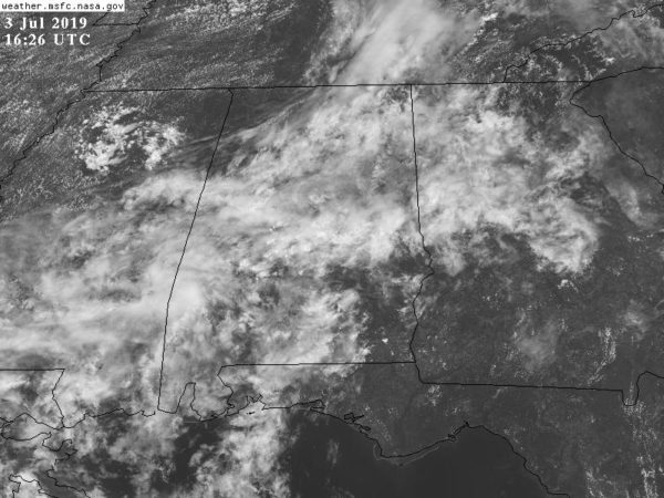
The weather remains hot and humid across the state, which is what you would expect for July in Alabama. Fortunately, much of the day, we have been dealing with clouds and scattered showers across the area, which have been holding temps in the 80s, and for the most part the rain has been light and scattered.
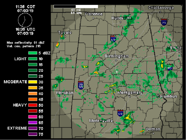
We are expecting to see more sunshine as we head into and through the afternoon hours, so that should allow temps to make their way into the upper 80s and lower to mid 90s in many locations. We do have more instability and moisture in place across the state and that should allow for an uptick in the coverage of showers and storms through the afternoon and evening hours, especially compared to recent days. Once again, the general coverage will be random and scattered across the Alabama landscape and storms which do develop will produce a lot of lightning, gusty winds, and intense rainfall over a short period of time. Though storms could be strong today, and really through the weekend, organized severe weather is not expected. For tonight, look for isolated to scattered evening showers and thunderstorms, with most of the activity ending by late night. Overnight low temperatures will be in the lower to middle 70s.
INDEPENDENCE DAY: Lots of folks will be out and about tomorrow enjoying the holiday. It will be a hot and humid day with you guessed it, scattered showers and storms. The greatest coverage will come during the afternoon and evening hours, and most of the storms should be ending by fireworks time tomorrow night, but that doesn’t mean all of them will be gone as it is certainly possible we will see a few rogue late night ones. Highs tomorrow should generally be in the lower 90s, dropping into the lower 80s during the evening for fireworks.
FRIDAY & THE WEEKEND: Expect hot humid days with a mix of sun and clouds, and the risk of random, hit or miss afternoon and evening storms. Rain chances these three days will be in the 40-50% range, but of course, that can fluctuate day to day with mesoscale boundaries and upper-level features. Rain distribution will remain very uneven with some locations getting too much, while others get none at all. Before the storms fire up each day, we will see highs in the lower to perhaps mid 90s, and with those high dew points, heat index values should be in the 100°-105° range.
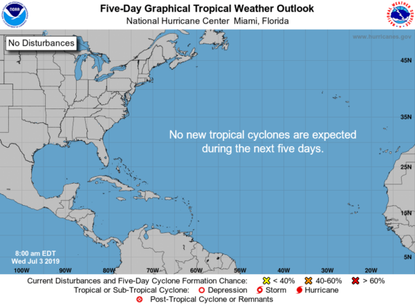
TROPICS: All is quiet across the Atlantic Basin and no tropical cyclones are expected to form the next five days.
BEACH FORECAST CENTER: Get the latest weather and rip current forecasts for the beaches from Fort Morgan to Panama City on our Beach Forecast Center page. There, you can select the forecast of the region that you are interested in visiting.
WORLD TEMPERATURE EXTREMES: Over the last 24 hours, the highest observation outside the U.S. was 119.7F at Omidieh Iran. The lowest observation was -91.1F at University Dome, Antarctica.
CONTIGUOUS TEMPERATURE EXTREMES: The highest observation was 111F at Death Valley, CA. The lowest observation was 36F at Leadville, CO.
WEATHER ON THIS DATE IN 1966: The northeastern U.S. was in the midst of a sweltering heat wave. The temperature at Philadelphia reached 104 degrees. Afternoon highs of 102 degrees at Hartford CT, 105 degrees at Allentown PA, and 107 degrees at LaGuardia Airport in New York City established all-time records for those two locations.
Category: Alabama's Weather, ALL POSTS
About the Author (Author Profile)
Macon, Georgia Television Chief Meteorologist, Birmingham native, and long time Contributor on AlabamaWX. Stormchaser. I did not choose Weather, it chose Me. College Football Fanatic. @Ryan_StinnetSubscribe
If you enjoyed this article, subscribe to receive more just like it.


