

Hot and Feeling Hotter
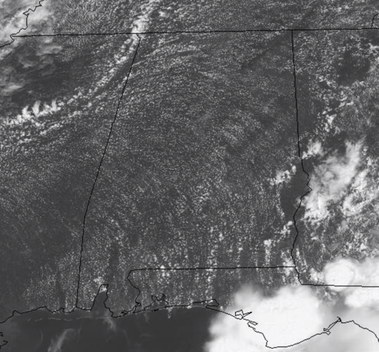
We are seeing ample sunshine across the state today and that has allowed our temperatures to surge into the lower and mid 90s across North/Central Alabama, while locations in South Alabama will be in the upper 90s and low 100s.
Dew points are in the lower 70s and that is making it feel down right miserable outside, but is also making it feel hotter than it is as heat indices are in the low 100s in many locations, while higher in others, and is why a heat advisory has been issued.
HEAT ADVISORY: Is in effect until 7PM this evening for nearly all of South/Central Alabama as well as locations through West/Central Alabama including Pickens, Tuscaloosa, Sumter, Greene, Hale, Perry, Bibb and Chilton counties.
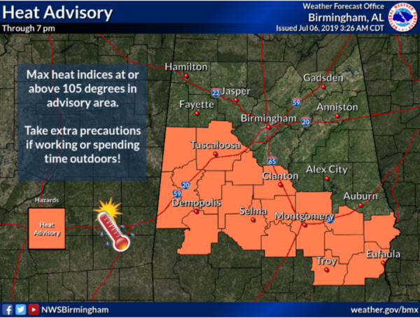
Heat index values in these areas will reach or exceed 105 degrees through out the afternoon hours. A heat advisory means the combination of hot temperatures and high humidity will combine to create a situation in which heat illnesses are possible. Drink plenty of fluids, stay in an air conditioned room, stay out of the sun, and check up on relatives and check up on relatives and neighbors.
Early this afternoon we are watching the radar as showers and storms are beginning to develop. These will be widely scattered in nature and are generally tracking off towards the southeast across the area. Most locations will be staying hot and dry today, but locations which find themselves under one of these storms can expect tremendous amounts of lightning and heavy rainfall. Showers and storms will continue into the evening hours, and some will last into the overnight hours as well, with temperatures sliding down into the 70s by first thing tomorrow morning.
TOMORROW: Some changes in the weather tomorrow as a weak upper-level low makes its way across the state. This will be enhancing uplift across the state and will produce more clouds and cause a higher coverage of showers and storms. We will forecast scattered to numerous storms tomorrow, but still not everyone will see the rain. With the additional clouds and higher storm coverage, highs tomorrow will range from the upper 80s to lower 90s.
BEACH FORECAST CENTER: Get the latest weather and rip current forecasts for the beaches from Fort Morgan to Panama City on our Beach Forecast Center page. There, you can select the forecast of the region that you are interested in visiting.
WORLD TEMPERATURE EXTREMES: Over the last 24 hours, the highest observation outside the U.S. was 119.8F at Jahra, Kuwait. The lowest observation was -94.4F at Dome A, Antarctica.
CONTIGUOUS TEMPERATURE EXTREMES: The highest observation was 113F at Death Valley, CA. The lowest observation was 27F at Peter Sinks, UT.
WEATHER ON THIS DATE IN 1985: Lightning struck a large transformer in Salt Lake County sending a 200 foot fireball into the air and blacking out almost the entire state for up to five hours.
Category: Alabama's Weather, ALL POSTS
About the Author (Author Profile)
Macon, Georgia Television Chief Meteorologist, Birmingham native, and long time Contributor on AlabamaWX. Stormchaser. I did not choose Weather, it chose Me. College Football Fanatic. @Ryan_StinnetSubscribe
If you enjoyed this article, subscribe to receive more just like it.


