

A Quick Check On Our Weather At 8:00 PM
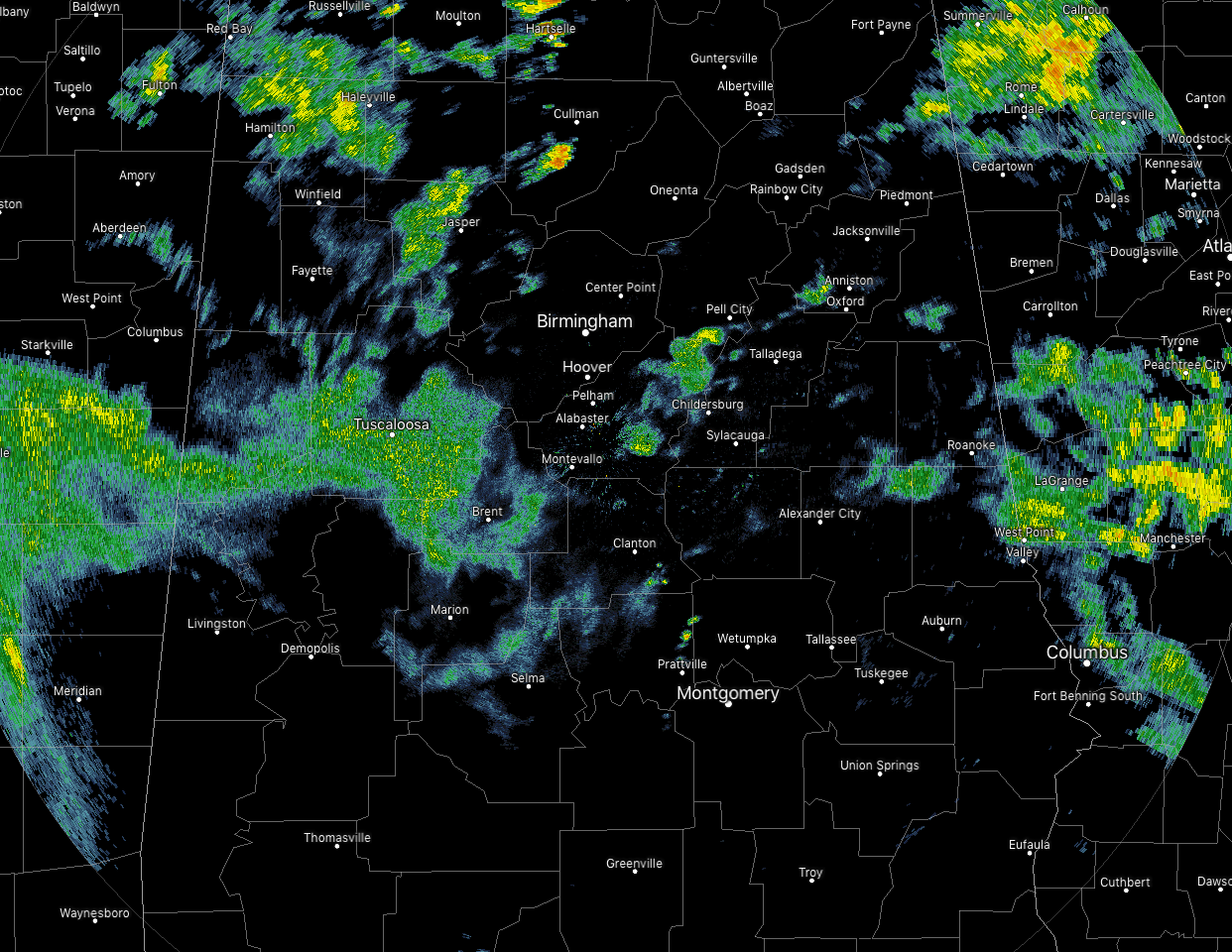
As of 7:55 pm, coverage of the tropical showers and storms continue to diminish as we are losing the heating of the day and the sun has set. We still see some shower activity over west-central and central parts of the area and up into the northwestern parts of the area. None of this rain is heavy at this point.
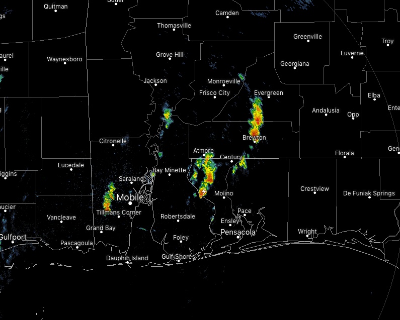
Not much is going on in the southwestern parts of the state as well. There are a few heavier showers over the central parts of Mobile County with another smaller shower over the northern parts of Baldwin County. A few heavier showers are over the central parts of Escambia and Conecuh counties.

The worst activity with Barry is currently located over the extreme eastern parts of Louisiana with heavy storms over and just west of New Orleans. There are two tornado warnings in effect as radar has indicated some rotation with two separate cells. Orleans, Plaquemines, and St. Bernard are the parishes being affected at this point.
Category: Alabama's Weather, ALL POSTS, Severe Weather, Tropical
About the Author (Author Profile)
Scott Martin is an operational meteorologist, professional graphic artist, musician, husband, and father. Not only is Scott a member of the National Weather Association, but he is also the Central Alabama Chapter of the NWA president. Scott is also the co-founder of Racecast Weather, which provides forecasts for many racing series across the USA. He also supplies forecasts for the BassMaster Elite Series events including the BassMaster Classic.Subscribe
If you enjoyed this article, subscribe to receive more just like it.


