

A Midday Check On Our Weather Situation
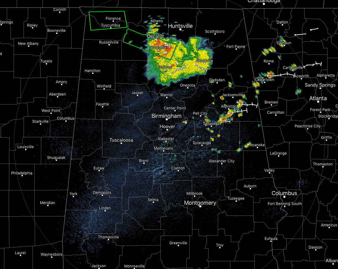
At 12:00 pm, we continue to have a mass of rain and thunderstorms pushing across the south-central parts of North Alabama and the extreme north-central parts of Central Alabama. We also have some scattered shower and thunderstorm activity over the eastern and northeastern parts of Central Alabama. All of this activity is pushing eastward at 20-25 MPH.
Flash Flood Warnings continue in effect for parts of Lauderdale and Colbert counties until 12:30 pm, and for parts of Lawrence and Morgan counties until 2:45 pm this afternoon.
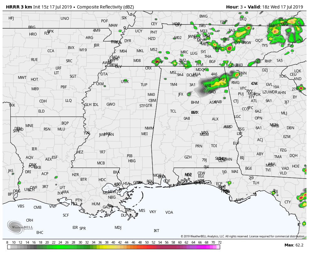
The latest HRRR is showing that much of the activity will stay over the northern half of the state throughout the remainder of the day and into the late-night hours, even though there looks to be some isolated to scattered showers and storms that may develop south of the I-20 corridor in the mid to late afternoon hours.
So for the rest of the daylight hours, we can expect a chance of isolated to scattered showers and storms in the southern half of Central Alabama while there will be a much higher chance of scattered to numerous showers and storms in the northern half. So rain may be heavy at times and some localized flash flooding could occur. With precipitable water values over 2 inches for the area, rainfall rates with some of these storms could reach as high as 2 inches per hour. Afternoon highs will be in the upper 80s to the mid-90s across the area from north to south.
Tonight, while much of the activity will diminish across the area, a few lingering showers and storms could hang around across the area into the late night and overnight hours. The higher rain chances will be over the northeastern parts of the area. Overnight lows will be in the lower to mid-70s.
Thursday looks to be a more typical summertime day across Central Alabama. We’ll have some sun early with convective clouds building during the heating of the day. We’ll have the standard chance of isolated to scattered mainly afternoon showers and thunderstorms from west to east. Afternoon highs will top out in the lower to mid-90s with heat indices in the 100-103 degree range for most.
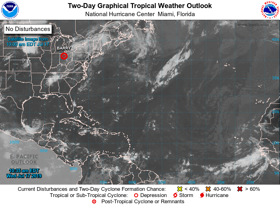
TROPICS: The Atlantic Ocean, Caribbean Sea, and the Gulf of Mexico are free from any tropical activity at this point, and no new tropical systems are expected to develop within the next five days. The low associated with the remnants of Barry is located over northern Ohio today and is expected to wash out by Thursday.
BEACH FORECAST CENTER: Get the latest weather and rip current forecasts for the beaches from Fort Morgan to Panama City on our Beach Forecast Center page. There, you can select the forecast of the region that you are interested in.
ALREADY OFF TO A HOT START IN 2019! ADVERTISE WITH THE BLOG!: We have enjoyed over 11 MILLION page views on AlabamaWx.com so far in 2019! Don’t miss out! We can customize a creative, flexible and affordable package that will suit your organization’s needs. Contact Bill Murray at (205) 687-0782.
E-FORECAST: Get the Alabama Wx Weather Blog’s Seven-Day Forecast delivered directly to your inbox by email twice daily. It is the most detailed weather forecast available in Central Alabama. Subscribe here… It’s free!
CONNECT WITH THE BLOG ON SOCIAL MEDIA: You can find the AlabamaWx Weather Blog on the major social media networks:
Facebook
Twitter
Instagram
WEATHERBRAINS: Don’t forget you can listen to our weekly 90 minute netcast anytime on the web at WeatherBrains.com or on iTunes, Stitcher, or Spotify. This is the show all about weather featuring many familiar voices, including the meteorologists at ABC 33/40.
Category: Alabama's Weather, ALL POSTS
About the Author (Author Profile)
Scott Martin is an operational meteorologist, professional graphic artist, musician, husband, and father. Not only is Scott a member of the National Weather Association, but he is also the Central Alabama Chapter of the NWA president. Scott is also the co-founder of Racecast Weather, which provides forecasts for many racing series across the USA. He also supplies forecasts for the BassMaster Elite Series events including the BassMaster Classic.Subscribe
If you enjoyed this article, subscribe to receive more just like it.


