

Spotty Showers Forming Well Before The Midday Hour
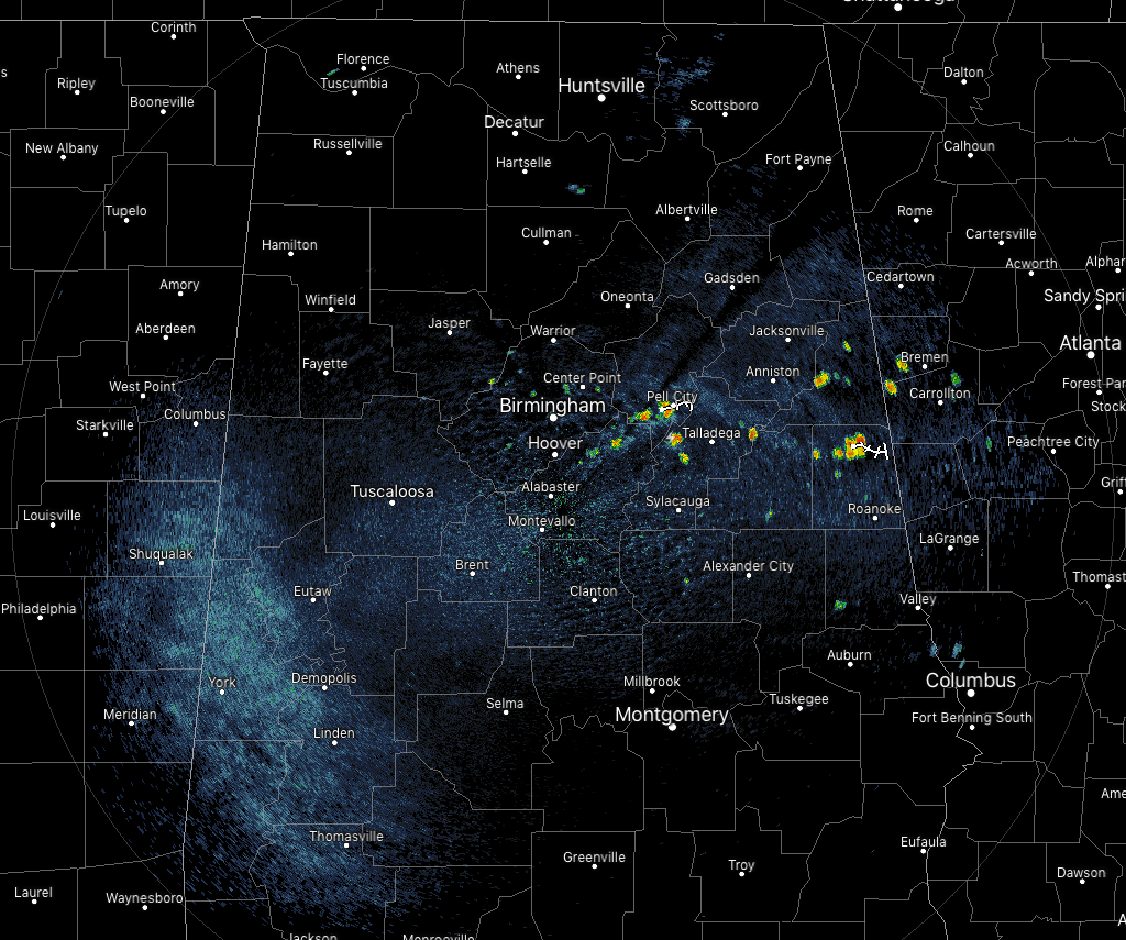
At 10:45 am, we have a few isolated spotty showers already forming along and just south of the I-20 corridor in the eastern parts of the area with the heat and the humidity of the morning, while the rest of Central Alabama remains dry at this point. Temperatures are ranging in the lower 80s to the lower 90s across the area. Birmingham was at 88 degrees while several locations were tied at 90 degrees at the hot spots. The cool spot was Haleyville at 82 degrees.
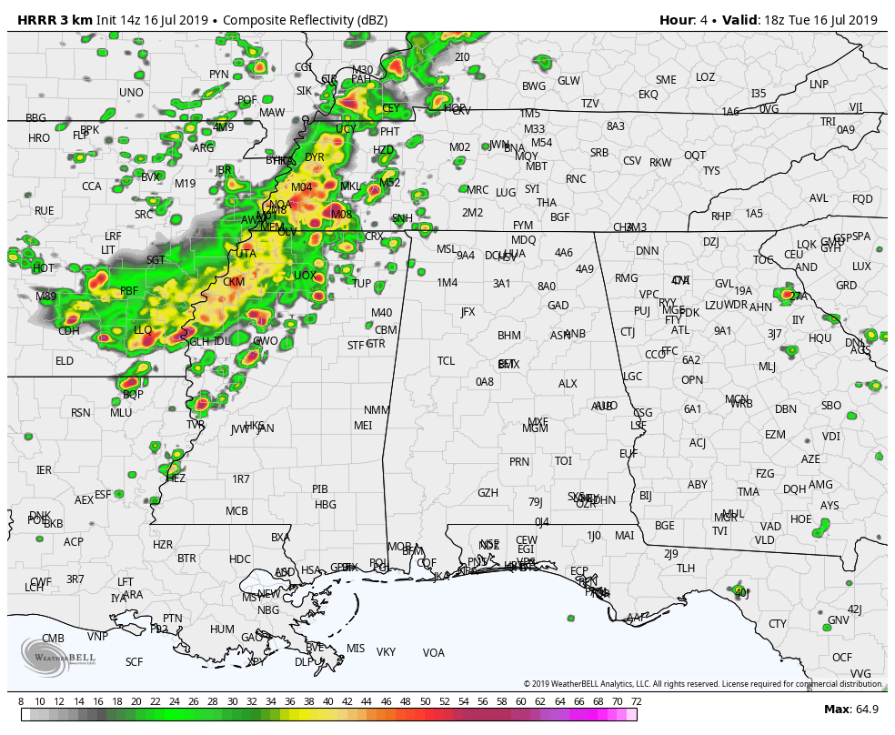
WEATHER FOR THE REST OF YOUR THURSDAY: The latest HRRR model solution for the rest of today through the late night and ends at 1:00 am Thursday is hinting at a line of storms moving eastward through much of Mississippi but falling apart as it crosses the state line around the 5pm-7pm time frame with only a few scattered storms affecting the northwestern parts of the state around midnight. At this point of the day, there is no line of storms, so maybe this run is out to lunch. We’ll keep a watch on it. At this point, we can expect scattered showers and thunderstorms across the area with the higher chances being north of a line from Fayette to Clanton to Auburn. Afternoon highs will be in the lower to mid-90s across much of the area with upper 90s possible in the southeastern corner of the area. Heat indices will top out in the 98-104 degree range.
For tonight and through the overnight hours, much of the activity will diminish after sunset but a few lingering showers and storms could persist for a few hours longer over the east and northeastern parts of the area, especially east of I-65 and north of I-85. Lows will be in the lower to mid-70s.
HEAT ADVISORY UNTIL 7:00 PM FOR PARTS OF NORTH ALABAMA: The western half of North Alabama is under a heat advisory until 7:00 pm this evening as the combination of high temperatures and increased humidity levels will result in dangerous heat levels this afternoon. Heat indices of up to 106 due to temperatures in the lower 90s, and dewpoints in the mid-70s. Counties in the advisory are Colbert, Franklin, Lauderdale, Lawrence, Limestone, Madison, and Morgan.
INCREASED RISK OF SCATTERED STORMS ON FRIDAY: With a trough over the Atlantic Coast and the ridge flattening out, we’ll continue to have hot and humid conditions on Friday. A developing surface low will be along the Alabama Gulf Coast and the western parts of the Florida Panhandle which will send more moisture and lift in our direction to allow for the development of scattered to numerous showers and thunderstorms across much of the area. The highest risk of storms will be south of the I-59 corridor, while there will still be a good chance of scattered showers north of that. Highs will be in the lower 90s across the area. Much of the activity will occur with the main heating of the day, but some showers and storms could occur during the morning and into the late night and overnight hours. Don’t expect much change at all for the weekend at this point.
BEACH FORECAST CENTER: Get the latest weather and rip current forecasts for the beaches from Fort Morgan to Panama City on our Beach Forecast Center page. There, you can select the forecast of the region that you are interested in.
ALREADY OFF TO A HOT START IN 2019! ADVERTISE WITH THE BLOG!: We have enjoyed over 11 MILLION page views on AlabamaWx.com so far in 2019! Don’t miss out! We can customize a creative, flexible and affordable package that will suit your organization’s needs. Contact Bill Murray at (205) 687-0782.
E-FORECAST: Get the Alabama Wx Weather Blog’s Seven-Day Forecast delivered directly to your inbox by email twice daily. It is the most detailed weather forecast available in Central Alabama. Subscribe here… It’s free!
CONNECT WITH THE BLOG ON SOCIAL MEDIA: You can find the AlabamaWx Weather Blog on the major social media networks:
Facebook
Twitter
Instagram
WEATHERBRAINS: Don’t forget you can listen to our weekly 90 minute netcast anytime on the web at WeatherBrains.com or on iTunes, Stitcher, or Spotify. This is the show all about weather featuring many familiar voices, including the meteorologists at ABC 33/40.
Category: Alabama's Weather, ALL POSTS
About the Author (Author Profile)
Scott Martin is an operational meteorologist, professional graphic artist, musician, husband, and father. Not only is Scott a member of the National Weather Association, but he is also the Central Alabama Chapter of the NWA president. Scott is also the co-founder of Racecast Weather, which provides forecasts for many racing series across the USA. He also supplies forecasts for the BassMaster Elite Series events including the BassMaster Classic.Subscribe
If you enjoyed this article, subscribe to receive more just like it.


