

Heavy Rain For Parts Of Alabama
**No afternoon Weather Xtreme video today**
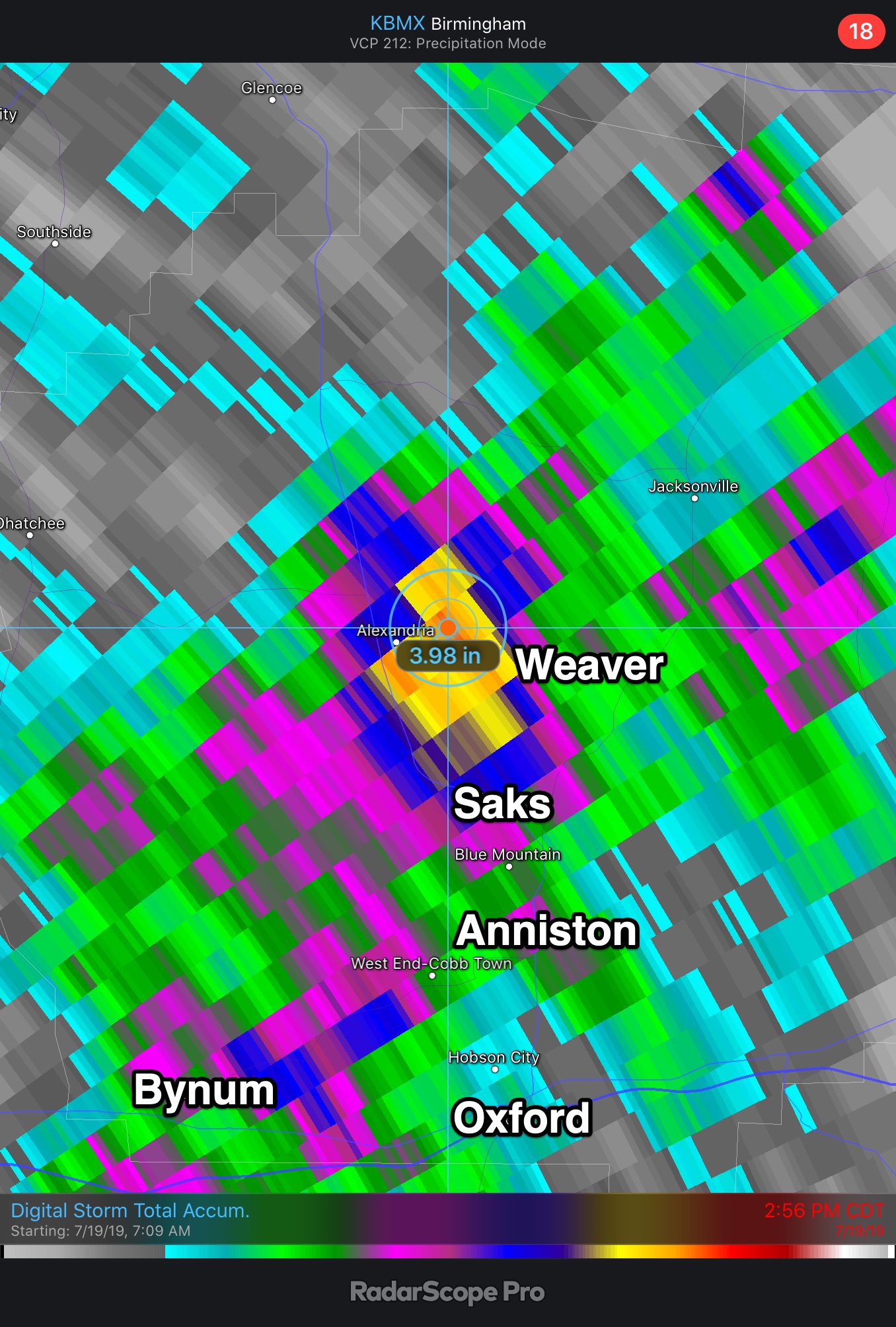
FLOODING ISSUES FOR EAST ALABAMA: Very high precipitable water values, combined with a weak disturbance aloft led to slow moving thunderstorms developing over parts of Alabama this morning. Significant flooding was reported in Calhoun County… here are some preliminary rain totals
Nances Creek (Riley Johnson) 3.71″
Weaver (Mike Calloway) 3.57″
Weaver (Michelle Miklik) 1.83″
Radar suggests a maximum of 3.98″ in the same general area just north of Anniston.
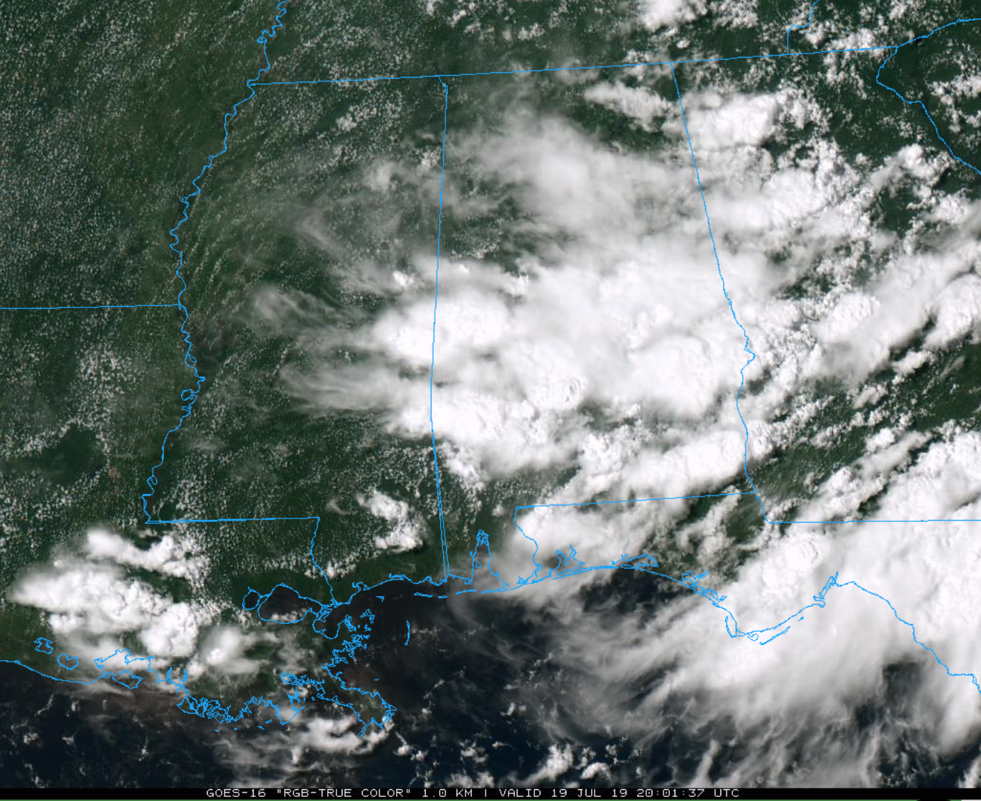
This afternoon light rain lingers over the eastern third of Alabama, with stronger storms over the southern counties of the state. Showers have been few and far between in the Birmingham metro, and areas to the north and west. Temperatures are in the 70s where rain has been falling; and in the 80s for most other places. The average high for today (at Birmingham) is 91.
Rain and storms will taper off later tonight once the sun goes down.
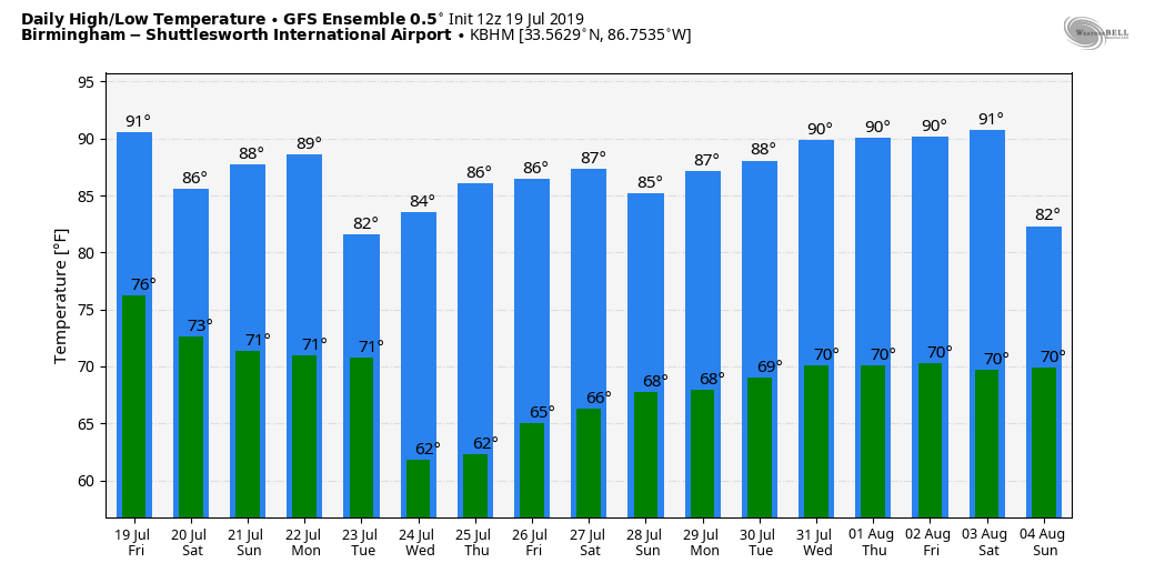
THE ALABAMA WEEKEND: Tomorrow is looking like a relatively wet day, with rain and thunderstorms likely. It won’t rain all day, and the sun could peek out at times, but occasional showers and storms are likely with highs in the mid 80s. Like today, some spots could see heavy amounts of rain. Showers and storms remain possible Sunday, but they will be more scattered in nature with a mix of sun and clouds. The high Sunday will be in the upper 80s.
NEXT WEEK: An approaching surface front will bring scattered to numerous showers and storms to the state Monday and Tuesday, followed by unusually dry air for summer Wednesday through Friday. Humidity levels should be lower over the latter half of the week, along with cooler nights. Some of the normally cooler spots have a good chance of reaching the 50s early Wednesday morning.
TROPICS: The Atlantic basin is very quiet, and tropical storm formation is not expected through next week.
ON THIS DATE IN 1997: The eye of hurricane Danny moved to the mouth of Mobile Bay near Fort Morgan just before dawn. The hurricane then drifted into southern Mobile Bay and stalled. Danny finally made landfall near Mullet Point, AL midday on the 19th as a Category 1 Hurricane. Danny drifted across Baldwin County through the rest of the day on the 19th and into the morning of the 20th. The weakening cyclone finally turned north late in the day and moved over the extreme northwest Florida panhandle before proceeding to move north and northeast over Alabama for the next 2 days.
Radar estimated an incredible 43 inches of storm total rain over the open water in Mobile Bay. Observing sites reported 30-40 inches across the area with Dauphin Island reporting 36.71 inches with 25.98 inches of this falling between 5pm and midnight on Saturday. Numerous roads were inundated and impassable for days after Hurricane Danny. Record flooding caused major damage to homes along the Fowl River in Mobile County and the Fish River in Baldwin County.
BEACH FORECAST: Click here to see the AlabamaWx Beach Forecast Center page.
WEATHER BRAINS: Don’t forget you can listen to our weekly 90 minute show anytime on your favorite podcast app. This is the show all about weather featuring many familiar voices, including our meteorologists here at ABC 33/40.
CONNECT: You can find me on all of the major social networks…
Facebook
Twitter
Instagram
Pinterest
Snapchat: spannwx
I enjoyed seeing a big group today at the Pell City Public Library this morning…. be looking for them on the Pepsi KIDCAM today at 5:00 on ABC 33/40 News! My next Weather Xtreme video will be posted here by 7:00 a.m. Monday… enjoy the weekend!
Category: Alabama's Weather, ALL POSTS, Weather Xtreme Videos
About the Author (Author Profile)
James Spann is one of the most recognized and trusted television meteorologists in the industry. He holds the AMS CCM designation and television seals from the AMS and NWA. He is a past winner of the Broadcast Meteorologist of the Year from both professional organizations.Subscribe
If you enjoyed this article, subscribe to receive more just like it.


