Scattered Storms Mainly Northwest Alabama Today; Front Brings Relief from Heat by Midweek
Heat is the story across much of the nation on this July Sunday, but change is coming.
HEAT ADVISORIES: Excessive Heat Warnings cover all of the East Coast from South Carolina to Maine. Highs today in New York City will be near 98F with a high of 107F. Changes will be coming by tomorrow. With showers and storms ahead of a cold front, highs will be in the middle 80s. The remainder of the week will feature high near 80F. More advisories and warnings are in effect from Oklahoma and eastern Kansas to Ohio. Highs today in St. Louis will be in the upper 90s. By tomorrow, highs will be in the upper 70s, and near 80 by Monday and Tuesday.
NO HEAT ADVISORIES HERE: Showers and storms and their associated clouds kept things cooler today and that will be the case again today and Monday. Highs will be in the upper 80s. The best chance for rain and storms today will be along and northwest of I-59 as drier air works its way into Alabama from the east.
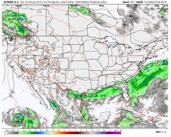
RIDGE BREAKING DOWN: The strong summer high-pressure ridge that has been aligned across the southern United States is beginning to break down over the southeastern United States as a digging trough swings down through the Midwest. By Tuesday, a full latitude trough will be set up just to the east of the Mississippi River. This will allow a cold front to slice through Alabama, an unusual occurrence for July. A batch of showers and thunderstorms will enter the state from the northwest late Monday night and progress southeastward through the early morning hours. By mid-afternoon, it should be over southeastern sections of the area. Rain chances will be high before ending late Tuesday.
DRIER AIR ARRIVES: Drier air will start moving into the state Tuesday night. By Wednesday morning, dew points will be in the 60s and morning readings will be in the lower to middle 60s. You will be hard-pressed to find a shower or storm north of I-10 or east of the Rockies by then. Highs on Wednesday will be in the middle 80s. Rinse and repeat for Thursday, with partly cloudy skies, reasonably low humidities, and highs in the middle 80s.
HEADING TO THE WEEKEND: High pressure will consolidate its power along the East Coast of the United States by Friday and by Saturday, moisture will start returning to Alabama. This means that isolated to scattered afternoon and evening showers and storms, the mantra of summer weather forecasts, will return to the state. Highs will be in the upper 80s. Lows will be near 70F.
GULF COAST WEATHER: Today will feature a good chance of showers and storms, but Monday and most of Tuesday will be perfect along the beautiful beaches of Alabama and Northwest Florida. Rain and storms will return late Tuesday and be prevalent again on Wednesday. They should start thinning back to normal levels for this time of year by Thursday into the weekend. Highs all week will be in the upper 80s. Lows will be in the middle 70s. Water temperatures are running in the upper 80s, about as warm as it gets. The rip current risk will be fairly low and yellow flags will be the rule along the coast. Click here to see the Beach Forecast Center page.
WEATHERBRAINS: This week, the panel will entertain Victoria Allen and Natalie Panasiak from the NWS in Flagstaff. They will be talking about their project to extend weather information of the Navajo community. Check out the show at www.WeatherBrains.com. You can also subscribe on iTunes. You can watch the show live at live.bigbrainsmedia.com You will be able to see the show on the James Spann 24×7 weather channel on cable or directly over the air on the dot 2 feed.
ON THIS DATE IN 1997: Extreme flooding occurs over Baldwin County Alabama as the remnants of Hurricane Danny drifted slowly northeastward after dumping thirty inches of rain over coastal Alabama. The worst flooding occurred around the Fish River where 500 homes were damaged. Follow my weather history tweets on Twitter. I am @wxhistorian at Twitter.com.
Category: ALL POSTS


