

Strong To Severe Storms Affecting North Alabama

At 4:00 pm, a broken line of strong to severe thunderstorms is moving southeastward across the southern portions of Tennessee and into the northern parts of Alabama. A couple of these cells have warranted Severe Thunderstorm Warnings for the threat of damaging winds up to 60 MPH and some smaller hail. These severe cells were moving to the southeast at 15-25 MPH.
Conditions across the northern two-thirds of the area are still favorable for a few stronger thunderstorms to become severe with damaging winds and some small hail as the main threats.
Surface-based CAPE is running in the 3000-4500 J/kg range across North/Central Alabama, along with downdraft CAPE values in the 1000-1300 J/kg range. Bulk shear values are in the 25-30 knot range. All of this to say there is the potential for thunderstorms to produce damaging downburst winds up to and exceeding 60 MPH and some small hail.
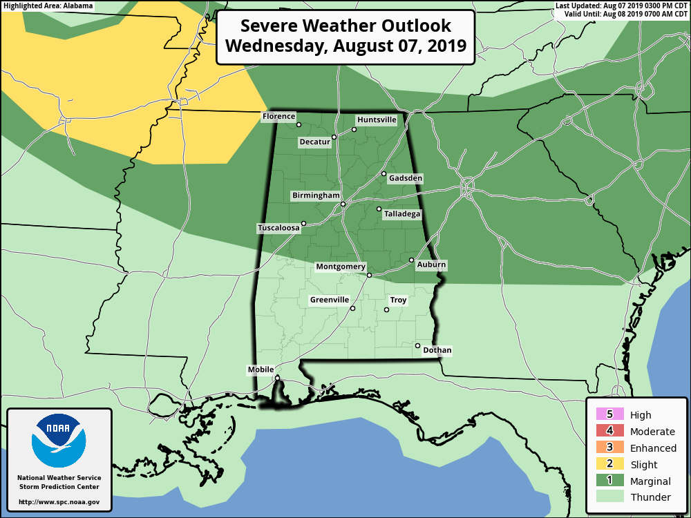
A Marginal Risk for severe storms continues across the northern two-thirds of the area, with the main window for strong to severe storms to go from now until around 10:00 pm tonight. We’ll keep you posted.
Category: Alabama's Weather, ALL POSTS, Severe Weather
About the Author (Author Profile)
Scott Martin is an operational meteorologist, professional graphic artist, musician, husband, and father. Not only is Scott a member of the National Weather Association, but he is also the Central Alabama Chapter of the NWA president. Scott is also the co-founder of Racecast Weather, which provides forecasts for many racing series across the USA. He also supplies forecasts for the BassMaster Elite Series events including the BassMaster Classic.Subscribe
If you enjoyed this article, subscribe to receive more just like it.


