

Random, Slow Moving, Shower/Storms
CLASSIC SUMMER DAY: This is just what we expect in summer in Alabama. After a mostly sunny morning, we have an array of random, scattered showers and thunderstorms this afternoon. They are drifting to the south/southwest, and are producing heavy rain, gusty winds, and lot of lightning. Away from the storms temperatures are mostly in the low to mid 90s.
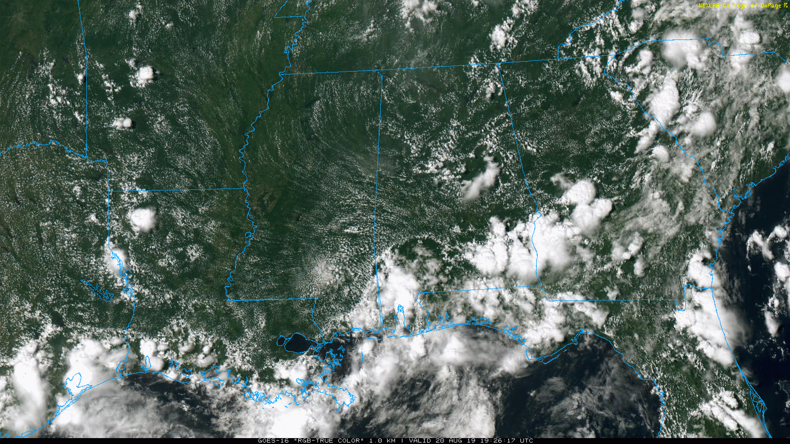
Showers will fade late tonight after sunset. The weather won’t change much tomorrow; odds of any one spot seeing a shower will be around 30 percent during the peak of the daytime heat.
THURSDAY THROUGH THE WEEKEND: We expect an increase in the number of showers and thunderstorms on these four days as the air aloft will be a bit colder, and the air more unstable. Look for a mix of sun and clouds each day with scattered to numerous showers and thunderstorms, mostly between 12:00 noon and 10:00 p.m. Heat levels will be lower due to increased cloud cover; highs mostly in the 86-90 degree range each day.
NEXT WEEK: A moist, unstable airmass will stay in place through much of the week, so “scattered, mostly afternoon and evening showers and thunderstorms will stay in the forecast”… perhaps numerous on some days. Highs will remain mostly in the mid to upper 80s. See the Weather Xtreme video for maps, graphics, and more details.
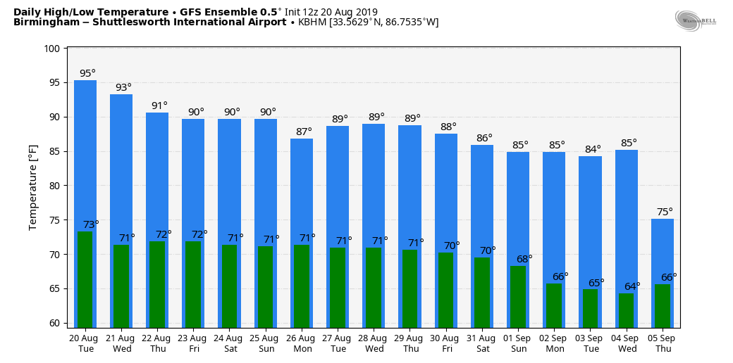
FOOTBALL WEATHER: For the high school football games across the state Friday night, a passing shower or storm is very possible, especially during the first half (but it won’t rain at every stadium). Temperatures will be in the mid 80s at kickoff, falling into the low 80s by the final whistle.
TROPICAL WEATHER: A small low is in the Atlantic, well east of Long Island, and moving out to sea… NHC gives this only a 10 percent chance of development. A tropical wave is over the far western Caribbean with no signs of development, and the rest of the Atlantic basin is quiet.
ON THIS DATE IN 1999: Bret reached hurricane status in the Southwest Gulf of Mexico. It would make landfall at South Padre Island, Texas, with winds of 115 miles per hour and a barometric pressure of 951 mb. At the height of the storm, an estimated 64,000 people were without power in south Texas.Portions of Texas State Highway Loop 281 were submerged in floodwaters, leaving $50,000 in damage. Damage in Corpus Christi were estimated at $100,000. In Duval County, 200 homes were damaged by flooding and large areas of agricultural land were flooded. Damage in the county amounted to roughly $2 million.
BEACH FORECAST: Click here to see the AlabamaWx Beach Forecast Center page.
WEATHER BRAINS: Don’t forget you can listen to our weekly 90 minute show anytime on your favorite podcast app. This is the show all about weather featuring many familiar voices, including our meteorologists here at ABC 33/40.
CONNECT: You can find me on all of the major social networks…
Facebook
Twitter
Instagram
Pinterest
Snapchat: spannwx
Look for the next Weather Xtreme video here by 7:00 a.m. tomorrow….
Category: Alabama's Weather, ALL POSTS, Weather Xtreme Videos
About the Author (Author Profile)
James Spann is one of the most recognized and trusted television meteorologists in the industry. He holds the AMS CCM designation and television seals from the AMS and NWA. He is a past winner of the Broadcast Meteorologist of the Year from both professional organizations.Subscribe
If you enjoyed this article, subscribe to receive more just like it.


