

Showers Fewer In Number So Far This Afternoon
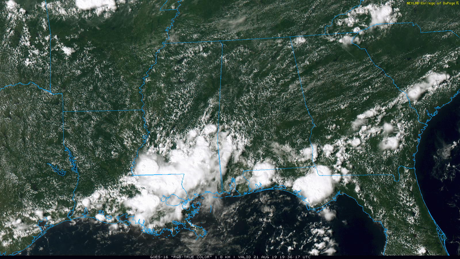
RADAR CHECK: Most of the showers and thunderstorms are over the southwest part of Alabama this afternoon in a broad zone from Livingston and Demopolis south to Mobile. Still, a few showers or storms could form over North/Central Alabama from now through about 10:00 tonight. The sky is partly sunny with temperatures in the upper 80s and low 80s for most communities.
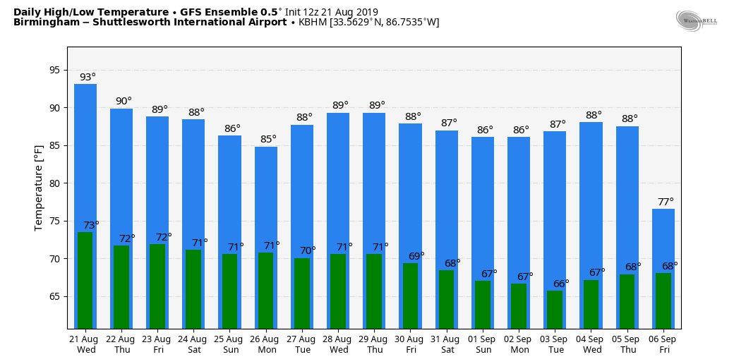
TOMORROW THROUGH THE WEEKEND: Scattered afternoon showers and storms will be more numerous tomorrow as colder air aloft drifts into Alabama, making the air more unstable. Then, we are forecasting scattered to numerous showers and storms Friday through Sunday as an unsettled pattern sets up. Most of the showers and thunderstorms will come from 12:00 noon until 10:00 p.m… but we can’t rule out a late night or morning shower over the weekend. The sky will be occasionally cloudy, and highs will drop into the 80s as heat levels fall.
NEXT WEEK: Scattered showers and storms, possibly numerous, will continue Monday and Tuesday, but global models are hinting at a pattern change late in the week that could push a drier, continental airmass into Alabama by Friday (August 30). See the Weather Xtreme video for maps, graphics, and more details.
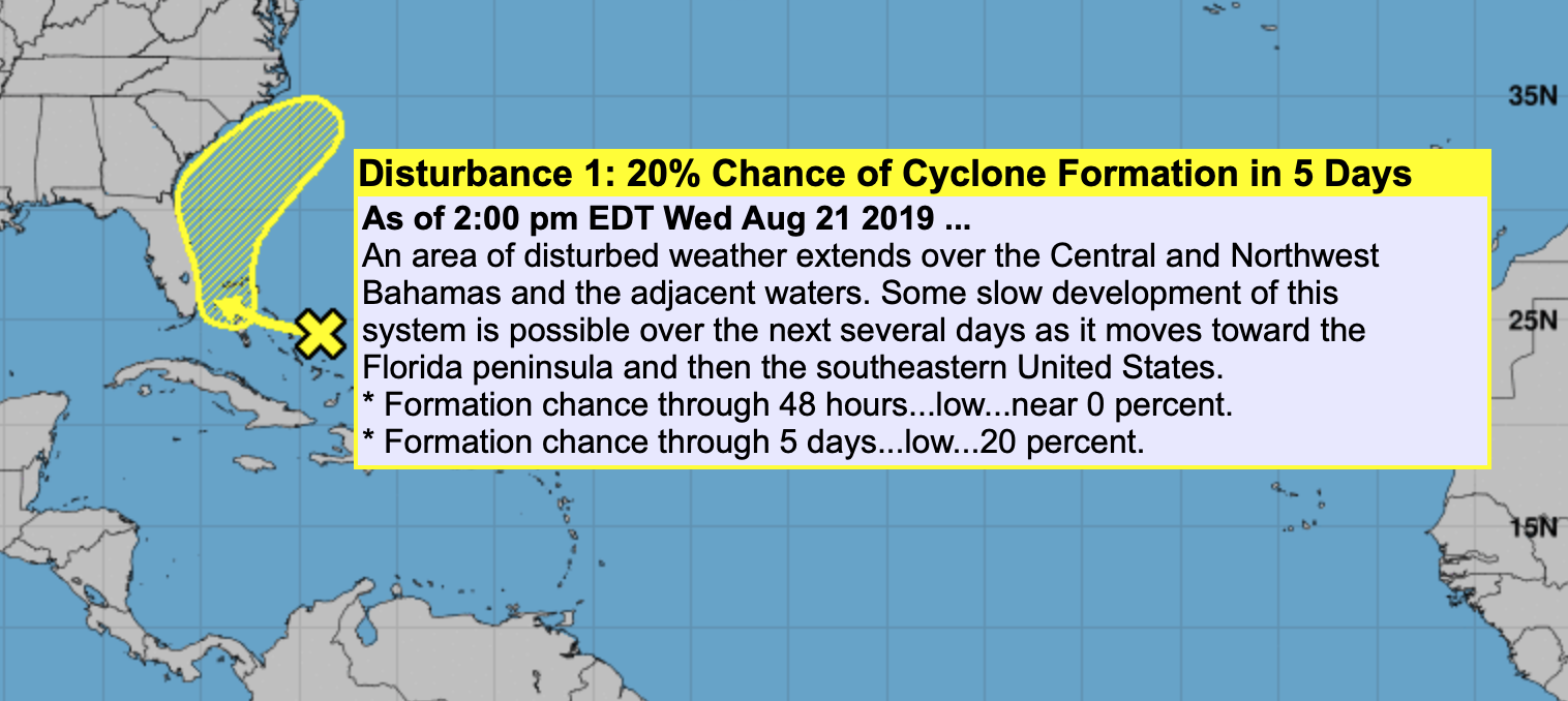
TROPICS: Tropical Storm Chantal is packing sustained winds of 40 mph, and is over the North Atlantic, far from land. It should dissipate within five days in that region. NHC is also watching a disturbance near the southeast Bahamas; it gives the wave a 20 percent chance of developing over the next five days as it moves just off the Southeast coast of the U.S. For now it does not look like a Gulf of Mexico threat.
ON THIS DATE IN 1992: Tropical Storm Andrew was midway between Bermuda and Puerto Rico and turning westward into a more favorable environment. Rapid strengthening occurred, with Andrew reaching hurricane strength on the 22nd and Category 4 status on the 23rd. After briefly weakening over the Bahamas, Andrew regained Category 4 status as it blasted its way across South Florida on August 24. The hurricane continued westward into the Gulf of Mexico where it gradually turned northward. This motion brought Andrew to the central Louisiana coast on August 26 as a Category 3 hurricane. Andrew then turned northeastward, eventually merging with a frontal system over the Mid-Atlantic states on August 28.
BEACH FORECAST: Click here to see the AlabamaWx Beach Forecast Center page.
WEATHER BRAINS: Don’t forget you can listen to our weekly 90 minute show anytime on your favorite podcast app. This is the show all about weather featuring many familiar voices, including our meteorologists here at ABC 33/40.
CONNECT: You can find me on all of the major social networks…
Facebook
Twitter
Instagram
Pinterest
Snapchat: spannwx
I enjoyed seeing the 6th graders this morning at Homewood Middle School… be looking for them on the Pepsi KIDCAM today at 5:00 on ABC 33/40 News! The next Weather Xtreme video will be posted here by 7:00 a.m. tomorrow…
Category: Alabama's Weather, ALL POSTS, Weather Xtreme Videos
About the Author (Author Profile)
James Spann is one of the most recognized and trusted television meteorologists in the industry. He holds the AMS CCM designation and television seals from the AMS and NWA. He is a past winner of the Broadcast Meteorologist of the Year from both professional organizations.Subscribe
If you enjoyed this article, subscribe to receive more just like it.


