

Jerry Potentially Bringing Heavy Rain To The Northern Leeward Islands Today
SUMMARY OF 7:00 AM CT
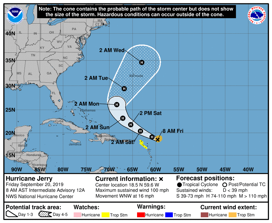
LOCATION…18.5N 59.6W
ABOUT 155 MI…245 KM ENE OF BARBUDA
MAXIMUM SUSTAINED WINDS…100 MPH…155 KM/H
PRESENT MOVEMENT…WNW OR 290 DEGREES AT 16 MPH…26 KM/H
MINIMUM CENTRAL PRESSURE…989 MB…29.20 INCHES
A Tropical Storm Watch is in effect for St. Maarten, St. Martin, St. Barthelemy, Saba, and St. Eustatius.
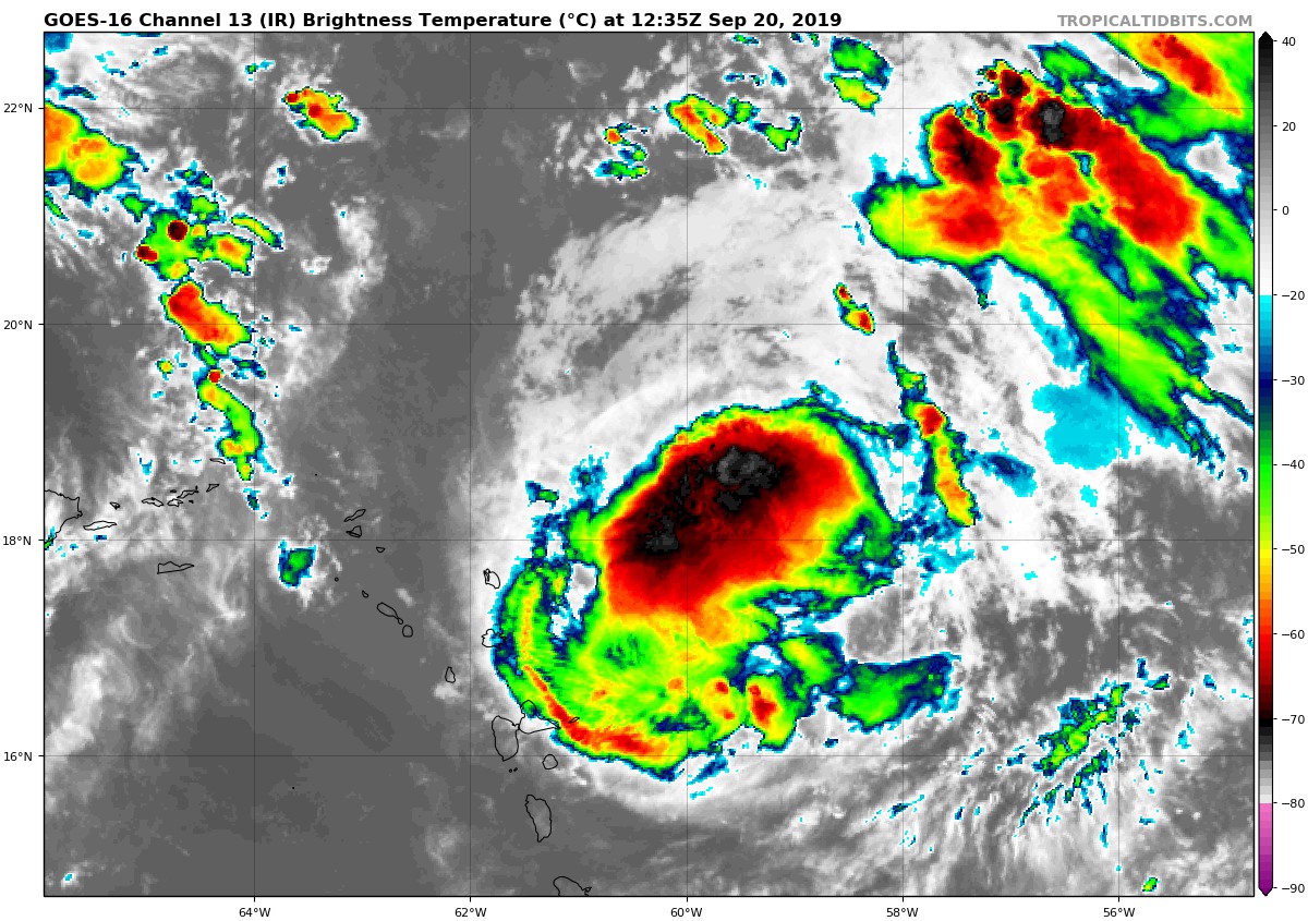
At 7:00 AM CT (1200 UTC), the center of Hurricane Jerry was located near latitude 18.5 North, longitude 59.6 West. Jerry is moving toward the west-northwest near 16 mph (26 km/h). A west-northwest to northwest motion at a decreasing forward speed is expected over the next few days. On the forecast track, the center of Jerry will move north of the northern Leeward Islands later today, pass well north of Puerto Rico on Saturday, and be well east-northeast of the southeastern Bahamas on Sunday.
Maximum sustained winds have decreased to near 100 mph (155 km/h) with higher gusts. A gradual weakening trend is forecast to continue today, but Jerry is expected to remain a hurricane during the next few days.
Hurricane-force winds extend outward up to 25 miles (35 km) from the center and tropical-storm-force winds extend outward up to 80 miles (130 km).
An Air Force Reserve Hurricane Hunter aircraft has recently reported a minimum central pressure of 989 MB (29.20 inches).
HAZARDS AFFECTING LAND
RAINFALL: Jerry is expected to produce 1 to 3 inches of rainfall, with isolated maximum totals of 4 to 6 inches from Barbuda northwest across St. Maarten, Anguilla, and Anegada. This rainfall may produce life-threatening flash floods.
Jerry is forecast to produce total rainfall accumulations of 1 to 2 inches with maximum amounts of 3 inches across the Virgin Islands and Puerto Rico.
WIND: Tropical storm conditions are possible within the watch areas later today.
SURF: Swells generated by Jerry are affecting portions of the northern Leeward Islands. These swells are likely to cause life-threatening surf and rip current conditions.
About the Author (Author Profile)
Scott Martin is an operational meteorologist, professional graphic artist, musician, husband, and father. Not only is Scott a member of the National Weather Association, but he is also the Central Alabama Chapter of the NWA president. Scott is also the co-founder of Racecast Weather, which provides forecasts for many racing series across the USA. He also supplies forecasts for the BassMaster Elite Series events including the BassMaster Classic.Subscribe
If you enjoyed this article, subscribe to receive more just like it.


