

Karen’s Wind Field Beginning To Unravel, Expected To Be A Remnant Low By Saturday
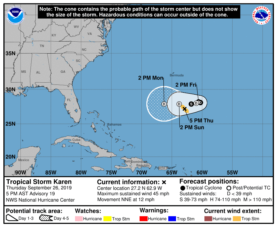
SUMMARY OF 400 PM CDT INFORMATION
LOCATION…27.2N 62.9W
ABOUT 370 MI…595 KM SSE OF BERMUDA
MAXIMUM SUSTAINED WINDS…45 MPH…75 KM/H
PRESENT MOVEMENT…NNE OR 25 DEGREES AT 12 MPH…19 KM/H
MINIMUM CENTRAL PRESSURE…1005 MB…29.68 INCHES
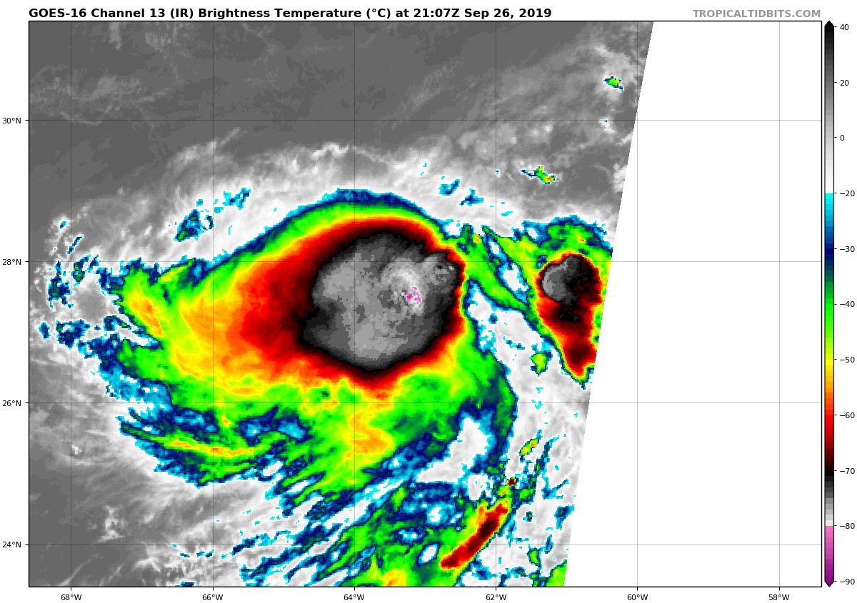
Data from aircraft reconnaissance, ASCAT, and NOAA buoy 41049 indicate that Karen’s circulation is becoming increasingly elongated. A combination of data from these platforms also supports maintaining an initial intensity of 40 kt for now. The deterioration of Karen’s structure suggests that weakening is imminent, especially with an expected increase in northerly shear during the next day or so. The GFS and ECMWF models–via their simulated infrared satellite fields–are unanimous in showing Karen losing its organized deep convection in about 36 hours. Based on that, the new NHC forecast depicts Karen as becoming a remnant low in 48 hours. Due to a significant increase in southwesterly shear by day 4, the system is expected to open up into a surface trough by day 5.
Fixes suggest that Karen is slowing down a bit and turning to the right, with an initial motion of 025/10 kt. The steering flow will be evolving over the next couple of days with high-pressure building to the north of Karen over the western Atlantic. This will cause the cyclone to almost come to a stop in about 36 hours, and then turn to the west by 48 hours until dissipation on day 5. This is the same forecast reasoning as before, and the new NHC forecast is just an update of the previous one.
About the Author (Author Profile)
Scott Martin is an operational meteorologist, professional graphic artist, musician, husband, and father. Not only is Scott a member of the National Weather Association, but he is also the Central Alabama Chapter of the NWA president. Scott is also the co-founder of Racecast Weather, which provides forecasts for many racing series across the USA. He also supplies forecasts for the BassMaster Elite Series events including the BassMaster Classic.Subscribe
If you enjoyed this article, subscribe to receive more just like it.


