

A Late Morning Look at Alabama’s Weather: Variable Clouds, Variable Temperatures
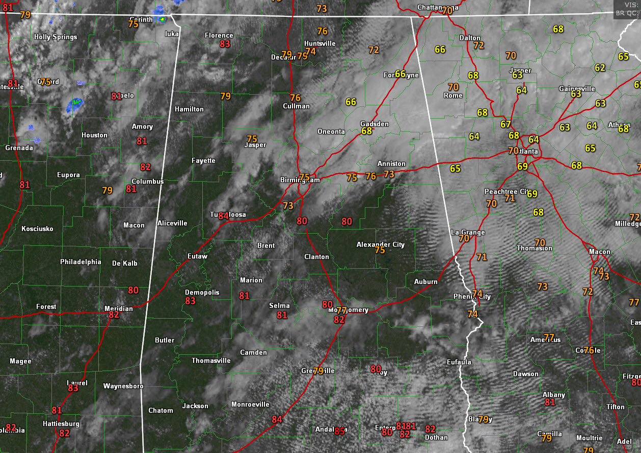
Quite a range in temperatures across late this morning. Readings range from 66F in Albertville and 68F at Gadsden, where they have been socked in by clouds all morning leftover from the rain and storms late last night, to 75F at Birmingham where the sun was starting to peek through, to 83F in Demopolis, and 84F in Evergreen.
The best moisture across Alabama is over the Tennessee Valley at this hour. The central part of the start has some drier air aloft, leading to increasing sunshine and temps. The band of mid-level moisture across the I-20/59 COrridor is where the clouds are thick. That band will push southeastward through the afternoon hours. A few showers could form as it does for places generally southeast of I-59/20, but probably not until it reaches the vicinity of I-85 later this afternoon.
But Alabama is under a minor ridge of high pressure again today that should generally keep the damper on any rain or storms for most folks. If one does manage to form over North Central Alabama in places like Jasper or Cullman, it will have a reservoir of 1,500-1,750 j/kg CAPE to work with, so any that do happen could pack a punch.
Highs today will generally be in the mid to upper 80s across much of the area, except over northeastern sections where lower 80s will be common.
Rainfall amounts will be very small, less than one-tenth of an inch. Rainfall coverage will be less than 10 percent.
Strong storms are expected this afternoon and this evening ahead of a cold front that is now over northwestern Tennessee. The SPC has outlooked areas from northeastern Texas through much of Arkansas into northwestern Mississippi, western Tennessee and the northwestern corner of Alabama for a marginal risk of severe weather this afternoon through the overnight hours. Those storms could reach places like Muscle Shoals and Florence after midnight. Damaging winds and small hail will be the main threat.
Monday, this front will push through the northern half of Alabama. Scattered showers will be the rule across much of Alabama on Monday. Don’t expect any drought-busting rains for sure. South of a line from Carrollton in Pickens County to Hamilton to Huntsville, rainfall amounts will be very light. Areas northwest of that line could see one-third of an inch to over an inch. Coverage over Northwest Alabama will be around 90% with less than 20% over the rest of Central Alabama.
Category: Alabama's Weather, ALL POSTS
About the Author (Author Profile)
Bill Murray is the President of The Weather Factory. He is the site's official weather historian and a weekend forecaster. He also anchors the site's severe weather coverage. Bill Murray is the proud holder of National Weather Association Digital Seal #0001 @wxhistorianSubscribe
If you enjoyed this article, subscribe to receive more just like it.


