

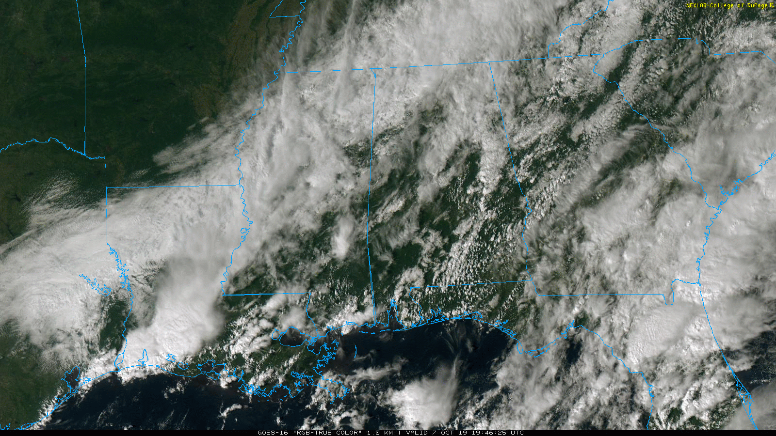
Showers Linger Over East Alabama
BIG CHANGE: Temperatures are in the 70-75 degree range over most of North and Central Alabama this afternoon; just five days ago they were near 100 degrees at this hour of the day. Showers linger over the eastern counties of the state; the western half oF Alabama is generally dry after the morning rain ahead of the cold front.
Parts of the Tennessee Valley were really soaked this morning; one observer reported 2.39″ at Hartselle, in Morgan County.
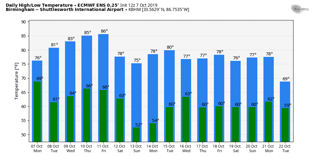
REST OF THE WEEK: Tomorrow will be a mostly dry day with a mix of sun and clouds along with a high in the low 80s; we will mention just a few isolated showers over East Alabama. Then, Wednesday and Thursday will be partly sunny with warm afternoons and pleasant nights; highs will be in the low to mid 80s. Clouds increase late in the week Friday, and some light rain is possible late Friday afternoon into Friday night ahead of the next cold front. Moisture will be very limited, and rain amounts should be light.
THE ALABAMA WEEKEND: A new surge of cooler air arrives; the sky becomes sunny Saturday with a high in the upper 60s, and Sunday will be bright and sunny with low 70s. Many places across North/Central Alabama will have a good chance of reaching the 40s early Sunday morning.
NEXT WEEK: The first half of the week starts with dry and pleasant weather… See the Weather Xtreme video for maps, graphics, and more details.
TROPICS: NHC is monitoring three disturbances in the Atlantic; one near Key West, one southwest of Bermuda, and one well east of Bermuda. They have some low potential for development over the next few days, but they are no threat to the U.S.
OCTOBER 2 HIGH ADJUSTED: A change was made to one of the temperatures recorded at Birmingham (BHM) last week, on October 2. The reported temperature of 103 was suspicious, and after further investigation, NWS Birmingham determined that the temperature was unreasonable. The 1 minute data from the site showed a spike in temperature up to 106, over a 15 minute period, around 1:30 in the afternoon. Removing this temperature, the highest observation in the afternoon then becomes 99 degrees. This new temperature of 99 degrees matches the trends from the several days leading up to October 2nd, and blends well with sites across central Alabama on that day. The high 99 degrees remains a record, breaking the old daily record maximum of 93 in 1904.
ON THIS DATE LAST YEAR: A tropical depression formed in the Caribbean; the next day it would become a hurricane, getting the name “Michael”. The hurricane strengthened rapidly in the Gulf of Mexico, reaching major hurricane status on October 9. It would go on to make landfall as a category five hurricane near Panama City Beach, Florida.
BEACH FORECAST: Click here to see the AlabamaWx Beach Forecast Center page.
WEATHER BRAINS: Don’t forget you can listen to our weekly 90 minute show anytime on your favorite podcast app. This is the show all about weather featuring many familiar voices, including our meteorologists here at ABC 33/40.
CONNECT: You can find me on all of the major social networks…
Facebook
Twitter
Instagram
Pinterest
Snapchat: spannwx
Category: Alabama's Weather, ALL POSTS, Weather Xtreme Videos
About the Author (Author Profile)
James Spann is one of the most recognized and trusted television meteorologists in the industry. He holds the AMS CCM designation and television seals from the AMS and NWA. He is a past winner of the Broadcast Meteorologist of the Year from both professional organizations.Subscribe
If you enjoyed this article, subscribe to receive more just like it.


