

Dry & Cool Today, Some Drought Relief Coming Soon
MUCH COOLER FOR YOUR SATURDAY
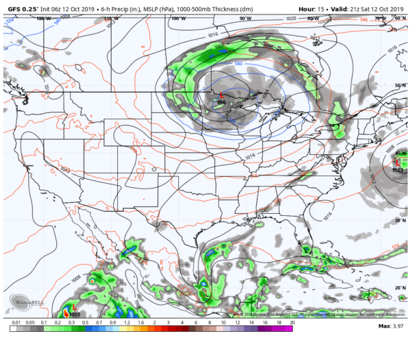
As advertised, the cold front that we have forecast to bring us much cooler and more fall-like temperatures moved through much of Central Alabama. The front will slow down in forward motion and will weaken today. That means for us a mainly dry day across Central Alabama with clouds slowly decreasing from northwest to southeast. Could there be a stray isolated shower somewhere across the area… yes, but those chances are almost not worth mentioning. Highs will be in the mid-60s to the lower 80s across the area from northwest to southeast. Some light rain may occur over the eastern and northeastern parts of the area during the overnight hours with rain chances topping out in the 20-30% range. Lows will be in the lower 40s to the lower 60s.
SUNDAY MAY FEATURE SOME RAIN
We’ll have a shortwave move in and interact with the old cold front which will add enough lift to bring a good chance of showers into the forecast on Sunday. Unfortunately for race fans, the higher chance of rainfall will be over and around the I-20 corridor which includes Talladega Superspeedway. It will not be an all-day rain event and amounts should be very light, but showers could occur at any time. Highs will be in the mid-60s to the upper 70s across the area with rain chances in the 30-60% range.
MAINLY DRY FOR MUCH OF YOUR MONDAY
Much of the shower chances will be over the southern parts of Central Alabama for the daytime hours on Monday before a warm front will start to lift northward across the area and bring those rain chances with it during the night. Highs will be in the mid-70s to the lower 80s.
SOME DROUGHT RELIEF ON TUESDAY
We’ll have a few small disturbances move through Central Alabama along the warm front that will bring us showers and thunderstorms on Tuesday. At this point, severe weather does not look likely, but a few strong storms could occur. The bigger news is that we could see rainfall totals of 1-3 inches across the area with the heavier totals expected over the central parts. Highs will be in the lower 70s to the lower 80s.
ANOTHER COLD FRONT SWINGS THROUGH ON WEDNESDAY
Rainfall will be pushed out of the area early on Wednesday as a cold front will move through bringing us much drier conditions. It may take a day or so for the clouds to clear out but we’ll love the temperatures that are forecast. Highs will be in the upper 60s to the upper 70s.
WE’LL FINALLY SEE THE SUN AGAIN TO END OFF THE WORK WEEK
Thursday and Friday look to be very nice days, but clouds will continue to stick around on Thursday. Those clouds will finally move out of the area on Friday and will allow us to have mostly sunny skies. Thursday’s highs will be in the lower to mid-70s. Highs on Friday will be a little warmer in the mid-70s to the lower 80s.

THE TROPICS
We only have one tropical system currently on the map and that is Subtropical Storm Melissa which is now moving to the northeast and away from the US. Maximum sustained winds were at 50 MPH. Melissa is expected to slowly weaken and should be a depression by Sunday morning. At this point, the rest of the tropics are quiet.
Category: Alabama's Weather, ALL POSTS, Weather Xtreme Videos
About the Author (Author Profile)
Scott Martin is an operational meteorologist, professional graphic artist, musician, husband, and father. Not only is Scott a member of the National Weather Association, but he is also the Central Alabama Chapter of the NWA president. Scott is also the co-founder of Racecast Weather, which provides forecasts for many racing series across the USA. He also supplies forecasts for the BassMaster Elite Series events including the BassMaster Classic.Subscribe
If you enjoyed this article, subscribe to receive more just like it.


